 |
|
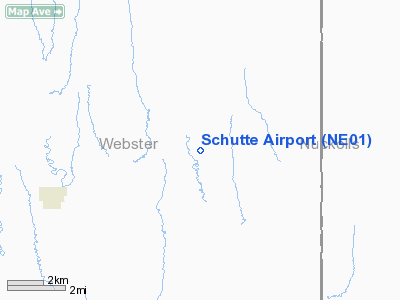
Location & QuickFacts
| FAA Information Effective: | 2008-09-25 |
| Airport Identifier: | NE01 |
| Airport Status: | Operational |
| Longitude/Latitude: | 098-21-07.1890W/40-11-41.0460N
-98.351997/40.194735 (Estimated) |
| Elevation: | 1876 ft / 571.80 m (Surveyed) |
| Land: | 0 acres |
| From nearest city: | 8 nautical miles NW of Guide Rock, NE |
| Location: | Webster County, NE |
| Magnetic Variation: | 07E (1985) |
Owner & Manager
| Ownership: | Privately owned |
| Owner: | Mrs Alfred Schutte |
| Address: |
Guide Rock, NE 68942 |
| Phone number: | 402-756-3465 |
| Address: |
|
Airport Operations and Facilities
| Airport Use: | Private |
| Wind indicator: | No |
| Segmented Circle: | No |
| Control Tower: | No |
| Landing fee charge: | No |
| Sectional chart: | Omaha |
| Region: | ACE - Central |
| Boundary ARTCC: | ZMP - Minneapolis |
| Tie-in FSS: | OLU - Columbus |
| FSS on Airport: | No |
| FSS Toll Free: | 1-800-WX-BRIEF |
Airport Services
| Airframe Repair: | NONE |
| Power Plant Repair: | NONE |
Runway Information
Runway NW/SE
| Dimension: | 2500 x 125 ft / 762.0 x 38.1 m |
| Surface: | TURF, |
| |
Runway NW |
Runway SE |
| Traffic Pattern: | Left | Left |
|
Radio Navigation Aids
| ID |
Type |
Name |
Ch |
Freq |
Var |
Dist |
| PSS | NDB | Prosser | | 338.00 | 07E | 30.1 nm |
| HJH | NDB | Hebron | | 323.00 | 06E | 35.2 nm |
| RPB | NDB | Republican | | 414.00 | 07E | 39.3 nm |
| FMZ | NDB | Beklof | | 392.00 | 07E | 43.0 nm |
| HDE | NDB | Holdrege | | 396.00 | 07E | 47.8 nm |
| EAR | VOR | Kearney | | 111.20 | 10E | 43.7 nm |
| HSI | VOR/DME | Hastings | 025X | 108.80 | 07E | 24.9 nm |
| TKO | VORTAC | Mankato | 035X | 109.80 | 10E | 23.7 nm |
| GRI | VORTAC | Grand Island | 057X | 112.00 | 07E | 47.5 nm |
Remarks
- PRVDD APCHS MAINT FOR MIN 20:1 GLIDE SLOPE & TRSNL SFC MAINT FOR A 7:1 SLOPE.
Images and information placed above are from
http://www.airport-data.com/airport/NE01/
We thank them for the data!
| General Info
|
| Country |
United States
|
| State |
NEBRASKA
|
| FAA ID |
NE01
|
| Latitude |
40-11-41.046N
|
| Longitude |
098-21-07.189W
|
| Elevation |
1876 feet
|
| Near City |
GUIDE ROCK
|
We don't guarantee the information is fresh and accurate. The data may
be wrong or outdated.
For more up-to-date information please refer to other sources.
|
|


