 |
|
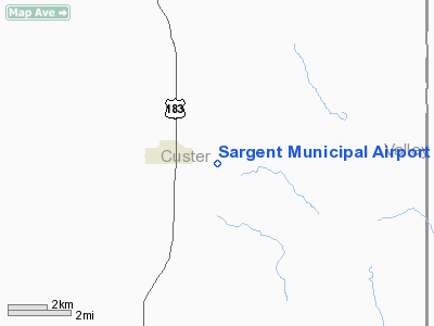
Location & QuickFacts
| FAA Information Effective: | 2008-09-25 |
| Airport Identifier: | 09K |
| Airport Status: | Operational |
| Longitude/Latitude: | 099-20-25.3730W/41-38-13.0230N
-99.340381/41.636951 (Estimated) |
| Elevation: | 2313 ft / 705.00 m (Surveyed) |
| Land: | 198 acres |
| From nearest city: | 2 nautical miles E of Sargent, NE |
| Location: | Custer County, NE |
| Magnetic Variation: | 08E (1985) |
Owner & Manager
| Ownership: | Publicly owned |
| Owner: | Sargent Airport Authority |
| Address: | P.o. Box 134
Sargent, NE 68874 |
| Phone number: | 308-527-4334 |
| Manager: | John Troxell |
| Address: | Box 134
Sargent, NE 68874 |
| Phone number: | 308-215-0437 |
Airport Operations and Facilities
| Airport Use: | Open to public |
| Wind indicator: | Yes |
| Segmented Circle: | No |
| Control Tower: | No |
| Lighting Schedule: | DUSK-DAWN
ACTVT MIRL RY 16/34 -CTAF. |
| Beacon Color: | Clear-Green (lighted land airport) |
| Landing fee charge: | No |
| Sectional chart: | Omaha |
| Region: | ACE - Central |
| Boundary ARTCC: | ZDV - Denver |
| Tie-in FSS: | OLU - Columbus |
| FSS on Airport: | No |
| FSS Toll Free: | 1-800-WX-BRIEF |
| NOTAMs Facility: | OLU (NOTAM-d service avaliable) |
| Federal Agreements: | N1 |
Airport Communications
Airport Services
| Bottled Oxygen: | NONE |
| Bulk Oxygen: | NONE |
Runway Information
Runway 16/34
| Dimension: | 3000 x 50 ft / 914.4 x 15.2 m |
| Surface: | ASPH, |
| Edge Lights: | Medium |
| |
Runway 16 |
Runway 34 |
| Traffic Pattern: | Left | Left |
| Markings: | Non-precision instrument, Good Condition | , |
| Obstruction: | 25 ft road, 600.0 ft from runway, 24:1 slope to clear | , 50:1 slope to clear |
|
Radio Navigation Aids
| ID |
Type |
Name |
Ch |
Freq |
Var |
Dist |
| BUB | NDB | Burwell | | 377.00 | 07E | 12.0 nm |
| ODX | NDB | Ord | | 356.00 | 07E | 17.6 nm |
| BBW | NDB | Broken Bow | | 265.00 | 08E | 18.0 nm |
| CUZ | VOR/DME | Custer County | 19X | 108.20 | 08E | 18.2 nm |
| OBH | VORTAC | Wolbach | 095X | 114.80 | 07E | 47.1 nm |
Remarks
- DEER ON & INVOF ARPT.
- EXISTED PRIOR TO 1959.
Images and information placed above are from
http://www.airport-data.com/airport/09K/
We thank them for the data!
| General Info
|
| Country |
United States
|
| State |
NEBRASKA
|
| FAA ID |
09K
|
| Latitude |
41-38-13.023N
|
| Longitude |
099-20-25.373W
|
| Elevation |
2313 feet
|
| Near City |
SARGENT
|
We don't guarantee the information is fresh and accurate. The data may
be wrong or outdated.
For more up-to-date information please refer to other sources.
|
|


