 |
|
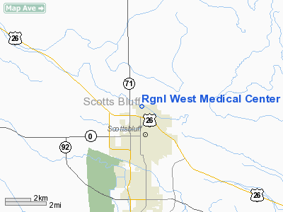
Rgnl West Medical Center Heliport |
Location & QuickFacts
| FAA Information Effective: | 2008-09-25 |
| Airport Identifier: | NE41 |
| Airport Status: | Operational |
| Longitude/Latitude: | 103-39-51.7900W/41-53-15.3800N
-103.664386/41.887606 (Estimated) |
| Elevation: | 3985 ft / 1214.63 m (Estimated) |
| Land: | 0 acres |
| From nearest city: | 2 nautical miles N of Scottsbluff, NE |
| Location: | Cheyenne County, NE |
| Magnetic Variation: | 10E (1995) |
Owner & Manager
| Ownership: | Privately owned |
| Owner: | Regional West Medical Center |
| Address: | 4021 Avenue B 1
Scottsbluff, NE 69361 |
| Phone number: | 308-630-1438 |
| Manager: | Facilities Management |
| Address: | 4021 Avenue B
Scottsbluff, NE 69361 |
| Phone number: | 308-630-1438 |
Airport Operations and Facilities
| Airport Use: | Private
FOR MEDICAL USE ONLY. |
| Wind indicator: | Yes |
| Segmented Circle: | No |
| Control Tower: | No |
| Lighting Schedule: | PHONE REQ
FOR PERIMETER LIGHTS CALL 308-635-3711. |
| Landing fee charge: | No |
| Sectional chart: | Cheyenne |
| Region: | ACE - Central |
| Boundary ARTCC: | ZDV - Denver |
| Tie-in FSS: | OLU - Columbus |
| FSS on Airport: | No |
| FSS Toll Free: | 1-800-WX-BRIEF |
Runway Information
Helipad H1
| Dimension: | 48 x 48 ft / 14.6 x 14.6 m |
| Surface: | CONC, |
| |
Runway H1 |
Runway |
| Traffic Pattern: | Left | Left |
|
Radio Navigation Aids
| ID |
Type |
Name |
Ch |
Freq |
Var |
Dist |
| GIG | NDB | Gering | | 341.00 | 11E | 3.5 nm |
| TOR | NDB | Torrington | | 293.00 | 11E | 24.3 nm |
| ALU | NDB | Alliance | | 380.00 | 11E | 39.8 nm |
| IBM | NDB | Kimball | | 317.00 | 10E | 41.9 nm |
| AIA | VOR/DME | Alliance | 055X | 111.80 | 11E | 39.7 nm |
| CDR | VOR/DME | Chadron | 081X | 113.40 | 13E | 43.3 nm |
| BFF | VORTAC | Scottsbluff | 073X | 112.60 | 13E | 8.2 nm |
Remarks
- PRVDD CLEAR 8:1 INGRESS/REGRESS; CLEAR 2:1 TRSNL SFC; PLINES E & W MKD WITH ORANGE BALLS.
Images and information placed above are from
http://www.airport-data.com/airport/NE41/
We thank them for the data!
| General Info
|
| Country |
United States
|
| State |
NEBRASKA
|
| FAA ID |
NE41
|
| Latitude |
41-53-15.380N
|
| Longitude |
103-39-51.790W
|
| Elevation |
3985 feet
|
| Near City |
SCOTTSBLUFF
|
We don't guarantee the information is fresh and accurate. The data may
be wrong or outdated.
For more up-to-date information please refer to other sources.
|
|


