 |
|
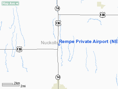
Location & QuickFacts
| FAA Information Effective: | 2008-09-25 |
| Airport Identifier: | NE87 |
| Airport Status: | Operational |
| Longitude/Latitude: | 098-03-53.1560W/40-05-50.0440N
-98.064766/40.097234 (Estimated) |
| Elevation: | 1760 ft / 536.45 m (Estimated) |
| Land: | 12 acres |
| From nearest city: | 5 nautical miles N of Superior, NE |
| Location: | Nuckolls County, NE |
| Magnetic Variation: | 07E (1990) |
Owner & Manager
| Ownership: | Privately owned |
| Owner: | Roy Rempe |
| Address: | 3612 Road G
Superior, NE 68978-9570 |
| Manager: | Roy Rempe |
| Address: | 3612 Road G
Superior, NE 68978-9570 |
Airport Operations and Facilities
| Airport Use: | Private |
| Wind indicator: | No |
| Segmented Circle: | No |
| Control Tower: | No |
| Sectional chart: | Wichita |
| Region: | ACE - Central |
| Boundary ARTCC: | ZMP - Minneapolis |
| Tie-in FSS: | OLU - Columbus |
| FSS on Airport: | No |
| FSS Toll Free: | 1-800-WX-BRIEF |
Runway Information
Runway 17/35
| Dimension: | 5280 x 110 ft / 1609.3 x 33.5 m |
| Surface: | TURF, |
| |
Runway 17 |
Runway 35 |
| Traffic Pattern: | Left | Left |
|
Radio Navigation Aids
| ID |
Type |
Name |
Ch |
Freq |
Var |
Dist |
| HJH | NDB | Hebron | | 323.00 | 06E | 22.2 nm |
| RPB | NDB | Republican | | 414.00 | 07E | 25.3 nm |
| FMZ | NDB | Beklof | | 392.00 | 07E | 37.3 nm |
| CNK | NDB | Concordia | | 335.00 | 06E | 37.9 nm |
| PSS | NDB | Prosser | | 338.00 | 07E | 40.1 nm |
| FBY | NDB | Fairbury | | 293.00 | 06E | 41.6 nm |
| HSI | VOR/DME | Hastings | 025X | 108.80 | 07E | 34.8 nm |
| TKO | VORTAC | Mankato | 035X | 109.80 | 10E | 19.7 nm |
Remarks
- OWNER DESIRES ARPT NOT BE CHARTED.
- PRVD APCHS HAVE 20:1 SLOPE & TRANSITIONAL SFC MAINTAINED AT A 7:1 SLOPE; WRITTEN NOTIFICATION TO FAA ADDRESSING OBSTN CONDITIONS.
Images and information placed above are from
http://www.airport-data.com/airport/NE87/
We thank them for the data!
| General Info
|
| Country |
United States
|
| State |
NEBRASKA
|
| FAA ID |
NE87
|
| Latitude |
40-05-50.044N
|
| Longitude |
098-03-53.156W
|
| Elevation |
1760 feet
|
| Near City |
SUPERIOR
|
We don't guarantee the information is fresh and accurate. The data may
be wrong or outdated.
For more up-to-date information please refer to other sources.
|
|


