 |
|
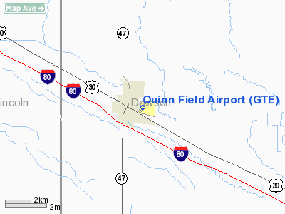
Location & QuickFacts
| FAA Information Effective: | 2008-09-25 |
| Airport Identifier: | GTE |
| Airport Status: | Operational |
| Longitude/Latitude: | 100-08-53.9000W/40-55-34.6000N
-100.148306/40.926278 (Estimated) |
| Elevation: | 2559 ft / 779.98 m (Surveyed) |
| Land: | 167 acres |
| From nearest city: | 1 nautical miles E of Gothenburg, NE |
| Location: | Dawson County, NE |
| Magnetic Variation: | 09E (1985) |
Owner & Manager
| Ownership: | Publicly owned |
| Owner: | Gothenburg Airport Authority
CRAIG BARTHUFF, CHAIRMAN OF ARPT AUTH, PHONE 308-537-3673. |
| Address: | Po Box 454
Gothenberg, NE 69138 |
| Phone number: | 308-537-3673 |
| Manager: | Rod Donner |
| Address: | Gothenburg Arpt Auth, Po Box 454
Gothenberg, NE 69138 |
| Phone number: | 308-537-3868 |
Airport Operations and Facilities
| Airport Use: | Open to public |
| Wind indicator: | Yes |
| Segmented Circle: | No |
| Control Tower: | No |
| Lighting Schedule: | DUSK-DAWN
ACTVT MIRL RY 03/21 - CTAF. |
| Beacon Color: | Clear-Green (lighted land airport) |
| Landing fee charge: | No |
| Sectional chart: | Omaha |
| Region: | ACE - Central |
| Boundary ARTCC: | ZDV - Denver |
| Tie-in FSS: | OLU - Columbus |
| FSS on Airport: | No |
| FSS Toll Free: | 1-800-WX-BRIEF |
| NOTAMs Facility: | OLU (NOTAM-d service avaliable) |
| Federal Agreements: | 1 |
Airport Communications
| CTAF: | 122.800 |
| Unicom: | 122.800 |
Airport Services
| Fuel available: | 100LL |
| Bottled Oxygen: | NONE |
| Bulk Oxygen: | NONE |
Runway Information
Runway 03/21
| Dimension: | 2599 x 50 ft / 792.2 x 15.2 m |
| Surface: | CONC, Good Condition |
| Weight Limit: | Single wheel: 28000 lbs. |
| Edge Lights: | Medium |
| |
Runway 03 |
Runway 21 |
| Longitude: | 100-09-04.4424W | 100-08-43.4132W |
| Latitude: | 40-55-24.5033N | 40-55-44.6222N |
| Elevation: | 2556.00 ft | 2559.00 ft |
| Alignment: | 38 | 127 |
| Traffic Pattern: | Left | Left |
| Markings: | Basic, Good Condition | Basic, Good Condition |
| Displaced threshold: | 70.00 ft | 0.00 ft |
| Obstruction: | 25 ft rr, 715.0 ft from runway, 30 ft left of centerline, 20:1 slope to clear | 18 ft road, 570.0 ft from runway, 100 ft right of centerline, 20:1 slope to clear |
|
Runway 14/32
| Dimension: | 3300 x 250 ft / 1005.8 x 76.2 m |
| Surface: | TURF, Good Condition |
| Edge Lights: | Low |
| |
Runway 14 |
Runway 32 |
| Longitude: | 100-08-53.9560W | 100-08-31.4560W |
| Latitude: | 40-55-43.5240N | 40-55-15.5240N |
| Elevation: | 2555.00 ft | 2555.00 ft |
| Traffic Pattern: | Left | Left |
| Obstruction: | 18 ft road, 400.0 ft from runway, 165 ft right of centerline, 22:1 slope to clear | 34 ft tree, 685.0 ft from runway, 84 ft left of centerline, 20:1 slope to clear |
|
Radio Navigation Aids
| ID |
Type |
Name |
Ch |
Freq |
Var |
Dist |
| MCK | FAN MARKER | Mc Cook | | | 11E | 48.4 nm |
| DWL | NDB | Willow | | 353.00 | 08E | 4.7 nm |
| RRX | NDB | Darr | | 326.00 | 07E | 14.2 nm |
| CSB | NDB | Harry Strunk | | 389.00 | 08E | 37.4 nm |
| BBW | NDB | Broken Bow | | 265.00 | 08E | 38.3 nm |
| HDE | NDB | Holdrege | | 396.00 | 07E | 46.7 nm |
| OZB | VOR | Cozad | | 109.00 | 09E | 7.4 nm |
| CUZ | VOR/DME | Custer County | 19X | 108.20 | 08E | 39.4 nm |
| MCK | VOR/DME | Mc Cook | 100X | 115.30 | 08E | 48.0 nm |
| LBF | VORTAC | North Platte | 121X | 117.40 | 11E | 28.1 nm |
| HCT | VORTAC | Hayes Center | 124X | 117.70 | 11E | 45.3 nm |
Remarks
- RY 14/32 NOT PLOWED WINTER MONTHS.
- EXISTED PRIOR TO 1959.
Images and information placed above are from
http://www.airport-data.com/airport/GTE/
We thank them for the data!
| General Info
|
| Country |
United States
|
| State |
NEBRASKA
|
| FAA ID |
GTE
|
| Latitude |
40-55-34.600N
|
| Longitude |
100-08-53.900W
|
| Elevation |
2559 feet
|
| Near City |
GOTHENBURG
|
We don't guarantee the information is fresh and accurate. The data may
be wrong or outdated.
For more up-to-date information please refer to other sources.
|
|


