|
|
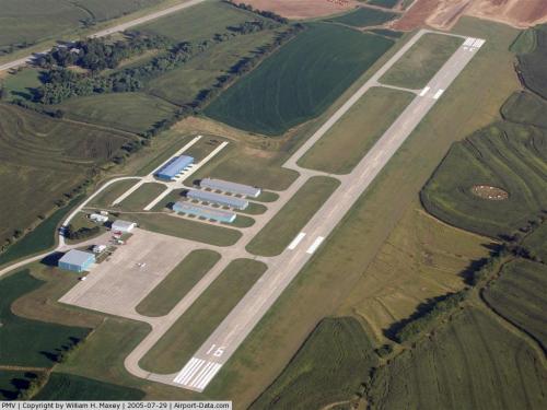 |
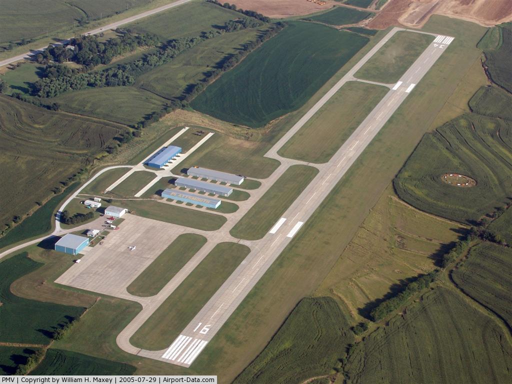
(Click on the photo to enlarge) |
Location & QuickFacts
| FAA Information Effective: | 2008-09-25 |
| Airport Identifier: | PMV |
| Airport Status: | Operational |
| Longitude/Latitude: | 095-55-02.4750W/40-56-54.1300N
-95.917354/40.948369 (Estimated) |
| Elevation: | 1204 ft / 366.98 m (Surveyed) |
| Land: | 206 acres |
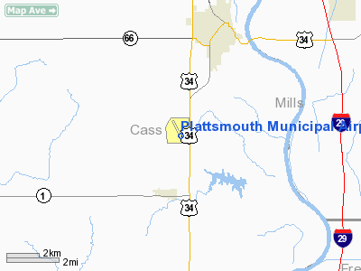
| From nearest city: | 4 nautical miles SW of Plattsmouth, NE |
| Location: | Cass County, NE |
| Magnetic Variation: | 05E (2000) |
Owner & Manager
| Ownership: | Publicly owned |
| Owner: | Plattsmouth Airport Authority |
| Address: | P.o. Box 128
Plattsmouth, NE 68048-0160 |
| Phone number: | 402-298-8468 |
| Manager: | Todd Stapf |
| Address: | P.o. Box 128
Plattsmouth, NE 68048-0160 |
| Phone number: | 402-298-8468 |
Airport Operations and Facilities
| Airport Use: | Open to public |
| Wind indicator: | Yes |
| Segmented Circle: | Yes |
| Control Tower: | No |
| Lighting Schedule: | DUSK-DAWN
ACTVT MIRL RY 16/34; REIL & PAPI RYS 16 & 34 - CTAF. |
| Beacon Color: | Clear-Green (lighted land airport) |
| Landing fee charge: | No |
| Sectional chart: | Omaha |
| Region: | ACE - Central |
| Boundary ARTCC: | ZMP - Minneapolis |
| Tie-in FSS: | OLU - Columbus |
| FSS on Airport: | No |
| FSS Toll Free: | 1-800-WX-BRIEF |
| NOTAMs Facility: | PMV (NOTAM-d service avaliable) |
| Federal Agreements: | NGY |
Airport Communications
| CTAF: | 122.700 |
| Unicom: | 122.700 |
Airport Services
| Fuel available: | 100LLA
100LL AVBL 24 HRS-SELF SERV. JET A AVBL AFT HRS ON REQ; CALL 402-298-8468 DURING ATNDD HRS. |
| Airframe Repair: | MAJOR |
| Power Plant Repair: | MAJOR |
| Bottled Oxygen: | NONE |
| Bulk Oxygen: | NONE |
Runway Information
Runway 16/34
| Dimension: | 5500 x 100 ft / 1676.4 x 30.5 m |
| Surface: | CONC, Good Condition |
| Weight Limit: | Single wheel: 30000 lbs.
Dual wheel: 45000 lbs.
Dual tandem wheel: 90000 lbs. |
| Edge Lights: | Medium |
| |
Runway 16 |
Runway 34 |
| Longitude: | 095-55-10.1600W | 095-54-54.7900W |
| Latitude: | 40-57-20.6700N | 40-56-27.5900N |
| Elevation: | 1188.00 ft | 1204.00 ft |
| Alignment: | 127 | 127 |
| Traffic Pattern: | Left | Left |
| Markings: | Non-precision instrument, Good Condition | Non-precision instrument, Good Condition |
| Crossing Height: | 39.00 ft | 29.00 ft |
| VASI: | 2-light PAPI on left side | 2-light PAPI on left side |
| Visual Glide Angle: | 3.00° | 3.00° |
| Runway End Identifier: | Yes | Yes |
|
Radio Navigation Aids
| ID |
Type |
Name |
Ch |
Freq |
Var |
Dist |
| PMV | NDB | Plattsmouth | | 329.00 | 06E | 0.4 nm |
| MLE | NDB | Millard | | 371.00 | 06E | 17.3 nm |
| AFK | NDB | Nebraska City | | 347.00 | 05E | 20.8 nm |
| OM | NDB | Gerfi | | 320.00 | 05E | 25.2 nm |
| SDA | NDB | Shenandoah | | 411.00 | 05E | 26.0 nm |
| RDK | NDB | Red Oak | | 230.00 | 04E | 30.4 nm |
| AYB | NDB | Auburn | | 430.00 | 05E | 31.2 nm |
| AHQ | NDB | Wahoo | | 400.00 | 07E | 35.5 nm |
| LN | NDB | Potts | | 385.00 | 06E | 40.3 nm |
| FET | NDB | Fremont | | 311.00 | 06E | 40.6 nm |
| ICL | NDB | Clarinda | | 353.00 | 04E | 42.6 nm |
| HNR | NDB | Harlan | | 272.00 | 05E | 46.0 nm |
| AIO | NDB | Atlantic | | 365.00 | 04E | 48.0 nm |
| OFF | TACAN | Offutt | 054X | | 05E | 10.2 nm |
| OVR | VORTAC | Omaha | 110X | 116.30 | 08E | 15.5 nm |
| LNK | VORTAC | Lincoln | 108X | 116.10 | 09E | 37.5 nm |
| PWE | VORTAC | Pawnee City | 071X | 112.40 | 05E | 46.9 nm |
| OMA | VOT | Omaha | | 109.00 | | 20.9 nm |
Images and information placed above are from
http://www.airport-data.com/airport/PMV/
We thank them for the data!
| General Info
|
| Country |
United States
|
| State |
NEBRASKA
|
| FAA ID |
PMV
|
| Latitude |
40-57-00.900N
|
| Longitude |
095-55-04.400W
|
| Elevation |
1202 feet
|
| Near City |
PLATTSMOUTH
|
We don't guarantee the information is fresh and accurate. The data may
be wrong or outdated.
For more up-to-date information please refer to other sources.
|
|