 |
|
Location & QuickFacts
| FAA Information Effective: | 2008-09-25 |
| Airport Identifier: | 0C4 |
| Airport Status: | Operational |
| Longitude/Latitude: | 096-43-40.1282W/42-06-48.3052N
-96.727813/42.113418 (Estimated) |
| Elevation: | 1345 ft / 409.96 m (Surveyed) |
| Land: | 129 acres |
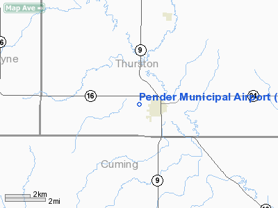
| From nearest city: | 1 nautical miles W of Pender, NE |
| Location: | Thurston County, NE |
| Magnetic Variation: | 06E (1985) |
Owner & Manager
| Ownership: | Publicly owned |
| Owner: | Pender Airport Authority |
| Address: | P.o. Box 646
Pender, NE 68047-0646 |
| Phone number: | 402-385-3229 |
| Manager: | Leonard Janke
CHAIRMAN OF AIRPORT AUTHORITY. |
| Address: | P.o. Box 646, Box 400
Pender, NE 68047-0646 |
| Phone number: | 402-385-3229 |
Airport Operations and Facilities
| Airport Use: | Open to public |
| Wind indicator: | Yes |
| Segmented Circle: | Yes |
| Control Tower: | No |
| Lighting Schedule: | DUSK-DAWN
ACTVT MIRL RY 15/33 AFT 2230 - 122.8. |
| Beacon Color: | Clear-Green (lighted land airport) |
| Landing fee charge: | No |
| Sectional chart: | Omaha |
| Region: | ACE - Central |
| Boundary ARTCC: | ZMP - Minneapolis |
| Tie-in FSS: | OLU - Columbus |
| FSS on Airport: | No |
| FSS Toll Free: | 1-800-WX-BRIEF |
| NOTAMs Facility: | OLU (NOTAM-d service avaliable) |
| Federal Agreements: | NGY |
Airport Communications
Airport Services
| Fuel available: | 100LL
FOR FUEL PHONE 402-385-3229/3089 |
| Airframe Repair: | NONE |
| Power Plant Repair: | NONE |
| Bottled Oxygen: | NONE |
| Bulk Oxygen: | NONE |
Runway Information
Runway 15/33
| Dimension: | 3600 x 60 ft / 1097.3 x 18.3 m |
| Surface: | CONC, Good Condition |
| Edge Lights: | Medium |
| |
Runway 15 |
Runway 33 |
| Longitude: | 096-43-50.1679W | 096-43-30.0885W |
| Latitude: | 42-07-04.4375N | 42-06-32.1729N |
| Elevation: | 1345.00 ft | 1332.00 ft |
| Alignment: | 127 | 127 |
| Traffic Pattern: | Left | Left |
| Markings: | Basic, Good Condition | Basic, Good Condition |
| Obstruction: | 15 ft hwy, 500.0 ft from runway, 20:1 slope to clear | 4 ft fence, 395.0 ft from runway, 48:1 slope to clear |
|
Radio Navigation Aids
| ID |
Type |
Name |
Ch |
Freq |
Var |
Dist |
| LCG | NDB | Wayne | | 389.00 | 06E | 13.8 nm |
| SU | NDB | Salix | | 414.00 | 07E | 23.3 nm |
| GAK | NDB | Sioux Gateway | | 233.00 | 06E | 23.3 nm |
| OI | NDB | Tommi | | 305.00 | 07E | 24.0 nm |
| OF | NDB | Carsy | | 510.00 | 08E | 36.2 nm |
| VMR | NDB | Vermillion | | 375.00 | 06E | 40.1 nm |
| FET | NDB | Fremont | | 311.00 | 06E | 40.9 nm |
| MEY | NDB | Mapleton | | 335.00 | 05E | 41.8 nm |
| PLT | NDB | Platte Center | | 407.00 | 08E | 47.3 nm |
| TQE | VOR | Tekamah | | 108.40 | 07E | 32.5 nm |
| SCB | VOR/DME | Scribner | 47X | 111.00 | 06E | 30.9 nm |
| OFK | VOR/DME | Norfolk | 033X | 109.60 | 08E | 32.4 nm |
| OLU | VOR/DME | Columbus | 055X | 111.80 | 08E | 48.4 nm |
| SUX | VORTAC | Sioux City | 112X | 116.50 | 09E | 22.7 nm |
Images and information placed above are from
http://www.airport-data.com/airport/0C4/
We thank them for the data!
| General Info
|
| Country |
United States
|
| State |
NEBRASKA
|
| FAA ID |
0C4
|
| Latitude |
42-06-49.994N
|
| Longitude |
096-43-44.132W
|
| Elevation |
1355 feet
|
| Near City |
PENDER
|
We don't guarantee the information is fresh and accurate. The data may
be wrong or outdated.
For more up-to-date information please refer to other sources.
|
|


