 |
|
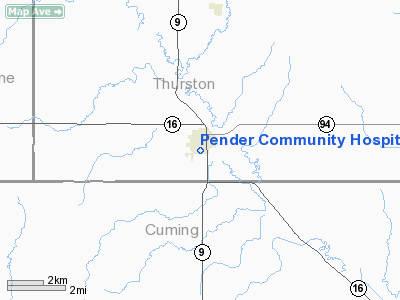
Pender Community Hospital Heliport |
Location & QuickFacts
| FAA Information Effective: | 2008-09-25 |
| Airport Identifier: | NE02 |
| Airport Status: | Operational |
| Longitude/Latitude: | 096-42-40.1300W/42-06-21.9900N
-96.711147/42.106108 (Estimated) |
| Elevation: | 1348 ft / 410.87 m (Estimated) |
| Land: | 0 acres |
| From nearest city: | 0 nautical miles N of Pender, NE |
| Location: | Thurston County, NE |
| Magnetic Variation: | 06E (1995) |
Owner & Manager
| Ownership: | Publicly owned |
| Owner: | Pender Community Hospital |
| Address: | Box 100, 603 Earl Street
Pender, NE 68047-0100 |
| Phone number: | 402-385-3083 |
| Manager: | Roger Mazour
ADMINISTRATOR |
| Address: | 603 Earl Street
Pender, NE 68047-0100 |
| Phone number: | 402-385-3083 |
Airport Operations and Facilities
| Airport Use: | Private
MEDICAL USE. |
| Segmented Circle: | No |
| Control Tower: | No |
| Lighting Schedule: | PHONE REQ
FOR PERIMETER LGTS CALL 402-385-3083. |
| Region: | ACE - Central |
| Boundary ARTCC: | ZMP - Minneapolis |
| Tie-in FSS: | OLU - Columbus |
| FSS Toll Free: | 1-800-WX-BRIEF |
Runway Information
Helipad H1
| Dimension: | 40 x 40 ft / 12.2 x 12.2 m |
| Surface: | CONC, |
| |
Runway H1 |
Runway |
| Traffic Pattern: | Left | Left |
|
Radio Navigation Aids
| ID |
Type |
Name |
Ch |
Freq |
Var |
Dist |
| LCG | NDB | Wayne | | 389.00 | 06E | 14.7 nm |
| SU | NDB | Salix | | 414.00 | 07E | 23.0 nm |
| GAK | NDB | Sioux Gateway | | 233.00 | 06E | 23.2 nm |
| OI | NDB | Tommi | | 305.00 | 07E | 24.0 nm |
| OF | NDB | Carsy | | 510.00 | 08E | 36.8 nm |
| FET | NDB | Fremont | | 311.00 | 06E | 40.4 nm |
| VMR | NDB | Vermillion | | 375.00 | 06E | 40.7 nm |
| MEY | NDB | Mapleton | | 335.00 | 05E | 41.1 nm |
| PLT | NDB | Platte Center | | 407.00 | 08E | 47.4 nm |
| TQE | VOR | Tekamah | | 108.40 | 07E | 31.6 nm |
| SCB | VOR/DME | Scribner | 47X | 111.00 | 06E | 30.3 nm |
| OFK | VOR/DME | Norfolk | 033X | 109.60 | 08E | 33.1 nm |
| OLU | VOR/DME | Columbus | 055X | 111.80 | 08E | 48.5 nm |
| SUX | VORTAC | Sioux City | 112X | 116.50 | 09E | 22.4 nm |
Remarks
- OWNER DESIRES ARPT NOT BE CHARTED.
- SEE AIRSPACE CASE 99-ACE-0135-NRA.
Images and information placed above are from
http://www.airport-data.com/airport/NE02/
We thank them for the data!
| General Info
|
| Country |
United States
|
| State |
NEBRASKA
|
| FAA ID |
NE02
|
| Latitude |
42-06-21.990N
|
| Longitude |
096-42-40.130W
|
| Elevation |
1348 feet
|
| Near City |
PENDER
|
We don't guarantee the information is fresh and accurate. The data may
be wrong or outdated.
For more up-to-date information please refer to other sources.
|
|


