 |
|
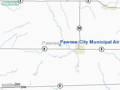
Location & QuickFacts
| FAA Information Effective: | 2008-09-25 |
| Airport Identifier: | 50K |
| Airport Status: | Operational |
| Longitude/Latitude: | 096-11-40.0300W/40-06-58.0000N
-96.194453/40.116111 (Estimated) |
| Elevation: | 1260 ft / 384.05 m (Estimated) |
| Land: | 211 acres |
| From nearest city: | 2 nautical miles W of Pawnee City, NE |
| Location: | Pawnee County, NE |
| Magnetic Variation: | 06E (1985) |
Owner & Manager
| Ownership: | Publicly owned |
| Owner: | Pawnee City Arpt Auth |
| Address: | 321 13th Street
Pawnee City, NE 68420-3548 |
| Phone number: | 402-239-8367 |
| Manager: | Allen Thomas |
| Address: | 321 13th Street
Pawnee City, NE 68420-3548 |
| Phone number: | 402-239-8367 |
Airport Operations and Facilities
| Airport Use: | Open to public |
| Wind indicator: | Yes |
| Segmented Circle: | Yes |
| Control Tower: | No |
| Lighting Schedule: | DUSK-DAWN |
| Beacon Color: | Clear-Green (lighted land airport)
ROTG BCN OTS INDEFLY. |
| Landing fee charge: | No |
| Sectional chart: | Omaha |
| Region: | ACE - Central |
| Traffic Pattern Alt: | 800 ft |
| Boundary ARTCC: | ZMP - Minneapolis |
| Tie-in FSS: | OLU - Columbus |
| FSS on Airport: | No |
| FSS Toll Free: | 1-800-WX-BRIEF |
| NOTAMs Facility: | OLU (NOTAM-d service avaliable) |
| Federal Agreements: | NGY |
Airport Communications
Airport Services
| Fuel available: | 100LL
FOR FUEL CALL 402-852-2672. |
| Airframe Repair: | MINOR |
| Power Plant Repair: | MINOR |
| Bottled Oxygen: | NONE |
| Bulk Oxygen: | NONE |
Runway Information
Runway 14/32
| Dimension: | 3375 x 125 ft / 1028.7 x 38.1 m |
| Surface: | TURF, Good Condition |
| Edge Lights: | Low
LIRL OTS INDEFLY. |
| |
Runway 14 |
Runway 32 |
| Traffic Pattern: | Left | Left |
| Obstruction: | 29 ft tree, 800.0 ft from runway, 50 ft left of centerline, 27:1 slope to clear | 23 ft pole, 1030.0 ft from runway, 26 ft left of centerline, 44:1 slope to clear |
|
Radio Navigation Aids
| ID |
Type |
Name |
Ch |
Freq |
Var |
Dist |
| MYZ | NDB | Marysville | | 341.00 | 06E | 25.7 nm |
| AYB | NDB | Auburn | | 430.00 | 05E | 26.2 nm |
| HWB | NDB | Shaw | | 263.00 | 06E | 27.3 nm |
| FNB | NDB | Brenner | | 404.00 | 05E | 28.0 nm |
| BJU | NDB | Big Blue | | 248.00 | 06E | 32.0 nm |
| AFK | NDB | Nebraska City | | 347.00 | 05E | 33.2 nm |
| DBX | NDB | Morrison | | 212.00 | 06E | 44.5 nm |
| FBY | NDB | Fairbury | | 293.00 | 06E | 44.8 nm |
| LN | NDB | Potts | | 385.00 | 06E | 46.0 nm |
| BIE | VOR | Beatrice | | 110.60 | 07E | 28.0 nm |
| RBA | VOR/DME | Robinson | 019X | 108.20 | 04E | 38.9 nm |
| PWE | VORTAC | Pawnee City | 071X | 112.40 | 05E | 5.1 nm |
Images and information placed above are from
http://www.airport-data.com/airport/50K/
We thank them for the data!
| General Info
|
| Country |
United States
|
| State |
NEBRASKA
|
| FAA ID |
50K
|
| Latitude |
40-06-58.000N
|
| Longitude |
096-11-40.030W
|
| Elevation |
1260 feet
|
| Near City |
PAWNEE CITY
|
We don't guarantee the information is fresh and accurate. The data may
be wrong or outdated.
For more up-to-date information please refer to other sources.
|
|


