 |
|
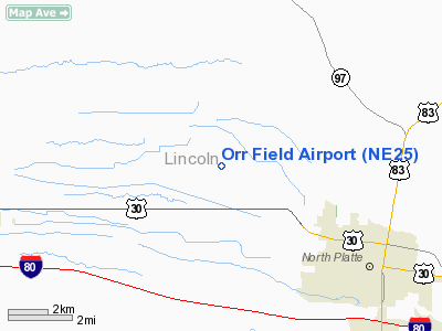
Location & QuickFacts
| FAA Information Effective: | 2008-09-25 |
| Airport Identifier: | NE25 |
| Airport Status: | Operational |
| Longitude/Latitude: | 100-51-35.5300W/41-10-54.9900N
-100.859869/41.181942 (Estimated) |
| Elevation: | 2860 ft / 871.73 m (Estimated) |
| Land: | 0 acres |
| From nearest city: | 6 nautical miles NW of North Platte, NE |
| Location: | Lincoln County, NE |
| Magnetic Variation: | 09E (1995) |
Owner & Manager
| Ownership: | Privately owned |
| Owner: | Jeff C Orr |
| Address: | Route 1 Box 322
North Platte, NE 69101 |
| Phone number: | 308-532-0114 |
| Manager: | Jeff C Orr |
| Address: | Route 1 Box 322
North Platte, NE 69101 |
| Phone number: | 308-532-0114 |
Airport Operations and Facilities
| Airport Use: | Private |
| Segmented Circle: | No |
| Control Tower: | No |
| Landing fee charge: | No |
| Sectional chart: | Omaha |
| Region: | ACE - Central |
| Boundary ARTCC: | ZDV - Denver |
| Tie-in FSS: | OLU - Columbus |
| FSS on Airport: | No |
| FSS Toll Free: | 1-800-WX-BRIEF |
Runway Information
Runway 08/26
| Dimension: | 1970 x 75 ft / 600.5 x 22.9 m |
| Surface: | TURF, |
| |
Runway 08 |
Runway 26 |
| Traffic Pattern: | Left | Left |
| Obstruction: | 30 ft pline, 1280.0 ft from runway | 30 ft pline, 2000.0 ft from runway |
|
Radio Navigation Aids
| ID |
Type |
Name |
Ch |
Freq |
Var |
Dist |
| DWL | NDB | Willow | | 353.00 | 08E | 40.2 nm |
| GGF | NDB | Grant | | 359.00 | 09E | 43.7 nm |
| RRX | NDB | Darr | | 326.00 | 07E | 49.8 nm |
| OZB | VOR | Cozad | | 109.00 | 09E | 43.1 nm |
| SAE | VOR/DME | Searle | 39X | 110.20 | 11E | 41.6 nm |
| TDD | VOR/DME | Thedford | 023X | 108.60 | 09E | 48.5 nm |
| LBF | VORTAC | North Platte | 121X | 117.40 | 11E | 9.5 nm |
| HCT | VORTAC | Hayes Center | 124X | 117.70 | 11E | 43.8 nm |
Remarks
- OWNER DESIRES ARPT NOT BE CHARTED.
- PRVDD CLEAR 20:1 APCH SURFACE AND CLEAR 7:1 TRANSITIONAL SURFACE.
Images and information placed above are from
http://www.airport-data.com/airport/NE25/
We thank them for the data!
| General Info
|
| Country |
United States
|
| State |
NEBRASKA
|
| FAA ID |
NE25
|
| Latitude |
41-10-54.990N
|
| Longitude |
100-51-35.530W
|
| Elevation |
2860 feet
|
| Near City |
NORTH PLATTE
|
We don't guarantee the information is fresh and accurate. The data may
be wrong or outdated.
For more up-to-date information please refer to other sources.
|
|


