 |
|
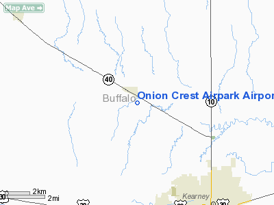
Onion Crest Airpark Airport |
Location & QuickFacts
| FAA Information Effective: | 2008-09-25 |
| Airport Identifier: | 43NE |
| Airport Status: | Operational |
| Longitude/Latitude: | 099-09-17.0000W/40-46-30.0000N
-99.154722/40.775000 (Estimated) |
| Elevation: | 2205 ft / 672.08 m (Estimated) |
| Land: | 10 acres |
| From nearest city: | 2 nautical miles S of Riverdale, NE |
| Location: | Buffalo County, NE |
| Magnetic Variation: | 08E (1990) |
Owner & Manager
| Ownership: | Privately owned |
| Owner: | M.d. |
| Address: | 5355 W. 85th
Kearney, NE 68845 |
| Phone number: | 308-236-5525 |
| Manager: | Mark H. Meyer |
| Address: | 5355 W. 85th
Kearney, NE 68845 |
| Phone number: | 308-236-5525 |
Airport Operations and Facilities
| Airport Use: | Private |
| Wind indicator: | Yes |
| Segmented Circle: | No |
| Control Tower: | No |
| Lighting Schedule: | RDO-CTL
ACTVT LIRL RY 17/35 - 5 CLICKS 122.95. |
| Sectional chart: | Omaha |
| Region: | ACE - Central |
| Boundary ARTCC: | ZDV - Denver |
| Tie-in FSS: | OLU - Columbus |
| FSS Toll Free: | 1-800-WX-BRIEF |
Airport Services
Runway Information
Runway 17/35
| Dimension: | 3400 x 50 ft / 1036.3 x 15.2 m |
| Surface: | ASPH, |
| Edge Lights: | Low |
| |
Runway 17 |
Runway 35 |
| Traffic Pattern: | Left | Left |
| Displaced threshold: | 200.00 ft | 200.00 ft |
|
Radio Navigation Aids
| ID |
Type |
Name |
Ch |
Freq |
Var |
Dist |
| HDE | NDB | Holdrege | | 396.00 | 07E | 21.4 nm |
| PSS | NDB | Prosser | | 338.00 | 07E | 31.3 nm |
| RRX | NDB | Darr | | 326.00 | 07E | 32.2 nm |
| DWL | NDB | Willow | | 353.00 | 08E | 42.2 nm |
| BBW | NDB | Broken Bow | | 265.00 | 08E | 45.2 nm |
| EAR | VOR | Kearney | | 111.20 | 10E | 7.4 nm |
| OZB | VOR | Cozad | | 109.00 | 09E | 39.0 nm |
| HSI | VOR/DME | Hastings | 025X | 108.80 | 07E | 34.6 nm |
| CUZ | VOR/DME | Custer County | 19X | 108.20 | 08E | 49.0 nm |
| GRI | VORTAC | Grand Island | 057X | 112.00 | 07E | 40.2 nm |
Remarks
- PRVDD APCH TO EACH RY IS MAINTAINED FOR 20:1 GLIDE SLOPE & TRANSITIONAL SFC OF 7:1.
Images and information placed above are from
http://www.airport-data.com/airport/43NE/
We thank them for the data!
| General Info
|
| Country |
United States
|
| State |
NEBRASKA
|
| FAA ID |
43NE
|
| Latitude |
40-46-30.000N
|
| Longitude |
099-09-17.000W
|
| Elevation |
2205 feet
|
| Near City |
RIVERDALE
|
We don't guarantee the information is fresh and accurate. The data may
be wrong or outdated.
For more up-to-date information please refer to other sources.
|
|


