 |
|
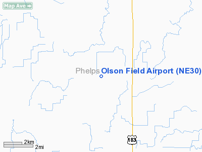
Location & QuickFacts
| FAA Information Effective: | 2008-09-25 |
| Airport Identifier: | NE30 |
| Airport Status: | Operational |
| Longitude/Latitude: | 099-25-13.3650W/40-34-25.0360N
-99.420379/40.573621 (Estimated) |
| Elevation: | 2330 ft / 710.18 m (Estimated) |
| Land: | 0 acres |
| From nearest city: | 10 nautical miles NW of Holdrege, NE |
| Location: | Phelps County, NE |
| Magnetic Variation: | 08E (1995) |
Owner & Manager
| Ownership: | Privately owned |
| Owner: | Arlen A Olson |
| Address: | Route 1 Box 67a
Elm Creek, NE 68836 |
| Phone number: | 308-995-8888 |
| Manager: | Arlen A Olson |
| Address: | Route 1 Box 67a
Elm Creek, NE 68836 |
| Phone number: | 308-995-8888 |
Airport Operations and Facilities
| Airport Use: | Private |
| Wind indicator: | Yes |
| Segmented Circle: | No |
| Control Tower: | No |
| Landing fee charge: | No |
| Sectional chart: | Omaha |
| Region: | ACE - Central |
| Boundary ARTCC: | ZDV - Denver |
| Tie-in FSS: | OLU - Columbus |
| FSS on Airport: | No |
| FSS Toll Free: | 1-800-WX-BRIEF |
Runway Information
Runway 17/35
| Dimension: | 3000 x 20 ft / 914.4 x 6.1 m |
| Surface: | ASPH, |
| |
Runway 17 |
Runway 35 |
| Traffic Pattern: | Left | Left |
|
Radio Navigation Aids
| ID |
Type |
Name |
Ch |
Freq |
Var |
Dist |
| HDE | NDB | Holdrege | | 396.00 | 07E | 8.4 nm |
| RRX | NDB | Darr | | 326.00 | 07E | 25.7 nm |
| DWL | NDB | Willow | | 353.00 | 08E | 34.7 nm |
| CSB | NDB | Harry Strunk | | 389.00 | 08E | 37.4 nm |
| PSS | NDB | Prosser | | 338.00 | 07E | 43.5 nm |
| NRN | NDB | Norton | | 230.00 | 08E | 48.2 nm |
| EAR | VOR | Kearney | | 111.20 | 10E | 21.0 nm |
| OZB | VOR | Cozad | | 109.00 | 09E | 32.0 nm |
| HSI | VOR/DME | Hastings | 025X | 108.80 | 07E | 45.3 nm |
Remarks
- PRVDD CLEAR 20:1 APCH; CLEAR 7:1 TRANSITIONAL SFC; BE ADVISED RY 35 IS CLOSE TO A ROAD WHICH NEEDS TO BE CLEARED BY 15 FT.
Images and information placed above are from
http://www.airport-data.com/airport/NE30/
We thank them for the data!
| General Info
|
| Country |
United States
|
| State |
NEBRASKA
|
| FAA ID |
NE30
|
| Latitude |
40-34-25.036N
|
| Longitude |
099-25-13.365W
|
| Elevation |
2330 feet
|
| Near City |
HOLDREGE
|
We don't guarantee the information is fresh and accurate. The data may
be wrong or outdated.
For more up-to-date information please refer to other sources.
|
|


