|
 |
|
||||
|
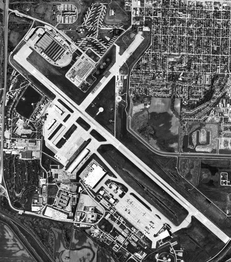
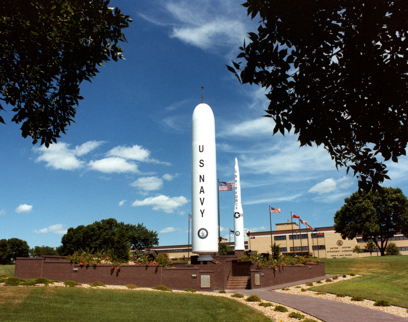
Offutt Air Force Base (IATA: OFF, ICAO: KOFF, FAA LID: OFF) is a U.S. Air Force installation near Omaha, and lies adjacent to Bellevue in Sarpy County, Nebraska. It is the headquarters of the U.S. Strategic Command (USSTRATCOM), the Air Force Weather Agency, and the 55th Wing (55 WG) of the Air Combat Command (ACC), the latter serving as the host unit. Aviation use at Offutt began in September 1918 during World War I as a Army Air Service balloon field. It was renamed in honor of World War I pilot and Omaha native 1st Lt. Jarvis Offutt in 1924. Offutt AFB's legacy includes the construction of the first two bombers to drop atomic bombs and over 40 years as the headquarters for the former Strategic Air Command (SAC) and home for its associated ground and aerial command centers for the U.S. in case of nuclear war during the Cold War. The population was 8,901 at the 2000 census. HistoryFort CrookFort Crook was commissioned by the War Department in 1890. Fort Crook was a U.S. Army Depot immediately south of Bellevue, Nebraska, along the Missouri River. It was first used as a dispatch point for Indian conflicts on the Great Plains. The fort was named for Major General George Crook, a Civil War veteran and Indian fighter. Troops from Fort Crook fought during the Spanish-American War when the 22nd Regiment under Charles A. Wikoff was dispatched to Cuba. The regiment suffered heavy casualties in the Battle of El Caney. Only 165 of the 513 regiment members survived with most succumbing to tropical diseases after the battle. The oldest surviving portion of Fort Crook is the parade grounds and surrounding red brick buildings that were constructed between 1894-96. These structures are still in active use today as squadron headquarters, living quarters for high-ranking generals (Generals Row), and Nebraska’s oldest operational jail. Offutt Field
In 1918, the 61st Balloon Company of the Army Air Corps was assigned to Fort Crook at the close of World War I. In 1921, an airfield was built at the fort as a refueling stop for mail and transcontinental flights and in 1924 the airfield was officially named "Offutt Field" in honor of 1st Lt. Jarvis Offutt. Offutt was an American pilot from nearby Omaha who was killed on 13 August 1918 while flying with the Royal Air Force in France during World War I.
Glenn L. Martin Bomber PlantIn 1940 the Army Air Corps chose Offutt Field as the site for a new bomber plant that was to be operated by the Glenn L. Martin Company. The plant's construction included a two mile (3 km)-long concrete runway, six large hangars, and a 1,700,000-square-foot (158,000 m) aircraft-assembly building.
531 B-29 Superfortresses and 1,585 B-26 Marauders were built at the Martin-Nebraska bomber plant before the end of World War II. Among these were the Enola Gay and Bockscar, the B-29's that dropped the first atomic weapons to be used in a military action (against the cities of Hiroshima and Nagasaki, Japan). Both planes were built and modified at the base. Paul Tibbets personally selected the Enola Gay from the assembly line. President Franklin D. Roosevelt toured the plant on April 26, 1943 with Nebraska Governor Dwight Griswold and plant owner Glenn L. Martin. Offutt Air Force BaseStrategic Air CommandIn 1948, Offutt Field transferred to the new Department of the Air Force and became Offutt Air Force Base. Later that same year, the 3902d Air Base Wing became the host unit at Offutt. During the same year, Offutt gained international prominence when it became the host base for the headquarters of the Strategic Air Command (SAC). Offutt was chosen for its strategic central position in the USA; allowing long-range, nuclear-armed bombers to (then) stay safely out of range of hostile missiles or bomber aircraft. Offutt's population and facilities grew dramatically to keep pace with the increased operational demands during the Cold War. Several new buildings were erected, including more than 2,000 family housing units. During the Cold War, a general and various support personnel from the base were airborne 24-hours a day on an EC-135 from February 3, 1961 to July 24, 1990 in Operation Looking Glass, creating an airborne command post in case of war. Operation Looking Glass carried out its mission without any mishaps or incidents during its 29 years of existence. During the late 1950s Offutt housed a Royal Air Force facility for servicing Avro Vulcans, which visited the air base frequently while on exercise with SAC. The 3902d Air Base Wing was deactivated on 1 March 1986, and the 55th Strategic Reconnaissance Wing assumed host-unit responsibilities for Offutt. Increased defense spending during the 1980s brought additional operational improvements to Offutt, including the Bennie Davis Aircraft Maintenance Hangar, and a new command center for Headquarters SAC. Offutt was brought to popular attention during its SAC period when the command was depicted in the 1955 film Strategic Air Command starring Jimmy Stewart, the 1963 film A Gathering of Eagles starring Rock Hudson, and 1964's Fail-Safe starring Henry Fonda (which not only claimed to show portions of the base but also a nearby Omaha neighborhood) and Dr. Strangelove or: How I Learned to Stop Worrying and Love the Bomb starring Peter Sellers (which depicts a nuclear first strike from a mad general at the fictional Burpelson Air Force Base). Offutt also appeared in the Star Trek episode "Tomorrow Is Yesterday" (identified as 'the Omaha installation'), when a fighter pilot stationed there detects the approaching USS Enterprise and is transported aboard. Strategic Command
In 1992, the Air Force reorganized its military unit structure; the Strategic Air Command (SAC) was deactivated on June 1, succeeded by the U.S. Strategic Command (USSTRATCOM), a Unified Combatant Command of the Department of Defense. The 55th Strategic Wing then became the 55th Wing, under the newly created Air Combat Command. In 1998, the Strategic Air and Space Museum moved 30 miles (48 km) southwest to Ashland, just off Interstate 80, midway between Omaha and Lincoln. In 2005, Offutt began several major renovations. The on-base Wherry housing area was demolished for replacement with new housing. A new fire house, AAFES mini-mall, and U.S. Post Office were completed in 2006. Additionally, the Air Force Weather Agency broke ground on a new facility which was completed in 2008. Bush Offutt Conference on September 11
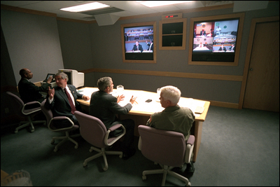
On September 11, 2001, President George W. Bush conducted one of the first major strategy sessions for the response to the September 11 attacks from a bunker at the base. Bush, who was in Florida at the Emma Booker Elementary School in Sarasota at the time of the attacks, first flew from Sarasota-Bradenton International Airport to Barksdale AFB in Louisiana and then to Offutt en route back to Washington, DC. Bush arrived at 2:50 PM (Eastern), conducted a video conference in an underground command bunker and left for Washington, DC at 4:30 PM. Air Force One left Barksdale AFB for Offutt AFB around 1:30 p.m. The Air Force One entourage was pared down to a few essential staffers such as Ari Fleischer, Andrew Card, Karl Rove, Dan Bartlett, and Gordon Johndroe, plus about five reporters. During the flight, Bush remained in “continuous contact” with the White House Situation Room and Vice President Dick Cheney. Air Force One landed at Offutt shortly before 3:00 p.m. At 3:06, Bush passed through security to the US Strategic Command Underground Command Center and was taken into an underground bunker designed to withstand a nuclear blast. There, he held a teleconference call with Vice President Cheney, National Security Advisor Condoleezza Rice, Defense Secretary Donald Rumsfeld, Deputy Secretary of State Richard Armitage, CIA Director Tenet, Transportation Secretary Norman Mineta, and others. The meeting lasted about an hour. Rice recalled that during the meeting, Tenet told Bush, "Sir, I believe it’s al-Qaeda. We’re doing the assessment but it looks like, it feels like, it smells like al-Qaeda." The White House staff was preparing for Bush to address the nation from the Offutt bunker, but Bush decided instead to return to Washington. Air Force One left Offutt around 4:30 p.m. Geography
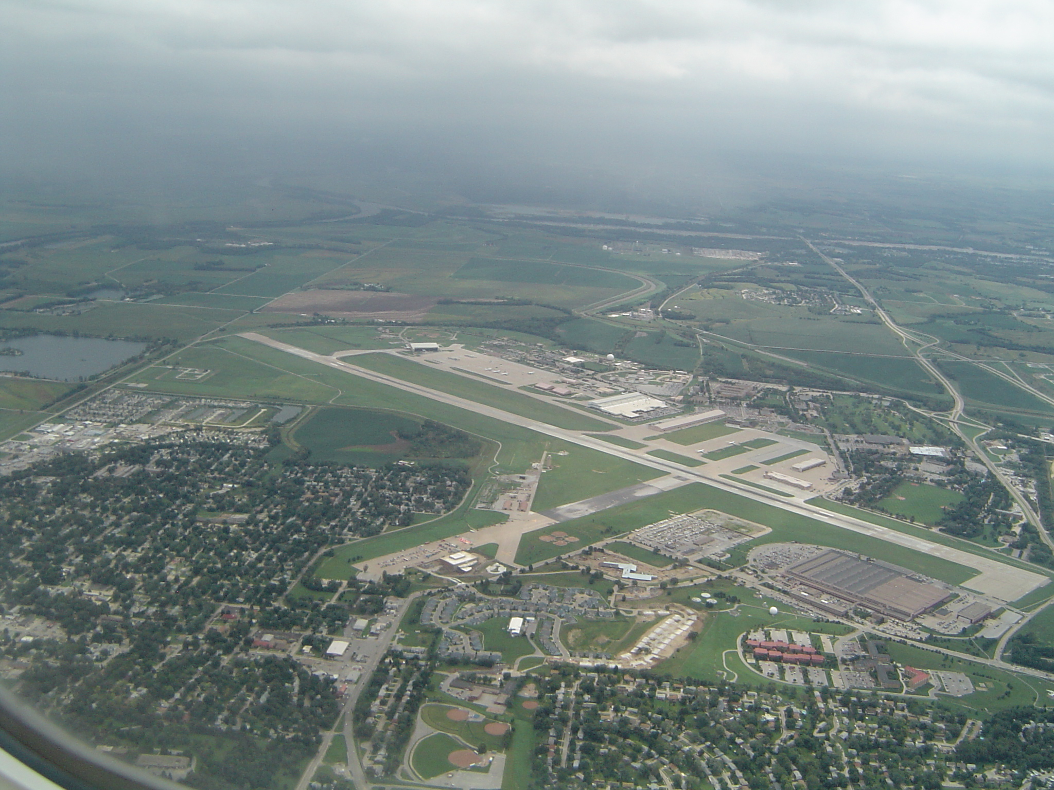
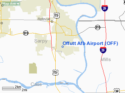
Offutt Air Force Base is located at 41°06′49″N 95°55′42″W / 41.11361°N 95.92833°WCoordinates: 41°06′49″N 95°55′42″W / 41.11361°N 95.92833°W. According to the United States Census Bureau, the base has a total area of 4.3 square miles (11.3 km²), of which, 4.2 square miles (10.9 km²) of it is land and 0.1 square miles (0.4 km²) of it (3.22%) is water. DemographicsAs of the census of 2000, there were 8,901 people, 2,304 households, and 2,255 families residing on the base. The population density was 2,113.1 people per square mile (816.3/km²). There were 2,429 housing units at an average density of 576.6/sq mi (222.8/km²). The racial makeup of the base was 77.97% White, 10.44% Black or African American, 0.69% Native American, 2.73% Asian, 0.31% Pacific Islander, 3.55% from other races, and 4.31% from two or more races. Hispanic or Latino of any race were 7.38% of the population. There were 2,304 households out of which 79.1% had children under the age of 18 living with them, 90.5% were married couples living together, 5.3% had a female householder with no husband present, and 2.1% were non-families. 1.9% of all households were made up of individuals and none had someone living alone who was 65 years of age or older. The average household size was 3.61 and the average family size was 3.64. On the base the population was spread out with 41.9% under the age of 18, 16.8% from 18 to 24, 39.7% from 25 to 44, 1.4% from 45 to 64, and 0.1% who were 65 years of age or older. The median age was 22 years. For every 100 females there were 105.4 males. For every 100 females age 18 and over, there were 109.7 males. The median income for a household on the base was $36,742, and the median income for a family was $36,619. Males had a median income of $25,391 versus $21,593 for females. The per capita income for the base was $11,580. About 4.4% of families and 5.6% of the population were below the poverty line, including 7.1% of those under age 18 and none of those age 65 or over. The above content comes from Wikipedia and is published under free licenses – click here to read more.
Location & QuickFacts
Owner & Manager
Airport Operations and Facilities
Airport Services
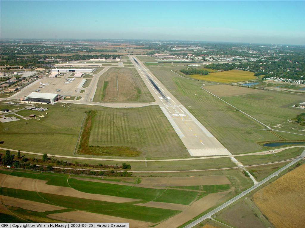
Runway InformationRunway 12/30
Radio Navigation Aids
Remarks
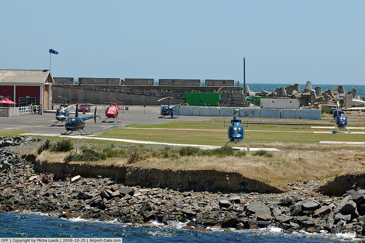
Images and information placed above are from We thank them for the data!
We don't guarantee the information is fresh and accurate. The data may
be wrong or outdated.
|
|||||||||||||||||||||||||||||||||||||||||||||||||||||||||||||||||||||||||||||||||||||||||||||||||||||||||||||||||||||||||||||||||||||||||||||||||||||||||||||||||||||||||||||||||||||||||||||||||||||||||||||||||||||||||||||||||||||||||||||||||||||||||||||||||||||||||||||||||||||||||||||||||||||||||||||||||||||||||||||||||||||||||||||||||||||||||||||||||||||||||||||||||||||||||||||||||||||||||||||||||||||||

 |
|
Copyright 2004-2026 © by Airports-Worldwide.com, Vyshenskoho st. 36, Lviv 79010, Ukraine Legal Disclaimer |