 |
|
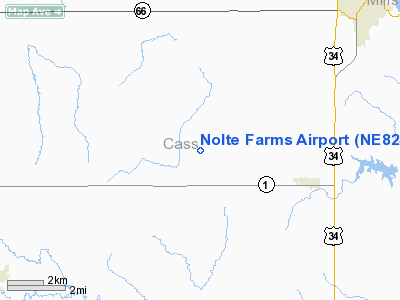
Location & QuickFacts
| FAA Information Effective: | 2008-09-25 |
| Airport Identifier: | NE82 |
| Airport Status: | Operational |
| Longitude/Latitude: | 095-59-58.0390W/40-55-56.9990N
-95.999455/40.932500 (Estimated) |
| Elevation: | 1245 ft / 379.48 m (Estimated) |
| Land: | 10 acres |
| From nearest city: | 4 nautical miles NW of Murray, NE |
| Location: | Cass County, NE |
| Magnetic Variation: | 06E (1990) |
Owner & Manager
| Ownership: | Privately owned |
| Owner: | Ronald Nolte |
| Address: | 10014 54th St
Murray, NE 68409-1930 |
| Phone number: | 402-298-8500 |
| Manager: | Ronald Nolte |
| Address: | 10014 54th St
Murray, NE 68409-1930 |
| Phone number: | 402-298-8500 |
Airport Operations and Facilities
| Airport Use: | Private |
| Wind indicator: | Yes |
| Segmented Circle: | No |
| Control Tower: | No |
| Sectional chart: | Omaha |
| Region: | ACE - Central |
| Boundary ARTCC: | ZMP - Minneapolis |
| Tie-in FSS: | OLU - Columbus |
| FSS on Airport: | No |
| FSS Toll Free: | 1-800-WX-BRIEF |
Runway Information
Runway 03/21
| Dimension: | 2300 x 65 ft / 701.0 x 19.8 m |
| Surface: | TURF, |
| |
Runway 03 |
Runway 21 |
| Traffic Pattern: | Right | Left |
| Obstruction: | | 100 ft pline, 2640.0 ft from runway |
|
Radio Navigation Aids
| ID |
Type |
Name |
Ch |
Freq |
Var |
Dist |
| PMV | NDB | Plattsmouth | | 329.00 | 06E | 4.0 nm |
| MLE | NDB | Millard | | 371.00 | 06E | 16.6 nm |
| AFK | NDB | Nebraska City | | 347.00 | 05E | 20.6 nm |
| OM | NDB | Gerfi | | 320.00 | 05E | 26.2 nm |
| SDA | NDB | Shenandoah | | 411.00 | 05E | 29.0 nm |
| AYB | NDB | Auburn | | 430.00 | 05E | 31.2 nm |
| AHQ | NDB | Wahoo | | 400.00 | 07E | 32.8 nm |
| RDK | NDB | Red Oak | | 230.00 | 04E | 34.2 nm |
| LN | NDB | Potts | | 385.00 | 06E | 36.4 nm |
| FET | NDB | Fremont | | 311.00 | 06E | 39.0 nm |
| ICL | NDB | Clarinda | | 353.00 | 04E | 45.9 nm |
| HNR | NDB | Harlan | | 272.00 | 05E | 49.0 nm |
| OFF | TACAN | Offutt | 054X | | 05E | 12.0 nm |
| SCB | VOR/DME | Scribner | 47X | 111.00 | 06E | 49.4 nm |
| OVR | VORTAC | Omaha | 110X | 116.30 | 08E | 18.5 nm |
| LNK | VORTAC | Lincoln | 108X | 116.10 | 09E | 33.7 nm |
| PWE | VORTAC | Pawnee City | 071X | 112.40 | 05E | 45.0 nm |
| OMA | VOT | Omaha | | 109.00 | | 22.4 nm |
Remarks
- PRVDD APCH MAINTAINED FOR 20:1; TRANSITIONAL SFC MAINTAINED FOR 7:1; ALL TFC PATTERNS SHOULD BE FLOWN WEST OF ARPT TO AVOID CONFLICT WITH PLATTSMOUTH ARPT.
Images and information placed above are from
http://www.airport-data.com/airport/NE82/
We thank them for the data!
| General Info
|
| Country |
United States
|
| State |
NEBRASKA
|
| FAA ID |
NE82
|
| Latitude |
40-55-56.999N
|
| Longitude |
095-59-58.039W
|
| Elevation |
1245 feet
|
| Near City |
MURRAY
|
We don't guarantee the information is fresh and accurate. The data may
be wrong or outdated.
For more up-to-date information please refer to other sources.
|
|


