 |
|
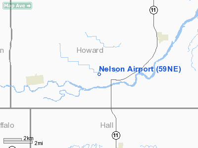
Location & QuickFacts
| FAA Information Effective: | 2008-09-25 |
| Airport Identifier: | 59NE |
| Airport Status: | Operational |
| Longitude/Latitude: | 098-37-46.2630W/41-04-52.0440N
-98.629517/41.081123 (Estimated) |
| Elevation: | 1982 ft / 604.11 m (Estimated) |
| Land: | 4 acres |
| From nearest city: | 4 nautical miles E of Boelus, NE |
| Location: | Howard County, NE |
| Magnetic Variation: | 08E (1985) |
Owner & Manager
| Ownership: | Privately owned |
| Owner: | James C. Nelson |
| Address: | 332 Salem Road
Boelus, NE 68820-2502 |
| Phone number: | 308-996-4349 |
| Manager: | James C. Nelson |
| Address: | 332 Salem Rd
Boelus, NE 68820-2502 |
| Phone number: | 308-996-4349 |
Airport Operations and Facilities
| Airport Use: | Private |
| Wind indicator: | Yes |
| Segmented Circle: | No |
| Control Tower: | No |
| Landing fee charge: | No |
| Sectional chart: | Omaha |
| Region: | ACE - Central |
| Boundary ARTCC: | ZMP - Minneapolis |
| Tie-in FSS: | OLU - Columbus |
| FSS on Airport: | No |
| FSS Toll Free: | 1-800-WX-BRIEF |
Runway Information
Runway 11/29
| Dimension: | 1650 x 80 ft / 502.9 x 24.4 m |
| Surface: | TURF, |
| |
Runway 11 |
Runway 29 |
| Traffic Pattern: | Left | Left |
|
Radio Navigation Aids
| ID |
Type |
Name |
Ch |
Freq |
Var |
Dist |
| PSS | NDB | Prosser | | 338.00 | 07E | 24.7 nm |
| ODX | NDB | Ord | | 356.00 | 07E | 35.6 nm |
| BVN | NDB | Alaby | | 332.00 | 06E | 46.9 nm |
| JYR | NDB | York | | 257.00 | 06E | 47.2 nm |
| BUB | NDB | Burwell | | 377.00 | 07E | 47.7 nm |
| HDE | NDB | Holdrege | | 396.00 | 07E | 50.0 nm |
| EAR | VOR | Kearney | | 111.20 | 10E | 27.3 nm |
| HSI | VOR/DME | Hastings | 025X | 108.80 | 07E | 30.1 nm |
| GRI | VORTAC | Grand Island | 057X | 112.00 | 07E | 15.4 nm |
| OBH | VORTAC | Wolbach | 095X | 114.80 | 07E | 21.7 nm |
Remarks
- CONDL: PROVIDED APPROACH TO EACH RWY IS MAINTAINED FOR A MIN 20:1 GLIDE SLOPE AND THE TRANSITIONAL SURFACE BE MAINTAINED FOR A 7:1 SLOPE.
Images and information placed above are from
http://www.airport-data.com/airport/59NE/
We thank them for the data!
| General Info
|
| Country |
United States
|
| State |
NEBRASKA
|
| FAA ID |
59NE
|
| Latitude |
41-04-52.044N
|
| Longitude |
098-37-46.263W
|
| Elevation |
1982 feet
|
| Near City |
BOELUS
|
We don't guarantee the information is fresh and accurate. The data may
be wrong or outdated.
For more up-to-date information please refer to other sources.
|
|


