 |
|
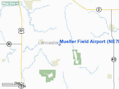
Location & QuickFacts
| FAA Information Effective: | 2008-09-25 |
| Airport Identifier: | NE79 |
| Airport Status: | Operational |
| Longitude/Latitude: | 096-37-16.0600W/40-39-10.0030N
-96.621128/40.652779 (Estimated) |
| Elevation: | 1405 ft / 428.24 m (Estimated) |
| Land: | 73 acres |
| From nearest city: | 2 nautical miles E of Roca, NE |
| Location: | Lancaster County, NE |
| Magnetic Variation: | 07E (1985) |
Owner & Manager
| Ownership: | Privately owned |
| Owner: | Ken Mueller |
| Address: | 7401 Roca Rd.
Roca, NE 68430 |
| Phone number: | 402-792-2878 |
| Address: |
|
Airport Operations and Facilities
| Airport Use: | Private |
| Wind indicator: | Yes |
| Segmented Circle: | No |
| Control Tower: | No |
| Sectional chart: | Omaha |
| Region: | ACE - Central |
| Boundary ARTCC: | ZMP - Minneapolis |
| Tie-in FSS: | OLU - Columbus |
| FSS on Airport: | No |
| FSS Toll Free: | 1-800-WX-BRIEF |
Runway Information
Runway 15/33
| Dimension: | 1660 x 40 ft / 506.0 x 12.2 m |
| Surface: | TURF, |
| |
Runway 15 |
Runway 33 |
| Traffic Pattern: | Left | Left |
| Obstruction: | 7 ft road, 140.0 ft from runway | 3 ft fence, 60.0 ft from runway |
|
Radio Navigation Aids
| ID |
Type |
Name |
Ch |
Freq |
Var |
Dist |
| LN | NDB | Potts | | 385.00 | 06E | 8.6 nm |
| BJU | NDB | Big Blue | | 248.00 | 06E | 19.5 nm |
| HWB | NDB | Shaw | | 263.00 | 06E | 24.1 nm |
| SWT | NDB | Seward | | 269.00 | 06E | 25.6 nm |
| AFK | NDB | Nebraska City | | 347.00 | 05E | 34.8 nm |
| AHQ | NDB | Wahoo | | 400.00 | 07E | 35.3 nm |
| PMV | NDB | Plattsmouth | | 329.00 | 06E | 36.7 nm |
| FBY | NDB | Fairbury | | 293.00 | 06E | 38.0 nm |
| AYB | NDB | Auburn | | 430.00 | 05E | 39.5 nm |
| MLE | NDB | Millard | | 371.00 | 06E | 39.9 nm |
| FMZ | NDB | Beklof | | 392.00 | 07E | 43.4 nm |
| JYR | NDB | York | | 257.00 | 06E | 47.7 nm |
| MYZ | NDB | Marysville | | 341.00 | 06E | 48.1 nm |
| FET | NDB | Fremont | | 311.00 | 06E | 48.2 nm |
| OFF | TACAN | Offutt | 054X | | 05E | 43.0 nm |
| BIE | VOR | Beatrice | | 110.60 | 07E | 22.0 nm |
| LNK | VORTAC | Lincoln | 108X | 116.10 | 09E | 17.2 nm |
| PWE | VORTAC | Pawnee City | 071X | 112.40 | 05E | 33.2 nm |
Remarks
- PRVDD APCHS MAINTAINED FOR 20:1 GLIDE SLOPE AND TRANSITIONAL SURFACES FOR 7:1 SLOPE.
Images and information placed above are from
http://www.airport-data.com/airport/NE79/
We thank them for the data!
| General Info
|
| Country |
United States
|
| State |
NEBRASKA
|
| FAA ID |
NE79
|
| Latitude |
40-39-10.003N
|
| Longitude |
096-37-16.060W
|
| Elevation |
1405 feet
|
| Near City |
ROCA
|
We don't guarantee the information is fresh and accurate. The data may
be wrong or outdated.
For more up-to-date information please refer to other sources.
|
|


