 |
|
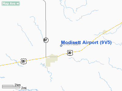
Location & QuickFacts
| FAA Information Effective: | 2008-09-25 |
| Airport Identifier: | 9V5 |
| Airport Status: | Operational |
| Longitude/Latitude: | 102-26-39.6965W/42-44-11.6717N
-102.444360/42.736575 (Estimated) |
| Elevation: | 3751 ft / 1143.30 m (Surveyed) |
| Land: | 251 acres |
| From nearest city: | 2 nautical miles NE of Rushville, NE |
| Location: | Sheridan County, NE |
| Magnetic Variation: | 10E (1985) |
Owner & Manager
| Ownership: | Publicly owned |
| Owner: | Rushville Airport Authority |
| Address: | P.o. Box 99
Rushville, NE 69360-0099 |
| Phone number: | 308-327-2221 |
| Manager: | Glenna Vodicka |
| Address: | Po Box 99
Rushville, NE 69360-0099 |
| Phone number: | 308-327-2221
CITY CLERK/AIRPORT AUTHORITY SECRETARY |
Airport Operations and Facilities
| Airport Use: | Open to public |
| Wind indicator: | Yes |
| Segmented Circle: | Yes |
| Control Tower: | No |
| Lighting Schedule: | DUSK-DAWN
ACTVT MIRL RY 14/32 - CTAF. |
| Beacon Color: | Clear-Green (lighted land airport) |
| Landing fee charge: | No |
| Sectional chart: | Cheyenne |
| Region: | ACE - Central |
| Boundary ARTCC: | ZDV - Denver |
| Tie-in FSS: | OLU - Columbus |
| FSS on Airport: | No |
| FSS Toll Free: | 1-800-WX-BRIEF |
| NOTAMs Facility: | OLU (NOTAM-d service avaliable) |
| Federal Agreements: | NGY |
Airport Communications
Airport Services
| Fuel available: | 100LL
24 HRS SELF SERVICE FUEL AVAILBLE VIA CREDIT CARD SYSTEM. |
| Airframe Repair: | NONE |
| Power Plant Repair: | NONE |
| Bottled Oxygen: | NONE |
| Bulk Oxygen: | NONE |
Runway Information
Runway 14/32
| Dimension: | 3909 x 60 ft / 1191.5 x 18.3 m |
| Surface: | CONC, Good Condition |
| Weight Limit: | Single wheel: 12000 lbs. |
| Edge Lights: | Medium |
| |
Runway 14 |
Runway 32 |
| Longitude: | 102-26-52.9320W | 102-26-26.4610W |
| Latitude: | 42-44-28.3302N | 42-43-55.0132N |
| Elevation: | 3749.00 ft | 3751.00 ft |
| Alignment: | 127 | 127 |
| Traffic Pattern: | Left | Left |
| Markings: | Non-precision instrument, Good Condition | Non-precision instrument, Good Condition |
| Obstruction: | 30 ft road, 1635.0 ft from runway, 47:1 slope to clear | 12 ft road, 540.0 ft from runway, 28:1 slope to clear |
|
Radio Navigation Aids
| ID |
Type |
Name |
Ch |
Freq |
Var |
Dist |
| GRN | NDB | Gordon | | 414.00 | 09E | 12.3 nm |
| HIN | NDB | Whitney | | 275.00 | 11E | 29.2 nm |
| ALU | NDB | Alliance | | 380.00 | 11E | 44.6 nm |
| CDR | VOR/DME | Chadron | 081X | 113.40 | 13E | 39.8 nm |
| AIA | VOR/DME | Alliance | 055X | 111.80 | 11E | 43.9 nm |
Remarks
- ULTRALIGHTS ON & INVOF ARPT.
- NUMEROUS CROP DUSTING ACFT INVOF ARPT.
- WILDLIFE ON & INVOF ARPT.
- COURTESY CAR AVBL.
Images and information placed above are from
http://www.airport-data.com/airport/9V5/
We thank them for the data!
| General Info
|
| Country |
United States
|
| State |
NEBRASKA
|
| FAA ID |
9V5
|
| Latitude |
42-44-14.951N
|
| Longitude |
102-26-41.621W
|
| Elevation |
3761 feet
|
| Near City |
RUSHVILLE
|
We don't guarantee the information is fresh and accurate. The data may
be wrong or outdated.
For more up-to-date information please refer to other sources.
|
|


