 |
|
Location & QuickFacts
| FAA Information Effective: | 2008-09-25 |
| Airport Identifier: | NE83 |
| Airport Status: | Operational |
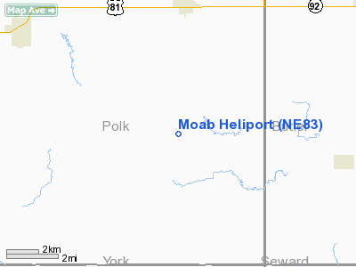
| Longitude/Latitude: | 097-25-53.1700W/41-07-14.0490N
-97.431436/41.120569 (Estimated) |
| Elevation: | 1640 ft / 499.87 m (Estimated) |
| Land: | 0 acres |
| From nearest city: | 4 nautical miles S of Shelby, NE |
| Location: | Polk County, NE |
| Magnetic Variation: | 07E (1985) |
Owner & Manager
| Ownership: | Privately owned |
| Owner: | Lee Grossnicklaus |
| Address: | Po Box 261
Shelby, NE 68662 |
| Phone number: | 402-527-5320 |
| Manager: | Lee Grossnicklaus |
| Address: | Po Box 261
Shelby, NE 68662 |
| Phone number: | 402-527-5320 |
Airport Operations and Facilities
| Airport Use: | Private |
| Wind indicator: | No |
| Segmented Circle: | No |
| Control Tower: | No |
| Landing fee charge: | No |
| Sectional chart: | Omaha |
| Region: | ACE - Central |
| Boundary ARTCC: | ZMP - Minneapolis |
| Tie-in FSS: | OLU - Columbus |
| FSS on Airport: | No |
| FSS Toll Free: | 1-800-WX-BRIEF |
Airport Services
| Airframe Repair: | NONE |
| Power Plant Repair: | NONE |
Runway Information
Helipad H1
| Dimension: | 90 x 60 ft / 27.4 x 18.3 m |
| Surface: | TURF, |
| |
Runway H1 |
Runway |
| Traffic Pattern: | Right | Left |
|
Radio Navigation Aids
| ID |
Type |
Name |
Ch |
Freq |
Var |
Dist |
| JYR | NDB | York | | 257.00 | 06E | 15.8 nm |
| SWT | NDB | Seward | | 269.00 | 06E | 21.3 nm |
| PLT | NDB | Platte Center | | 407.00 | 08E | 22.7 nm |
| FMZ | NDB | Beklof | | 392.00 | 07E | 32.5 nm |
| LN | NDB | Potts | | 385.00 | 06E | 37.8 nm |
| AHQ | NDB | Wahoo | | 400.00 | 07E | 38.4 nm |
| FET | NDB | Fremont | | 311.00 | 06E | 45.8 nm |
| BVN | NDB | Alaby | | 332.00 | 06E | 46.1 nm |
| OF | NDB | Carsy | | 510.00 | 08E | 46.2 nm |
| OLU | VOR/DME | Columbus | 055X | 111.80 | 08E | 20.2 nm |
| SCB | VOR/DME | Scribner | 47X | 111.00 | 06E | 46.5 nm |
| LNK | VORTAC | Lincoln | 108X | 116.10 | 09E | 33.4 nm |
| GRI | VORTAC | Grand Island | 057X | 112.00 | 07E | 40.9 nm |
| OBH | VORTAC | Wolbach | 095X | 114.80 | 07E | 44.4 nm |
Remarks
Images and information placed above are from
http://www.airport-data.com/airport/NE83/
We thank them for the data!
| General Info
|
| Country |
United States
|
| State |
NEBRASKA
|
| FAA ID |
NE83
|
| Latitude |
41-07-14.049N
|
| Longitude |
097-25-53.170W
|
| Elevation |
1640 feet
|
| Near City |
SHELBY
|
We don't guarantee the information is fresh and accurate. The data may
be wrong or outdated.
For more up-to-date information please refer to other sources.
|
|


