 |
|
| Miller Field |
| IATA: VTN – ICAO: KVTN – FAA LID: VTN |
| Summary |
| Airport type |
Public |
| Owner |
City of Valentine |
| Serves |
Valentine, Nebraska |
| Elevation AMSL |
2,596 ft / 791 m |
| Coordinates |
42°51′24″N 100°32′56″W / 42.85667°N 100.54889°W / 42.85667; -100.54889 |
| Runways |
| Direction |
Length |
Surface |
| ft |
m |
| 14/32 |
4,700 |
1,433 |
Asphalt |
| 3/21 |
3,700 |
1,128 |
Asphalt |
| Statistics (2006) |
| Aircraft operations |
4,264 |
| Source: Federal Aviation Administration |
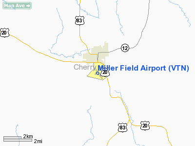
Miller Field (IATA: VTN, ICAO: KVTN, FAA LID: VTN) is a city-owned public-use airport located one nautical mile (2 km) south of the central business district of Valentine, a city in Cherry County, Nebraska, United States.
Facilities and aircraft
Miller Field covers an area of 279 acres (113 ha) at an elevation of 2,596 feet (791 m) above mean sea level. It has two asphalt paved runways: 14/32 is 4,700 by 100 feet (1,433 x 30 m) and 3/21 is 3,700 by 60 feet. For the 12-month period ending June 27, 2006, the airport had 4,264 aircraft operations, an average of 11 per day: 86% general aviation, 14% air taxi and <1% military.
The above content comes from Wikipedia and is published under free licenses – click here to read more.
Location & QuickFacts
| FAA Information Effective: | 2008-09-25 |
| Airport Identifier: | VTN |
| Airport Status: | Operational |
| Longitude/Latitude: | 100-32-56.2780W/42-51-24.1090N
-100.548966/42.856697 (Estimated) |
| Elevation: | 2596 ft / 791.26 m (Surveyed) |
| Land: | 279 acres |
| From nearest city: | 1 nautical miles S of Valentine, NE |
| Location: | Cherry County, NE |
| Magnetic Variation: | 08E (2000) |
Owner & Manager
| Ownership: | Publicly owned |
| Owner: | City Of Valentine |
| Address: | P.o. Box 177, 323 North Main
Valentine, NE 69201-0177 |
| Phone number: | 402-376-2323
CITY HALL PHONE NUMBER. |
| Manager: | Robert Kilmer |
| Address: | Hc 37 Box 1c
Valentine, NE 69201-9501 |
| Phone number: | 402-376-1611 |
Airport Operations and Facilities
| Airport Use: | Open to public |
| Wind indicator: | Yes |
| Segmented Circle: | Yes |
| Control Tower: | No |
| Lighting Schedule: | DUSK-DAWN
ACTVT MIRL RYS 03/21 & 14/32 & REIL RY 32 - CTAF. |
| Beacon Color: | Clear-Green (lighted land airport) |
| Landing fee charge: | No |
| Sectional chart: | Omaha |
| Region: | ACE - Central |
| Boundary ARTCC: | ZDV - Denver |
| Tie-in FSS: | OLU - Columbus |
| FSS on Airport: | No |
| FSS Toll Free: | 1-800-WX-BRIEF |
| NOTAMs Facility: | VTN (NOTAM-d service avaliable) |
| Federal Agreements: | NGY |
Airport Communications
| CTAF: | 122.800 |
| Unicom: | 122.800 |
Airport Services
| Fuel available: | 100LLA
FUEL AVBL 24 HRS WITH CREDIT CARD OR BY PRIOR ARRANGEMENT CALL (402) 376-1611. |
| Airframe Repair: | MAJOR |
| Power Plant Repair: | MAJOR |
| Bottled Oxygen: | NONE |
| Bulk Oxygen: | NONE |
Runway Information
Runway 03/21
| Dimension: | 3700 x 60 ft / 1127.8 x 18.3 m |
| Surface: | ASPH, |
| Weight Limit: | Single wheel: 12500 lbs. |
| Edge Lights: | Medium |
| |
Runway 03 |
Runway 21 |
| Longitude: | 100-33-19.5000W | 100-32-50.0900W |
| Latitude: | 42-51-10.1400N | 42-51-39.5800N |
| Elevation: | 2596.00 ft | 2586.00 ft |
| Alignment: | 36 | 127 |
| Traffic Pattern: | Left | Left |
| Markings: | Non-precision instrument, Good Condition | Non-precision instrument, Good Condition |
| Crossing Height: | 39.00 ft | 45.00 ft |
| Displaced threshold: | 0.00 ft | 300.00 ft |
| VASI: | 2-light PAPI on left side | 2-light PAPI on left side |
| Visual Glide Angle: | 3.00° | 3.00° |
| Decleard distances: | Take off run available 3700.00 ft
Take off distance available 3700.00 ft
Actual stop distance available 3400.00 ft
Landing distance available 3400.00 ft
| Take off run available 3700.00 ft
Take off distance available 3700.00 ft
Actual stop distance available 3700.00 ft
Landing distance available 3400.00 ft
|
|
Runway 14/32
| Dimension: | 4700 x 100 ft / 1432.6 x 30.5 m |
| Surface: | ASPH, Good Condition |
| Weight Limit: | Single wheel: 12500 lbs. |
| Edge Lights: | Medium |
| |
Runway 14 |
Runway 32 |
| Longitude: | 100-33-07.4622W | 100-32-31.6642W |
| Latitude: | 42-51-42.6491N | 42-51-04.3813N |
| Elevation: | 2587.00 ft | 2582.00 ft |
| Alignment: | 127 | 127 |
| Traffic Pattern: | Left | Left |
| Markings: | Non-precision instrument, Good Condition | Non-precision instrument, Good Condition |
| Crossing Height: | 40.00 ft | 43.00 ft |
| VASI: | 2-light PAPI on left side | 2-light PAPI on left side |
| Visual Glide Angle: | 3.00° | 3.00° |
| Runway End Identifier: | | Yes |
| Obstruction: | , 50:1 slope to clear | 8 ft fence, 400.0 ft from runway, 25:1 slope to clear |
|
Radio Navigation Aids
| ID |
Type |
Name |
Ch |
Freq |
Var |
Dist |
| VTN | NDB | Valentine | | 314.00 | 08E | 0.3 nm |
| RBE | NDB | Rock County | | 341.00 | 08E | 46.1 nm |
| ANW | VOR/DME | Ainsworth | 074X | 112.70 | 09E | 30.1 nm |
Images and information placed above are from
http://www.airport-data.com/airport/VTN/
We thank them for the data!
| General Info
|
| Country |
United States
|
| State |
NEBRASKA
|
| FAA ID |
VTN
|
| Latitude |
42-51-27.619N
|
| Longitude |
100-32-50.478W
|
| Elevation |
2590 feet
|
| Near City |
VALENTINE
|
We don't guarantee the information is fresh and accurate. The data may
be wrong or outdated.
For more up-to-date information please refer to other sources.
|
|


