|
|
Coordinates: 41°11′46″N 096°06′44″W / 41.19611°N 96.11222°W / 41.19611; -96.11222
| Millard Airport |
| IATA: MIQ – ICAO: KMLE – FAA LID: MLE |
| Summary |
| Airport type |
Public |
| Owner |
Omaha Airport Authority |
| Serves |
greater Omaha, Nebraska |
| Elevation AMSL |
1,051 ft / 320 m |
| Runways |
| Direction |
Length |
Surface |
| ft |
m |
| 12/30 |
3,801 |
1,159 |
Concrete |
| Statistics (2005) |
| Aircraft operations |
72,300 |
| Based aircraft |
173 |
| Source: Federal Aviation Administration |
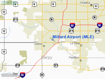
Millard Airport (IATA: MIQ, ICAO: KMLE, FAA LID: MLE) is a public airport located seven miles (11 km) southwest of the central business district of Omaha, a city in Douglas County, Nebraska, United States. It is owned by the Omaha Airport Authority.
Although most U.S. airports use the same three-letter location identifier for the FAA and IATA, Millard Airport is assigned MLE by the FAA and MIQ by the IATA (which assigned MLE to Malé International Airport on Hulhulé Island in the Malé Atoll of the Maldives).
Facilities and aircraft
Millard Airport covers an area of 165 acres (67 ha) which contains one concrete paved runway (12/30) measuring 3,801 x 75 ft (1,159 x 23 m). For the 12-month period ending August 16, 2005, the airport had 72,300 aircraft operations, an average of 198 per day: 98% general aviation, 2% air taxi and <1% military. There are 173 aircraft based at this airport: 82% single-engine, 15% multi-engine, 2% helicopter and 1% jet.
The above content comes from Wikipedia and is published under free licenses – click here to read more.
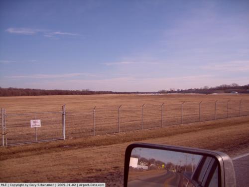 |
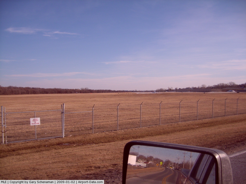
(Click on the photo to enlarge) |
Location & QuickFacts
| FAA Information Effective: | 2008-09-25 |
| Airport Identifier: | MLE |
| Airport Status: | Operational |
| Longitude/Latitude: | 096-06-44.1530W/41-11-45.5500N
-96.112265/41.195986 (Estimated) |
| Elevation: | 1051 ft / 320.34 m (Surveyed) |
| Land: | 165 acres |
| From nearest city: | 7 nautical miles SW of Omaha, NE |
| Location: | Douglas County, NE |
| Magnetic Variation: | 06E (1990) |
Owner & Manager
| Ownership: | Publicly owned |
| Owner: | Omaha Airport Authority |
| Address: | Eppley Airfield-box 19103
Omaha, NE 68119 |
| Phone number: | 402-661-8000 |
| Manager: | Donald L. Smithey |
| Address: | Eppley Airfield-box 19103
Omaha, NE 68119 |
| Phone number: | 402-661-8000 |
Airport Operations and Facilities
| Airport Use: | Open to public |
| Wind indicator: | Yes |
| Segmented Circle: | No |
| Control Tower: | No |
| Lighting Schedule: | DUSK-DAWN
ACTVT MIRL RY 12/30 & REIL RY 12 - CTAF. |
| Beacon Color: | Clear-Green (lighted land airport) |
| Landing fee charge: | No |
| Sectional chart: | Omaha |
| Region: | ACE - Central |
| Traffic Pattern Alt: | 949 ft |
| Boundary ARTCC: | ZMP - Minneapolis |
| Tie-in FSS: | OLU - Columbus |
| FSS on Airport: | No |
| FSS Toll Free: | 1-800-WX-BRIEF |
| NOTAMs Facility: | MLE (NOTAM-d service avaliable) |
| Federal Agreements: | NGY |
Airport Communications
| CTAF: | 123.000 |
| Unicom: | 123.000 |
Airport Services
| Fuel available: | 100LLA |
| Airframe Repair: | MAJOR |
| Power Plant Repair: | MAJOR |
| Bottled Oxygen: | LOW |
| Bulk Oxygen: | LOW |
Runway Information
Runway 12/30
| Dimension: | 3801 x 75 ft / 1158.5 x 22.9 m |
| Surface: | CONC, Good Condition |
| Weight Limit: | Single wheel: 12500 lbs.
Dual wheel: 12500 lbs. |
| Edge Lights: | Medium |
| |
Runway 12 |
Runway 30 |
| Longitude: | 096-07-03.5320W | 096-06-24.7740W |
| Latitude: | 41-11-57.3080N | 41-11-33.7930N |
| Elevation: | 1051.00 ft | 1046.00 ft |
| Alignment: | 127 | 127 |
| Traffic Pattern: | Left | Left |
| Markings: | Non-precision instrument, Good Condition | Non-precision instrument, Good Condition |
| Crossing Height: | 39.00 ft | 39.00 ft |
| Displaced threshold: | 212.00 ft | 0.00 ft |
| VASI: | 2-light PAPI on left side | 2-light PAPI on left side |
| Visual Glide Angle: | 3.08° | 3.08° |
| Runway End Identifier: | Yes | |
| Obstruction: | 17 ft road, 410.0 ft from runway, 285 ft right of centerline, 12:1 slope to clear
APCH RATIO 36:1 FROM DSPLCD THR. | 68 ft pole, 1566.0 ft from runway, 20:1 slope to clear |
| Decleard distances: | Take off run available 3801.00 ft
Take off distance available 3801.00 ft
Actual stop distance available 3801.00 ft
Landing distance available 3588.00 ft
| Take off run available 3801.00 ft
Take off distance available 3801.00 ft
Actual stop distance available 3588.00 ft
Landing distance available 3801.00 ft
|
|
Radio Navigation Aids
| ID |
Type |
Name |
Ch |
Freq |
Var |
Dist |
| MLE | NDB | Millard | | 371.00 | 06E | 0.1 nm |
| OM | NDB | Gerfi | | 320.00 | 05E | 12.5 nm |
| PMV | NDB | Plattsmouth | | 329.00 | 06E | 17.7 nm |
| AHQ | NDB | Wahoo | | 400.00 | 07E | 22.1 nm |
| FET | NDB | Fremont | | 311.00 | 06E | 23.9 nm |
| AFK | NDB | Nebraska City | | 347.00 | 05E | 37.3 nm |
| LN | NDB | Potts | | 385.00 | 06E | 40.0 nm |
| RDK | NDB | Red Oak | | 230.00 | 04E | 40.4 nm |
| SDA | NDB | Shenandoah | | 411.00 | 05E | 41.7 nm |
| HNR | NDB | Harlan | | 272.00 | 05E | 41.7 nm |
| AYB | NDB | Auburn | | 430.00 | 05E | 47.8 nm |
| SWT | NDB | Seward | | 269.00 | 06E | 49.6 nm |
| AIO | NDB | Atlantic | | 365.00 | 04E | 49.7 nm |
| OFF | TACAN | Offutt | 054X | | 05E | 10.7 nm |
| TQE | VOR | Tekamah | | 108.40 | 07E | 34.0 nm |
| SCB | VOR/DME | Scribner | 47X | 111.00 | 06E | 33.9 nm |
| OVR | VORTAC | Omaha | 110X | 116.30 | 08E | 17.1 nm |
| LNK | VORTAC | Lincoln | 108X | 116.10 | 09E | 32.9 nm |
| OMA | VOT | Omaha | | 109.00 | | 11.8 nm |
Remarks
- MIL JETS OVERFLYING AT 3000 FT MSL.
- AFTER TKOF ON RY 30 ALTER HDG 20 DEGS TO THE R TO AVOID NOISE SENSITIVE AREA.
- NORMAL CALM & CROSS WIND TKOFS & LNDGS OF RY 12; NO INTXN TKOFS.
- RADIO CONTROLLED ACFT OCCASIONAL OPERATION 1.7 MI SW OF ARPT.
- VFR ACFT REQUESTING FLIGHT FLWG & IFR ACFT SHOULD CONTACT OMAHA APCH ON FREQ 125.4 PRIOR TO TAKING THE RY FOR CLNC/TRAFFIC ADVISORIES/GEN INFO.
- DEER ON & INVOF ARPT.
Images and information placed above are from
http://www.airport-data.com/airport/MLE/
We thank them for the data!
| General Info
|
| Country |
United States
|
| State |
NEBRASKA
|
| FAA ID |
MLE
|
| Latitude |
41-11-45.600N
|
| Longitude |
096-06-44.200W
|
| Elevation |
1051 feet
|
| Near City |
OMAHA
|
We don't guarantee the information is fresh and accurate. The data may
be wrong or outdated.
For more up-to-date information please refer to other sources.
|
|