 |
|
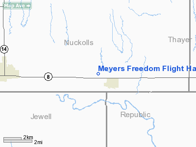
Meyers Freedom Flight Hardy Airport |
Location & QuickFacts
| FAA Information Effective: | 2008-09-25 |
| Airport Identifier: | 85NE |
| Airport Status: | Operational |
| Longitude/Latitude: | 097-56-31.1540W/40-01-15.0450N
-97.941987/40.020846 (Estimated) |
| Elevation: | 1624 ft / 495.00 m (Surveyed) |
| Land: | 160 acres |
| From nearest city: | 1 nautical miles NW of Hardy, NE |
| Location: | Nuckolls County, NE |
| Magnetic Variation: | 08E (1985) |
Owner & Manager
| Ownership: | Privately owned |
| Owner: | Fred & Nancy Meyers |
| Address: | 4248 Highway 8
Hardy, NE 68943 |
| Phone number: | 402-279-2645 |
| Manager: | Fred & Nancy Meyers |
| Address: | 4248 Highway 8
Hardy, NE 68943 |
| Phone number: | 402-279-2645 |
Airport Operations and Facilities
| Airport Use: | Private |
| Wind indicator: | Yes |
| Segmented Circle: | No |
| Control Tower: | No |
| Lighting Schedule: | PHONE REQ
FOR LIRL RY 17/35 CALL 402-279-2645. |
| Landing fee charge: | No |
| Sectional chart: | Omaha |
| Region: | ACE - Central |
| Boundary ARTCC: | ZMP - Minneapolis |
| Tie-in FSS: | OLU - Columbus |
| FSS on Airport: | No |
| FSS Toll Free: | 1-800-WX-BRIEF |
Airport Services
Runway Information
Runway 17/35
| Dimension: | 2400 x 70 ft / 731.5 x 21.3 m |
| Surface: | TURF, |
| Edge Lights: | Low
LIRL SOUTH END; REFLECTORS ON REST OF RY. |
| |
Runway 17 |
Runway 35 |
| Traffic Pattern: | Left | Left |
|
Radio Navigation Aids
| ID |
Type |
Name |
Ch |
Freq |
Var |
Dist |
| HJH | NDB | Hebron | | 323.00 | 06E | 18.1 nm |
| RPB | NDB | Republican | | 414.00 | 07E | 18.1 nm |
| CNK | NDB | Concordia | | 335.00 | 06E | 31.1 nm |
| FBY | NDB | Fairbury | | 293.00 | 06E | 36.9 nm |
| FMZ | NDB | Beklof | | 392.00 | 07E | 38.3 nm |
| DBX | NDB | Morrison | | 212.00 | 06E | 44.3 nm |
| PSS | NDB | Prosser | | 338.00 | 07E | 46.9 nm |
| HSI | VOR/DME | Hastings | 025X | 108.80 | 07E | 41.6 nm |
| TKO | VORTAC | Mankato | 035X | 109.80 | 10E | 19.5 nm |
Remarks
- PROVIDED APPROACHES ARE MAINTAINED FOR A 20:1 GLIDE SLOPE & TRANSITINAL SURFACES FOR A 7:1 SLOPE.
Images and information placed above are from
http://www.airport-data.com/airport/85NE/
We thank them for the data!
| General Info
|
| Country |
United States
|
| State |
NEBRASKA
|
| FAA ID |
85NE
|
| Latitude |
40-01-15.045N
|
| Longitude |
097-56-31.154W
|
| Elevation |
1624 feet
|
| Near City |
HARDY
|
We don't guarantee the information is fresh and accurate. The data may
be wrong or outdated.
For more up-to-date information please refer to other sources.
|
|


