 |
|
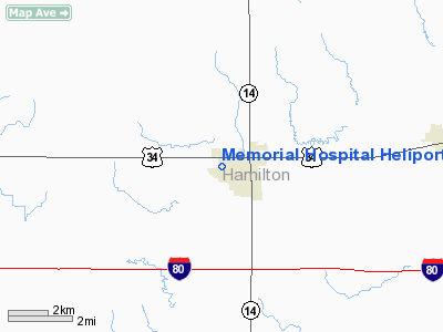
Memorial Hospital Heliport |
Location & QuickFacts
| FAA Information Effective: | 2008-09-25 |
| Airport Identifier: | NE84 |
| Airport Status: | Operational |
| Longitude/Latitude: | 098-00-52.1970W/40-52-06.0440N
-98.014499/40.868346 (Estimated) |
| Elevation: | 1802 ft / 549.25 m (Estimated) |
| Land: | 0 acres |
| From nearest city: | 0 nautical miles N of Aurora, NE |
| Location: | Hamilton County, NE |
| Magnetic Variation: | 07E (1990) |
Owner & Manager
| Ownership: | Privately owned |
| Owner: | Memorial Hospital |
| Address: | 1423 Seventh St
Aurora, NE 68818-1197 |
| Phone number: | 402-694-3171 |
| Manager: | Dale Saddler |
| Address: | 1423 Seventh St
Aurora, NE 68818-1197 |
| Phone number: | 402-694-3171 |
Airport Operations and Facilities
| Airport Use: | Private
MEDICAL USE. |
| Wind indicator: | Yes |
| Segmented Circle: | No |
| Control Tower: | No |
| Lighting Schedule: | PHONE REQ
FOR PERIMETER & FLOOD LGTS CALL 402-694-3171. |
| Sectional chart: | Omaha |
| Region: | ACE - Central |
| Boundary ARTCC: | ZMP - Minneapolis |
| Tie-in FSS: | OLU - Columbus |
| FSS Toll Free: | 1-800-WX-BRIEF |
Runway Information
Helipad H1
| Dimension: | 40 x 40 ft / 12.2 x 12.2 m |
| Surface: | CONC, |
| |
Runway H1 |
Runway |
| Traffic Pattern: | Left | Left |
|
Radio Navigation Aids
| ID |
Type |
Name |
Ch |
Freq |
Var |
Dist |
| JYR | NDB | York | | 257.00 | 06E | 18.1 nm |
| PSS | NDB | Prosser | | 338.00 | 07E | 23.7 nm |
| FMZ | NDB | Beklof | | 392.00 | 07E | 26.3 nm |
| SWT | NDB | Seward | | 269.00 | 06E | 41.0 nm |
| HJH | NDB | Hebron | | 323.00 | 06E | 47.4 nm |
| PLT | NDB | Platte Center | | 407.00 | 08E | 47.4 nm |
| EAR | VOR | Kearney | | 111.20 | 10E | 45.9 nm |
| HSI | VOR/DME | Hastings | 025X | 108.80 | 07E | 24.7 nm |
| OLU | VOR/DME | Columbus | 055X | 111.80 | 08E | 46.4 nm |
| GRI | VORTAC | Grand Island | 057X | 112.00 | 07E | 15.3 nm |
| OBH | VORTAC | Wolbach | 095X | 114.80 | 07E | 34.1 nm |
Remarks
- OWNER DESIRES HELIPAD NOT BE CHARTED.
- PRVDD 8:1 GLIDE SLOPE & 2:1 TRANSITIONAL SLOPE.
Images and information placed above are from
http://www.airport-data.com/airport/NE84/
We thank them for the data!
| General Info
|
| Country |
United States
|
| State |
NEBRASKA
|
| FAA ID |
NE84
|
| Latitude |
40-52-06.044N
|
| Longitude |
098-00-52.197W
|
| Elevation |
1802 feet
|
| Near City |
AURORA
|
We don't guarantee the information is fresh and accurate. The data may
be wrong or outdated.
For more up-to-date information please refer to other sources.
|
|


