 |
|
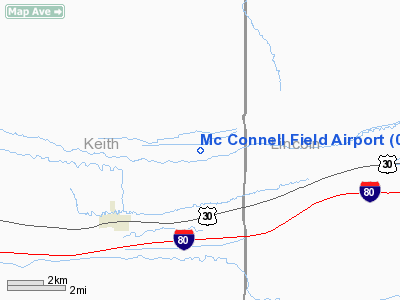
Location & QuickFacts
| FAA Information Effective: | 2008-09-25 |
| Airport Identifier: | 04NE |
| Airport Status: | Operational |
| Longitude/Latitude: | 101-17-56.5890W/41-09-35.9760N
-101.299052/41.159993 (Estimated) |
| Elevation: | 3035 ft / 925.07 m (Estimated) |
| Land: | 0 acres |
| From nearest city: | 1 nautical miles ES of Sarben, NE |
| Location: | Keith County, NE |
| Magnetic Variation: | 09E (1985) |
Owner & Manager
| Ownership: | Privately owned |
| Owner: | Mark Mc Connell |
| Address: | 2330 Rd East 120
Sutherland, NE 69165 |
| Phone number: | 308-239-4270 |
| Manager: | Mark Mc Connell |
| Address: | 2330 Rd East 120
Sutherland, NE 69165 |
| Phone number: | 308-239-4318 |
Airport Operations and Facilities
| Airport Use: | Private |
| Wind indicator: | Yes |
| Segmented Circle: | No |
| Control Tower: | No |
| Landing fee charge: | No |
| Sectional chart: | Cheyenne |
| Region: | ACE - Central |
| Boundary ARTCC: | ZDV - Denver |
| Tie-in FSS: | OLU - Columbus |
| FSS on Airport: | No |
| FSS Toll Free: | 1-800-WX-BRIEF
NEBRASKA ONLY. |
Runway Information
Runway N/S
| Dimension: | 2500 x 100 ft / 762.0 x 30.5 m |
| Surface: | TURF, |
| |
Runway N |
Runway S |
| Traffic Pattern: | Left | Left |
| Obstruction: | 200 ft hills, 1000.0 ft from runway | 20 ft pline, 100.0 ft from runway |
|
Radio Navigation Aids
| ID |
Type |
Name |
Ch |
Freq |
Var |
Dist |
| GGF | NDB | Grant | | 359.00 | 09E | 26.2 nm |
| IML | NDB | Imperial | | 283.00 | 09E | 41.7 nm |
| OKS | NDB | Oshkosh | | 233.00 | 09E | 49.7 nm |
| SAE | VOR/DME | Searle | 39X | 110.20 | 11E | 21.7 nm |
| LBF | VORTAC | North Platte | 121X | 117.40 | 11E | 25.9 nm |
| HCT | VORTAC | Hayes Center | 124X | 117.70 | 11E | 45.7 nm |
Remarks
- PRVDD THAT THE APCH TO EA RWY IS MAINTD FOR A MIN 20:1 GS AND THAT THE TRSNL SFC BE MAINTD FOR A 7:1 SLOPE.
Images and information placed above are from
http://www.airport-data.com/airport/04NE/
We thank them for the data!
| General Info
|
| Country |
United States
|
| State |
NEBRASKA
|
| FAA ID |
04NE
|
| Latitude |
41-09-35.976N
|
| Longitude |
101-17-56.589W
|
| Elevation |
3035 feet
|
| Near City |
SARBEN
|
We don't guarantee the information is fresh and accurate. The data may
be wrong or outdated.
For more up-to-date information please refer to other sources.
|
|


