 |
|
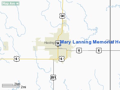
Mary Lanning Memorial Hospital Heliport |
Location & QuickFacts
| FAA Information Effective: | 2008-09-25 |
| Airport Identifier: | NE90 |
| Airport Status: | Operational |
| Longitude/Latitude: | 098-23-15.0000W/40-35-29.0000N
-98.387500/40.591389 (Estimated) |
| Elevation: | 1925 ft / 586.74 m (Estimated) |
| Land: | 0 acres |
| From nearest city: | 0 nautical miles N of Hastings, NE |
| Location: | Adams County, NE |
| Magnetic Variation: | 06E (2000) |
Owner & Manager
| Ownership: | Privately owned |
| Owner: | Mary Lanning Memorial Hospital |
| Address: | 715 North Saint Joseph Ave
Hastings, NE 68901 |
| Phone number: | 402-463-4521 |
| Manager: | Ronda Ehly, Dir. Ambulatory Nursing
OTHER CONTACT DAVID PATTERSON 402-461-5268 |
| Address: | 715 North Saint Joseph Ave
Hastings, NE 68901 |
| Phone number: | 402-461-5350 |
Airport Operations and Facilities
| Airport Use: | Private
MEDICAL USE. |
| Segmented Circle: | No |
| Control Tower: | No |
| Region: | ACE - Central |
| Boundary ARTCC: | ZMP - Minneapolis |
| Tie-in FSS: | OLU - Columbus |
| FSS Toll Free: | 1-800-WX-BRIEF |
Runway Information
Helipad H1
| Dimension: | 45 x 45 ft / 13.7 x 13.7 m |
| Surface: | CONC, |
| |
Runway H1 |
Runway |
| Traffic Pattern: | Left | Left |
|
Radio Navigation Aids
| ID |
Type |
Name |
Ch |
Freq |
Var |
Dist |
| PSS | NDB | Prosser | | 338.00 | 07E | 7.0 nm |
| FMZ | NDB | Beklof | | 392.00 | 07E | 37.4 nm |
| JYR | NDB | York | | 257.00 | 06E | 39.6 nm |
| HDE | NDB | Holdrege | | 396.00 | 07E | 44.4 nm |
| HJH | NDB | Hebron | | 323.00 | 06E | 45.2 nm |
| EAR | VOR | Kearney | | 111.20 | 10E | 29.3 nm |
| HSI | VOR/DME | Hastings | 025X | 108.80 | 07E | 2.1 nm |
| GRI | VORTAC | Grand Island | 057X | 112.00 | 07E | 23.8 nm |
| OBH | VORTAC | Wolbach | 095X | 114.80 | 07E | 47.2 nm |
| TKO | VORTAC | Mankato | 035X | 109.80 | 10E | 47.5 nm |
Remarks
- SEE AIRSPACE CASE 98-ACE-194-NRA.
Images and information placed above are from
http://www.airport-data.com/airport/NE90/
We thank them for the data!
| General Info
|
| Country |
United States
|
| State |
NEBRASKA
|
| FAA ID |
NE90
|
| Latitude |
40-35-29.000N
|
| Longitude |
098-23-15.000W
|
| Elevation |
1925 feet
|
| Near City |
HASTINGS
|
We don't guarantee the information is fresh and accurate. The data may
be wrong or outdated.
For more up-to-date information please refer to other sources.
|
|


