 |
|
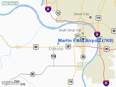
Location & QuickFacts
| FAA Information Effective: | 2008-09-25 |
| Airport Identifier: | 7K8 |
| Airport Status: | Operational |
| Longitude/Latitude: | 096-28-21.1120W/42-27-14.9800N
-96.472531/42.454161 (Estimated) |
| Elevation: | 1100 ft / 335.28 m (Estimated) |
| Land: | 175 acres |
| From nearest city: | 3 nautical miles SW of So Sioux City, NE |
| Location: | Dakota County, NE |
| Magnetic Variation: | 06E (1985) |
Owner & Manager
| Ownership: | Privately owned |
| Owner: | T/m Holding Limited |
| Address: | Box 425
South Sioux City, NE 68776-0425 |
| Phone number: | 402-494-3667 |
| Manager: | Eugene T Martin, Sr. |
| Address: | Box 425
South Sioux City, NE 68776-0425 |
| Phone number: | 402-494-3667 |
Airport Operations and Facilities
| Airport Use: | Open to public |
| Wind indicator: | Yes |
| Segmented Circle: | No |
| Control Tower: | No |
| Lighting Schedule: | ON REQ
CALL AMGR ON 402-494-3667. |
| Beacon Color: | Clear-Green (lighted land airport) |
| Landing fee charge: | No |
| Sectional chart: | Omaha |
| Region: | ACE - Central |
| Boundary ARTCC: | ZMP - Minneapolis |
| Tie-in FSS: | OLU - Columbus |
| FSS on Airport: | No |
| FSS Toll Free: | 1-800-WX-BRIEF |
| NOTAMs Facility: | OLU (NOTAM-d service avaliable) |
| Federal Agreements: | N |
Airport Communications
| CTAF: | 122.800 |
| Unicom: | 122.800 |
Airport Services
| Fuel available: | 100LL |
| Airframe Repair: | MAJOR |
| Power Plant Repair: | MAJOR |
| Bottled Oxygen: | NONE |
| Bulk Oxygen: | NONE |
Runway Information
Runway 14/32
| Dimension: | 3323 x 50 ft / 1012.9 x 15.2 m |
| Surface: | ASPH, Good Condition |
| Weight Limit: | Single wheel: 12500 lbs. |
| Edge Lights: | Non-standard lighting system
EDGE LGTS ARE APRXLY 75 FT FM CNTRLN AT APRXLY 400 FT SPACING; 30 WATTS. |
| |
Runway 14 |
Runway 32 |
| Traffic Pattern: | Right | Left |
| Markings: | Basic, Good Condition | Basic, Good Condition |
| Displaced threshold: | 0.00 ft | 650.00 ft |
| Obstruction: | 15 ft berm, 502.0 ft from runway, 20:1 slope to clear
5 FT FENCE APRXLY 50 FT FM RY END. | 89 ft trees, 1350.0 ft from runway, 12:1 slope to clear
RY 32 APCH RATIO 22:1 TO THE DSPLCD THLD. |
|
Radio Navigation Aids
| ID |
Type |
Name |
Ch |
Freq |
Var |
Dist |
| OI | NDB | Tommi | | 305.00 | 07E | 0.6 nm |
| GAK | NDB | Sioux Gateway | | 233.00 | 06E | 4.7 nm |
| SU | NDB | Salix | | 414.00 | 07E | 11.1 nm |
| LCG | NDB | Wayne | | 389.00 | 06E | 26.0 nm |
| VMR | NDB | Vermillion | | 375.00 | 06E | 27.6 nm |
| MEY | NDB | Mapleton | | 335.00 | 05E | 34.3 nm |
| ORC | NDB | Orange City | | 521.00 | 05E | 37.1 nm |
| SOY | NDB | Sioux Center | | 368.00 | 06E | 42.7 nm |
| CKP | NDB | Pilot Rock | | 423.00 | 05E | 44.0 nm |
| TQE | VOR | Tekamah | | 108.40 | 07E | 43.8 nm |
| YKN | VOR/DME | Yankton | 051X | 111.40 | 07E | 49.0 nm |
| SUX | VORTAC | Sioux City | 112X | 116.50 | 09E | 9.3 nm |
Images and information placed above are from
http://www.airport-data.com/airport/7K8/
We thank them for the data!
| General Info
|
| Country |
United States
|
| State |
NEBRASKA
|
| FAA ID |
7K8
|
| Latitude |
42-27-14.980N
|
| Longitude |
096-28-21.112W
|
| Elevation |
1100 feet
|
| Near City |
SO SIOUX CITY
|
We don't guarantee the information is fresh and accurate. The data may
be wrong or outdated.
For more up-to-date information please refer to other sources.
|
|


