 |
|
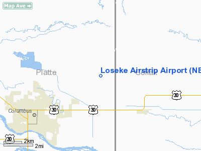
Location & QuickFacts
| FAA Information Effective: | 2008-09-25 |
| Airport Identifier: | NE37 |
| Airport Status: | Operational |
| Longitude/Latitude: | 097-16-17.1380W/41-28-21.0380N
-97.271427/41.472511 (Estimated) |
| Elevation: | 1490 ft / 454.15 m (Estimated) |
| Land: | 0 acres |
| From nearest city: | 5 nautical miles NE of Columbus, NE |
| Location: | Platte County, NE |
| Magnetic Variation: | 07E (1985) |
Owner & Manager
| Ownership: | Privately owned |
| Owner: | Louis E Loseke |
| Address: | Route 7, Box 30
Columbus, NE 68601 |
| Phone number: | 402-564-5824 |
| Address: |
|
Airport Operations and Facilities
| Airport Use: | Private |
| Wind indicator: | Yes |
| Segmented Circle: | No |
| Control Tower: | No |
| Landing fee charge: | No |
| Sectional chart: | Omaha |
| Region: | ACE - Central |
| Boundary ARTCC: | ZMP - Minneapolis |
| Tie-in FSS: | OLU - Columbus |
| FSS on Airport: | No |
| FSS Toll Free: | 1-800-WX-BRIEF |
Runway Information
Runway E/W
| Dimension: | 1300 x 60 ft / 396.2 x 18.3 m |
| Surface: | TURF, |
| |
Runway E |
Runway W |
| Traffic Pattern: | Left | Left |
|
Radio Navigation Aids
| ID |
Type |
Name |
Ch |
Freq |
Var |
Dist |
| PLT | NDB | Platte Center | | 407.00 | 08E | 5.2 nm |
| OF | NDB | Carsy | | 510.00 | 08E | 26.7 nm |
| AHQ | NDB | Wahoo | | 400.00 | 07E | 33.5 nm |
| FET | NDB | Fremont | | 311.00 | 06E | 34.0 nm |
| SWT | NDB | Seward | | 269.00 | 06E | 37.4 nm |
| JYR | NDB | York | | 257.00 | 06E | 37.9 nm |
| BVN | NDB | Alaby | | 332.00 | 06E | 38.4 nm |
| LCG | NDB | Wayne | | 389.00 | 06E | 48.0 nm |
| LN | NDB | Potts | | 385.00 | 06E | 49.3 nm |
| OLU | VOR/DME | Columbus | 055X | 111.80 | 08E | 3.4 nm |
| SCB | VOR/DME | Scribner | 47X | 111.00 | 06E | 30.0 nm |
| OFK | VOR/DME | Norfolk | 033X | 109.60 | 08E | 31.8 nm |
| LNK | VORTAC | Lincoln | 108X | 116.10 | 09E | 40.8 nm |
| OBH | VORTAC | Wolbach | 095X | 114.80 | 07E | 49.1 nm |
Remarks
- PRVDD CLEAR AND MAINT 20:1 APCH; MAINT A CLEAR 7:1 TRSNL; ESTABLISH RIGHT TFC TO RY 27.
Images and information placed above are from
http://www.airport-data.com/airport/NE37/
We thank them for the data!
| General Info
|
| Country |
United States
|
| State |
NEBRASKA
|
| FAA ID |
NE37
|
| Latitude |
41-28-21.038N
|
| Longitude |
097-16-17.138W
|
| Elevation |
1490 feet
|
| Near City |
COLUMBUS
|
We don't guarantee the information is fresh and accurate. The data may
be wrong or outdated.
For more up-to-date information please refer to other sources.
|
|


