 |
|
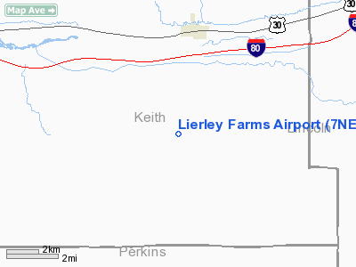
Location & QuickFacts
| FAA Information Effective: | 2008-09-25 |
| Airport Identifier: | 7NE5 |
| Airport Status: | Operational |
| Longitude/Latitude: | 101-22-03.5910W/41-03-59.9800N
-101.367664/41.066661 (Estimated) |
| Elevation: | 3220 ft / 981.46 m (Estimated) |
| Land: | 0 acres |
| From nearest city: | 3 nautical miles SW of Paxton, NE |
| Location: | Keith County, NE |
| Magnetic Variation: | 09E (1985) |
Owner & Manager
| Ownership: | Privately owned |
| Owner: | Archie Lierley |
| Address: | Rr 1 Box 59
Paxton, NE 69155 |
| Phone number: | 308-239-4524 |
| Manager: | Fred Lierley |
| Address: | Rr 1 Box 44
Paxton, NE 69155 |
| Phone number: | 308-239-4524 |
Airport Operations and Facilities
| Airport Use: | Private |
| Wind indicator: | Yes |
| Segmented Circle: | No |
| Control Tower: | No |
| Landing fee charge: | No |
| Sectional chart: | Cheyenne |
| Region: | ACE - Central |
| Boundary ARTCC: | ZDV - Denver |
| Tie-in FSS: | OLU - Columbus |
| FSS on Airport: | No |
| FSS Toll Free: | 1-800-WX-BRIEF |
Runway Information
Runway N/S
| Dimension: | 3000 x 40 ft / 914.4 x 12.2 m |
| Surface: | TURF, |
| |
Runway N |
Runway S |
| Traffic Pattern: | Left | Left |
| Obstruction: | 30 ft pline | |
|
Radio Navigation Aids
| ID |
Type |
Name |
Ch |
Freq |
Var |
Dist |
| GGF | NDB | Grant | | 359.00 | 09E | 20.2 nm |
| IML | NDB | Imperial | | 283.00 | 09E | 35.4 nm |
| OKS | NDB | Oshkosh | | 233.00 | 09E | 48.8 nm |
| CNP | NDB | Chappell | | 383.00 | 10E | 49.5 nm |
| SAE | VOR/DME | Searle | 39X | 110.20 | 11E | 18.8 nm |
| LBF | VORTAC | North Platte | 121X | 117.40 | 11E | 28.1 nm |
| HCT | VORTAC | Hayes Center | 124X | 117.70 | 11E | 42.0 nm |
Remarks
- RWY SLOPES DOWN 20' TO THE NORTH.
- PRVDD EACH APCH IS MAINT FOR MIN 20:1 GLIDE SLOPE & TRSNL SFC MAINT FOR 7:1 SLOPE.
Images and information placed above are from
http://www.airport-data.com/airport/7NE5/
We thank them for the data!
| General Info
|
| Country |
United States
|
| State |
NEBRASKA
|
| FAA ID |
7NE5
|
| Latitude |
41-03-59.980N
|
| Longitude |
101-22-03.591W
|
| Elevation |
3220 feet
|
| Near City |
PAXTON
|
We don't guarantee the information is fresh and accurate. The data may
be wrong or outdated.
For more up-to-date information please refer to other sources.
|
|


