 |
|
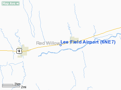
Location & QuickFacts
| FAA Information Effective: | 2008-09-25 |
| Airport Identifier: | 6NE7 |
| Airport Status: | Operational |
| Longitude/Latitude: | 100-20-16.5170W/40-14-40.0200N
-100.337921/40.244450 (Estimated) |
| Elevation: | 2450 ft / 746.76 m (Estimated) |
| Land: | 0 acres |
| From nearest city: | 1 nautical miles W of Bartley, NE |
| Location: | Red Willow County, NE |
| Magnetic Variation: | 09E (1985) |
Owner & Manager
| Ownership: | Privately owned |
| Owner: | Michael Sides |
| Address: |
Bartley, NE 69020 |
| Phone number: | 308-692-3392 |
| Address: |
|
| Phone number: | 308-692-3201 |
Airport Operations and Facilities
| Airport Use: | Private |
| Wind indicator: | Yes |
| Segmented Circle: | No |
| Control Tower: | No |
| Landing fee charge: | No |
| Sectional chart: | Omaha |
| Region: | ACE - Central |
| Boundary ARTCC: | ZDV - Denver |
| Tie-in FSS: | OLU - Columbus |
| FSS on Airport: | No |
| FSS Toll Free: | 1-800-WX-BRIEF |
Runway Information
Runway E/W
| Dimension: | 2100 x 125 ft / 640.1 x 38.1 m
20 FT CONC IN MIDDLE WITH TURF ON BOTH SIDES. |
| Surface: | CONC-TURF, |
| |
Runway E |
Runway W |
| Traffic Pattern: | Left | Left |
|
Radio Navigation Aids
| ID |
Type |
Name |
Ch |
Freq |
Var |
Dist |
| MCK | FAN MARKER | Mc Cook | | | 11E | 10.3 nm |
| CSB | NDB | Harry Strunk | | 389.00 | 08E | 9.0 nm |
| OIN | NDB | Oberlin | | 341.00 | 09E | 26.6 nm |
| NRN | NDB | Norton | | 230.00 | 08E | 31.2 nm |
| DWL | NDB | Willow | | 353.00 | 08E | 39.7 nm |
| ADT | NDB | Atwood | | 365.00 | 09E | 40.7 nm |
| RRX | NDB | Darr | | 326.00 | 07E | 42.2 nm |
| HDE | NDB | Holdrege | | 396.00 | 07E | 47.3 nm |
| OZB | VOR | Cozad | | 109.00 | 09E | 40.6 nm |
| MCK | VOR/DME | Mc Cook | 100X | 115.30 | 08E | 12.0 nm |
| HCT | VORTAC | Hayes Center | 124X | 117.70 | 11E | 29.6 nm |
Remarks
- PRVDD EACH APCH IS MAINT FOR MIN 20:1 GLIDE SLOPE & TRSNL SFC MAINT FOR 7:1 SLOPE.
Images and information placed above are from
http://www.airport-data.com/airport/6NE7/
We thank them for the data!
| General Info
|
| Country |
United States
|
| State |
NEBRASKA
|
| FAA ID |
6NE7
|
| Latitude |
40-14-40.020N
|
| Longitude |
100-20-16.517W
|
| Elevation |
2450 feet
|
| Near City |
BARTLEY
|
We don't guarantee the information is fresh and accurate. The data may
be wrong or outdated.
For more up-to-date information please refer to other sources.
|
|


