 |
|
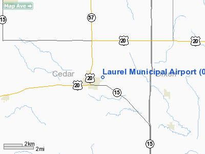
Location & QuickFacts
| FAA Information Effective: | 2008-09-25 |
| Airport Identifier: | 08NE |
| Airport Status: | Operational |
| Longitude/Latitude: | 097-04-46.1720W/42-25-54.0010N
-97.079492/42.431667 (Estimated) |
| Elevation: | 1467 ft / 447.14 m (Estimated) |
| Land: | 43 acres |
| From nearest city: | 0 nautical miles NE of Laurel, NE |
| Location: | Cedar County, NE |
| Magnetic Variation: | 06E (1985) |
Owner & Manager
| Ownership: | Privately owned |
| Owner: | D. Nelson/ R. Ward/ C. Paulsen |
| Address: |
Laurel, NE 68745 |
| Phone number: | 402-375-7811 |
| Manager: | L. J. Mallatt |
| Address: | 604 Oak St.
Laurel, NE 68745 |
| Phone number: | 402-375-7811 |
Airport Operations and Facilities
| Airport Use: | Private |
| Wind indicator: | Yes |
| Segmented Circle: | No |
| Control Tower: | No |
| Lighting Schedule: | DUSK-DAWN |
| Landing fee charge: | No |
| Sectional chart: | Omaha |
| Region: | ACE - Central |
| Boundary ARTCC: | ZMP - Minneapolis |
| Tie-in FSS: | OLU - Columbus |
| FSS on Airport: | No |
| FSS Toll Free: | 1-800-WX-BRIEF |
Runway Information
Runway 11/29
| Dimension: | 3000 x 100 ft / 914.4 x 30.5 m |
| Surface: | TURF, Good Condition |
| Edge Lights: | Low |
| |
Runway 11 |
Runway 29 |
| Traffic Pattern: | Left | Left |
| Obstruction: | 86 ft tree, 1100.0 ft from runway, 285 ft right of centerline, 12:1 slope to clear | 72 ft trees, 985.0 ft from runway, 150 ft right of centerline, 13:1 slope to clear |
|
Radio Navigation Aids
| ID |
Type |
Name |
Ch |
Freq |
Var |
Dist |
| LCG | NDB | Wayne | | 389.00 | 06E | 12.1 nm |
| VMR | NDB | Vermillion | | 375.00 | 06E | 20.9 nm |
| OI | NDB | Tommi | | 305.00 | 07E | 27.4 nm |
| GAK | NDB | Sioux Gateway | | 233.00 | 06E | 30.8 nm |
| SU | NDB | Salix | | 414.00 | 07E | 35.6 nm |
| OF | NDB | Carsy | | 510.00 | 08E | 37.3 nm |
| OFK | VOR/DME | Norfolk | 033X | 109.60 | 08E | 31.0 nm |
| YKN | VOR/DME | Yankton | 051X | 111.40 | 07E | 32.2 nm |
| SUX | VORTAC | Sioux City | 112X | 116.50 | 09E | 34.0 nm |
Remarks
- 92' TREES NORTH OF RWY 29 REDUCE TRANSITION SLOPE TO 3:1. 174' GRAIN ELEVATOR SOUTH OF RWY 11 REDUCES TRANSITION SLOPE TO 5:1.
- CONDL: PROVIDED APPROACH TO EACH RWY IS MAINTAINED FOR A MIN 20:1 GLIDE SLOPE AND THE TRANSITIONAL SURFACE BE MAINTAINED FOR A 7:1 SLOPE.
Images and information placed above are from
http://www.airport-data.com/airport/08NE/
We thank them for the data!
| General Info
|
| Country |
United States
|
| State |
NEBRASKA
|
| FAA ID |
08NE
|
| Latitude |
42-25-54.001N
|
| Longitude |
097-04-46.172W
|
| Elevation |
1467 feet
|
| Near City |
LAUREL
|
We don't guarantee the information is fresh and accurate. The data may
be wrong or outdated.
For more up-to-date information please refer to other sources.
|
|


