 |
|
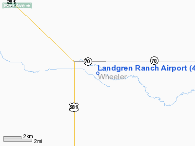
Location & QuickFacts
| FAA Information Effective: | 2008-09-25 |
| Airport Identifier: | 40NE |
| Airport Status: | Operational |
| Longitude/Latitude: | 098-30-57.2800W/41-58-30.0250N
-98.515911/41.975007 (Estimated) |
| Elevation: | 2100 ft / 640.08 m (Estimated) |
| Land: | 0 acres |
| From nearest city: | 6 nautical miles NE of Bartlett, NE |
| Location: | Wheeler County, NE |
| Magnetic Variation: | 08E (1985) |
Owner & Manager
| Ownership: | Privately owned |
| Owner: | James Landgren |
| Address: | 83893 Stone House Ave
Bartlett, NE 68622 |
| Phone number: | 308-654-3221 |
| Manager: | James Landgren |
| Address: | 83893 Stone House Ave
Bartlett, NE 68622 |
| Phone number: | 308-654-3221 |
Airport Operations and Facilities
| Airport Use: | Private |
| Wind indicator: | Yes |
| Segmented Circle: | No |
| Control Tower: | No |
| Landing fee charge: | No |
| Sectional chart: | Omaha |
| Region: | ACE - Central |
| Boundary ARTCC: | ZMP - Minneapolis |
| Tie-in FSS: | OLU - Columbus |
| FSS on Airport: | No |
| FSS Toll Free: | 1-800-WX-BRIEF |
Runway Information
Runway 13/31
| Dimension: | 3200 x 125 ft / 975.4 x 38.1 m |
| Surface: | TURF, |
| |
Runway 13 |
Runway 31 |
| Traffic Pattern: | Left | Left |
|
Radio Navigation Aids
| ID |
Type |
Name |
Ch |
Freq |
Var |
Dist |
| BVN | NDB | Alaby | | 332.00 | 06E | 25.5 nm |
| ODX | NDB | Ord | | 356.00 | 07E | 28.6 nm |
| BUB | NDB | Burwell | | 377.00 | 07E | 30.6 nm |
| OF | NDB | Carsy | | 510.00 | 08E | 46.6 nm |
| OFK | VOR/DME | Norfolk | 033X | 109.60 | 08E | 48.3 nm |
| ONL | VORTAC | O'neill | 086X | 113.90 | 10E | 30.7 nm |
| OBH | VORTAC | Wolbach | 095X | 114.80 | 07E | 36.8 nm |
Remarks
- CONDITIONAL - PROVIDED THE APCH TO EACH RWY IS MAINTAINED FOR A MINIMUM 20:1 GLIDE SLOPE AND THE TRANSITIONAL SURFACE BE MAINTAINED FOR A 7:1 SLOPE.
Images and information placed above are from
http://www.airport-data.com/airport/40NE/
We thank them for the data!
| General Info
|
| Country |
United States
|
| State |
NEBRASKA
|
| FAA ID |
40NE
|
| Latitude |
41-58-30.025N
|
| Longitude |
098-30-57.280W
|
| Elevation |
2100 feet
|
| Near City |
BARTLETT
|
We don't guarantee the information is fresh and accurate. The data may
be wrong or outdated.
For more up-to-date information please refer to other sources.
|
|


