 |
|
Location & QuickFacts
| FAA Information Effective: | 2008-09-25 |
| Airport Identifier: | 2NE7 |
| Airport Status: | Operational |
| Longitude/Latitude: | 101-56-33.6460W/40-51-04.9850N
-101.942679/40.851385 (Estimated) |
| Elevation: | 3520 ft / 1072.90 m (Estimated) |
| Land: | 0 acres |
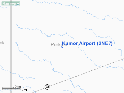
| From nearest city: | 10 nautical miles W of Grant, NE |
| Location: | Perkins County, NE |
| Magnetic Variation: | 10E (1985) |
Owner & Manager
| Ownership: | Privately owned |
| Owner: | Leon Kumor |
| Address: |
Grant, NE 69140 |
| Phone number: | 308-352-4166 |
| Address: |
|
Airport Operations and Facilities
| Airport Use: | Private |
| Wind indicator: | Yes |
| Segmented Circle: | No |
| Control Tower: | No |
| Landing fee charge: | No |
| Sectional chart: | Cheyenne |
| Region: | ACE - Central |
| Boundary ARTCC: | ZDV - Denver |
| Tie-in FSS: | OLU - Columbus |
| FSS on Airport: | No |
| FSS Toll Free: | 1-800-WX-BRIEF |
Airport Services
| Airframe Repair: | NONE |
| Power Plant Repair: | NONE |
Runway Information
Runway E/W
| Dimension: | 2600 x 100 ft / 792.5 x 30.5 m |
| Surface: | TURF, |
| |
Runway E |
Runway W |
| Traffic Pattern: | Left | Left |
|
Runway N/S
| Dimension: | 3500 x 60 ft / 1066.8 x 18.3 m |
| Surface: | TURF, |
| |
Runway N |
Runway S |
| Traffic Pattern: | Left | Left |
|
Radio Navigation Aids
| ID |
Type |
Name |
Ch |
Freq |
Var |
Dist |
| GGF | NDB | Grant | | 359.00 | 09E | 9.7 nm |
| HEQ | NDB | Heginbotham | | 404.00 | 11E | 22.4 nm |
| IML | NDB | Imperial | | 283.00 | 09E | 25.0 nm |
| CNP | NDB | Chappell | | 383.00 | 10E | 27.1 nm |
| OKS | NDB | Oshkosh | | 233.00 | 09E | 37.9 nm |
| SAE | VOR/DME | Searle | 39X | 110.20 | 11E | 17.8 nm |
| SNY | VORTAC | Sidney | 106X | 115.90 | 13E | 49.5 nm |
Remarks
- THE NAME 'KUMOR' PAINTED IN 6' LTRS ON BLDG ROOF ADJ TO RWY.
- CONDL-PROVIDED A CLEAR APPROACH TO EACH RWY IS MAINTAINED FOR A MINIMUM 20:1 GLIDE SLOPE AND THE TRANSITIONAL SURFACE IS MAINTAINED FOR A 7:1 SLOPE.
Images and information placed above are from
http://www.airport-data.com/airport/2NE7/
We thank them for the data!
| General Info
|
| Country |
United States
|
| State |
NEBRASKA
|
| FAA ID |
2NE7
|
| Latitude |
40-51-04.985N
|
| Longitude |
101-56-33.646W
|
| Elevation |
3520 feet
|
| Near City |
GRANT
|
We don't guarantee the information is fresh and accurate. The data may
be wrong or outdated.
For more up-to-date information please refer to other sources.
|
|


