 |
|
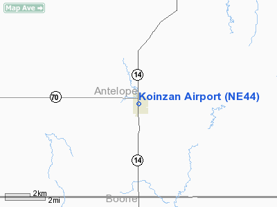
Location & QuickFacts
| FAA Information Effective: | 2008-09-25 |
| Airport Identifier: | NE44 |
| Airport Status: | Operational |
| Longitude/Latitude: | 098-05-01.2380W/41-59-00.0280N
-98.083677/41.983341 (Estimated) |
| Elevation: | 1919 ft / 584.91 m (Estimated) |
| Land: | 0 acres |
| From nearest city: | 1 nautical miles N of Elgin, NE |
| Location: | Antelope County, NE |
| Magnetic Variation: | 07E (1985) |
Owner & Manager
| Ownership: | Privately owned |
| Owner: | Lee Koinzan |
| Address: | 609 North 2nd St
Elgin, NE 68636 |
| Phone number: | 402-843-5800 |
| Manager: | Lynn Koinzan |
| Address: | Po Box 408
Elgin, NE 68636 |
| Phone number: | 402-843-2292 |
Airport Operations and Facilities
| Airport Use: | Private |
| Wind indicator: | Yes |
| Segmented Circle: | No |
| Control Tower: | No |
| Landing fee charge: | No |
| Sectional chart: | Omaha |
| Region: | ACE - Central |
| Boundary ARTCC: | ZMP - Minneapolis |
| Tie-in FSS: | OLU - Columbus |
| FSS on Airport: | No |
| FSS Toll Free: | 1-800-WX-BRIEF |
Airport Services
| Fuel available: | 100LL |
| Airframe Repair: | MINOR |
| Power Plant Repair: | MINOR |
Runway Information
Runway 08/26
| Dimension: | 2600 x 100 ft / 792.5 x 30.5 m |
| Surface: | TURF, |
| |
Runway 08 |
Runway 26 |
| Traffic Pattern: | Left | Left |
|
Runway 10/28
| Dimension: | 1300 x 100 ft / 396.2 x 30.5 m |
| Surface: | TURF, |
| |
Runway 10 |
Runway 28 |
| Traffic Pattern: | Left | Left |
|
Radio Navigation Aids
| ID |
Type |
Name |
Ch |
Freq |
Var |
Dist |
| BVN | NDB | Alaby | | 332.00 | 06E | 15.3 nm |
| OF | NDB | Carsy | | 510.00 | 08E | 27.6 nm |
| PLT | NDB | Platte Center | | 407.00 | 08E | 43.0 nm |
| ODX | NDB | Ord | | 356.00 | 07E | 44.4 nm |
| BUB | NDB | Burwell | | 377.00 | 07E | 49.1 nm |
| OFK | VOR/DME | Norfolk | 033X | 109.60 | 08E | 29.0 nm |
| OLU | VOR/DME | Columbus | 055X | 111.80 | 08E | 46.2 nm |
| OBH | VORTAC | Wolbach | 095X | 114.80 | 07E | 38.5 nm |
| ONL | VORTAC | O'neill | 086X | 113.90 | 10E | 39.7 nm |
Remarks
Images and information placed above are from
http://www.airport-data.com/airport/NE44/
We thank them for the data!
| General Info
|
| Country |
United States
|
| State |
NEBRASKA
|
| FAA ID |
NE44
|
| Latitude |
41-59-00.028N
|
| Longitude |
098-05-01.238W
|
| Elevation |
1919 feet
|
| Near City |
ELGIN
|
We don't guarantee the information is fresh and accurate. The data may
be wrong or outdated.
For more up-to-date information please refer to other sources.
|
|


