 |
|
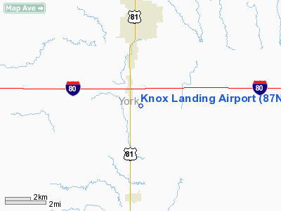
Location & QuickFacts
| FAA Information Effective: | 2008-09-25 |
| Airport Identifier: | 87NE |
| Airport Status: | Operational |
| Longitude/Latitude: | 097-35-16.1810W/40-48-33.0380N
-97.587828/40.809177 (Estimated) |
| Elevation: | 1638 ft / 499.26 m (Estimated) |
| Land: | 30 acres |
| From nearest city: | 4 nautical miles S of York, NE |
| Location: | York County, NE |
| Magnetic Variation: | 07E (1985) |
Owner & Manager
| Ownership: | Privately owned |
| Owner: | Craig A. Bair |
| Address: | 1309 Rd 9
York, NE 68467-8405 |
| Phone number: | 402-362-3550 |
| Manager: | Craig A. Bair |
| Address: | 1309 Rd 9
York, NE 68467-8405 |
| Phone number: | 402-362-3550 |
Airport Operations and Facilities
| Airport Use: | Private |
| Wind indicator: | Yes |
| Segmented Circle: | No |
| Control Tower: | No |
| Sectional chart: | Omaha |
| Region: | ACE - Central |
| Boundary ARTCC: | ZMP - Minneapolis |
| Tie-in FSS: | OLU - Columbus |
| FSS Toll Free: | 1-800-WX-BRIEF |
Airport Services
Runway Information
Runway 17/35
| Dimension: | 2000 x 24 ft / 609.6 x 7.3 m |
| Surface: | CONC, |
| |
Runway 17 |
Runway 35 |
| Traffic Pattern: | Left | Right |
| Displaced threshold: | 500.00 ft | 0.00 ft |
|
Radio Navigation Aids
| ID |
Type |
Name |
Ch |
Freq |
Var |
Dist |
| JYR | NDB | York | | 257.00 | 06E | 5.5 nm |
| FMZ | NDB | Beklof | | 392.00 | 07E | 13.2 nm |
| SWT | NDB | Seward | | 269.00 | 06E | 21.9 nm |
| LN | NDB | Potts | | 385.00 | 06E | 37.8 nm |
| HJH | NDB | Hebron | | 323.00 | 06E | 39.6 nm |
| PSS | NDB | Prosser | | 338.00 | 07E | 41.2 nm |
| PLT | NDB | Platte Center | | 407.00 | 08E | 42.4 nm |
| FBY | NDB | Fairbury | | 293.00 | 06E | 42.6 nm |
| BJU | NDB | Big Blue | | 248.00 | 06E | 44.4 nm |
| BIE | VOR | Beatrice | | 110.60 | 07E | 48.8 nm |
| OLU | VOR/DME | Columbus | 055X | 111.80 | 08E | 40.1 nm |
| HSI | VOR/DME | Hastings | 025X | 108.80 | 07E | 40.3 nm |
| GRI | VORTAC | Grand Island | 057X | 112.00 | 07E | 34.7 nm |
| LNK | VORTAC | Lincoln | 108X | 116.10 | 09E | 39.1 nm |
| OBH | VORTAC | Wolbach | 095X | 114.80 | 07E | 48.6 nm |
Remarks
- PRVDD APCH TO EA RY IS MNTND FOR A MIN 20:1 GLD SLP & ARPT TRANSTNL SFC MNTND FOR A 7:1 SLOPE.
Images and information placed above are from
http://www.airport-data.com/airport/87NE/
We thank them for the data!
| General Info
|
| Country |
United States
|
| State |
NEBRASKA
|
| FAA ID |
87NE
|
| Latitude |
40-48-33.038N
|
| Longitude |
097-35-16.181W
|
| Elevation |
1638 feet
|
| Near City |
YORK
|
We don't guarantee the information is fresh and accurate. The data may
be wrong or outdated.
For more up-to-date information please refer to other sources.
|
|


