 |
|
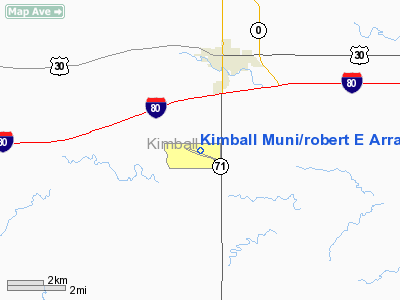
Kimball Muni/robert E Arraj Field Airport |
Location & QuickFacts
| FAA Information Effective: | 2008-09-25 |
| Airport Identifier: | IBM |
| Airport Status: | Operational |
| Longitude/Latitude: | 103-40-38.6000W/41-11-17.0000N
-103.677389/41.188056 (Estimated) |
| Elevation: | 4926 ft / 1501.44 m (Surveyed) |
| Land: | 342 acres |
| From nearest city: | 3 nautical miles S of Kimball, NE |
| Location: | Kimball County, NE |
| Magnetic Variation: | 10E (2000) |
Owner & Manager
| Ownership: | Publicly owned |
| Owner: | Kimball Airport Authority
KEN RISK, CHAIRMAN OF AIRPORT AUTHORITY. |
| Address: | 802 South Elm
Kimball, NE 69145 |
| Phone number: | 308-235-4645 |
| Manager: | Ken Risk |
| Address: |
Kimball, NE 69145 |
Airport Operations and Facilities
| Airport Use: | Open to public |
| Wind indicator: | Yes |
| Segmented Circle: | Yes |
| Control Tower: | No |
| Lighting Schedule: | DUSK-DAWN
ACTVT MIRL RY 10/28 & PAPI RYS 10 & 28 - CTAF. |
| Beacon Color: | Clear-Green (lighted land airport) |
| Landing fee charge: | No |
| Sectional chart: | Cheyenne |
| Region: | ACE - Central |
| Boundary ARTCC: | ZDV - Denver |
| Tie-in FSS: | OLU - Columbus |
| FSS on Airport: | No |
| FSS Toll Free: | 1-800-WX-BRIEF |
| NOTAMs Facility: | IBM (NOTAM-d service avaliable) |
| Federal Agreements: | NGY |
Airport Communications
| CTAF: | 122.800 |
| Unicom: | 122.800 |
Airport Services
| Fuel available: | 100LLA |
| Airframe Repair: | MAJOR |
| Power Plant Repair: | MAJOR |
| Bottled Oxygen: | NONE |
| Bulk Oxygen: | NONE |
Runway Information
Runway 10/28
| Dimension: | 6199 x 75 ft / 1889.5 x 22.9 m |
| Surface: | CONC, Good Condition |
| Weight Limit: | Single wheel: 30000 lbs.
Dual wheel: 45000 lbs. |
| Edge Lights: | Medium |
| |
Runway 10 |
Runway 28 |
| Longitude: | 103-41-17.7630W | 103-39-59.3860W |
| Latitude: | 41-11-24.8050N | 41-11-09.1770N |
| Elevation: | 4926.00 ft | 4900.00 ft |
| Alignment: | 105 | 127 |
| Traffic Pattern: | Left | Left |
| Markings: | Non-precision instrument, Good Condition | Non-precision instrument, Good Condition |
| Crossing Height: | 40.00 ft | 40.00 ft |
| VASI: | 2-light PAPI on left side | 2-light PAPI on left side |
| Visual Glide Angle: | 3.00° | 3.00° |
| Obstruction: | 12 ft road, 400.0 ft from runway, 298 ft right of centerline, 16:1 slope to clear | , 50:1 slope to clear |
|
Radio Navigation Aids
| ID |
Type |
Name |
Ch |
Freq |
Var |
Dist |
| IBM | NDB | Kimball | | 317.00 | 10E | 0.4 nm |
| BAJ | NDB | Batten | | 392.00 | 11E | 44.4 nm |
| GIG | NDB | Gering | | 341.00 | 11E | 45.5 nm |
| SNY | VORTAC | Sidney | 106X | 115.90 | 13E | 31.9 nm |
| BFF | VORTAC | Scottsbluff | 073X | 112.60 | 13E | 43.3 nm |
| CYS | VORTAC | Cheyenne | 078X | 113.10 | 13E | 49.6 nm |
Images and information placed above are from
http://www.airport-data.com/airport/IBM/
We thank them for the data!
| General Info
|
| Country |
United States
|
| State |
NEBRASKA
|
| FAA ID |
IBM
|
| Latitude |
41-11-17.000N
|
| Longitude |
103-40-38.600W
|
| Elevation |
4926 feet
|
| Near City |
KIMBALL
|
We don't guarantee the information is fresh and accurate. The data may
be wrong or outdated.
For more up-to-date information please refer to other sources.
|
|


