|
|
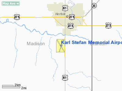
Karl Stefan Memorial Airport |
| Karl Stefan Memorial Airport |
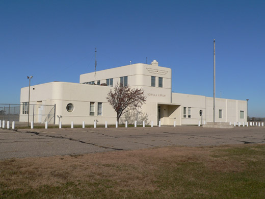 |
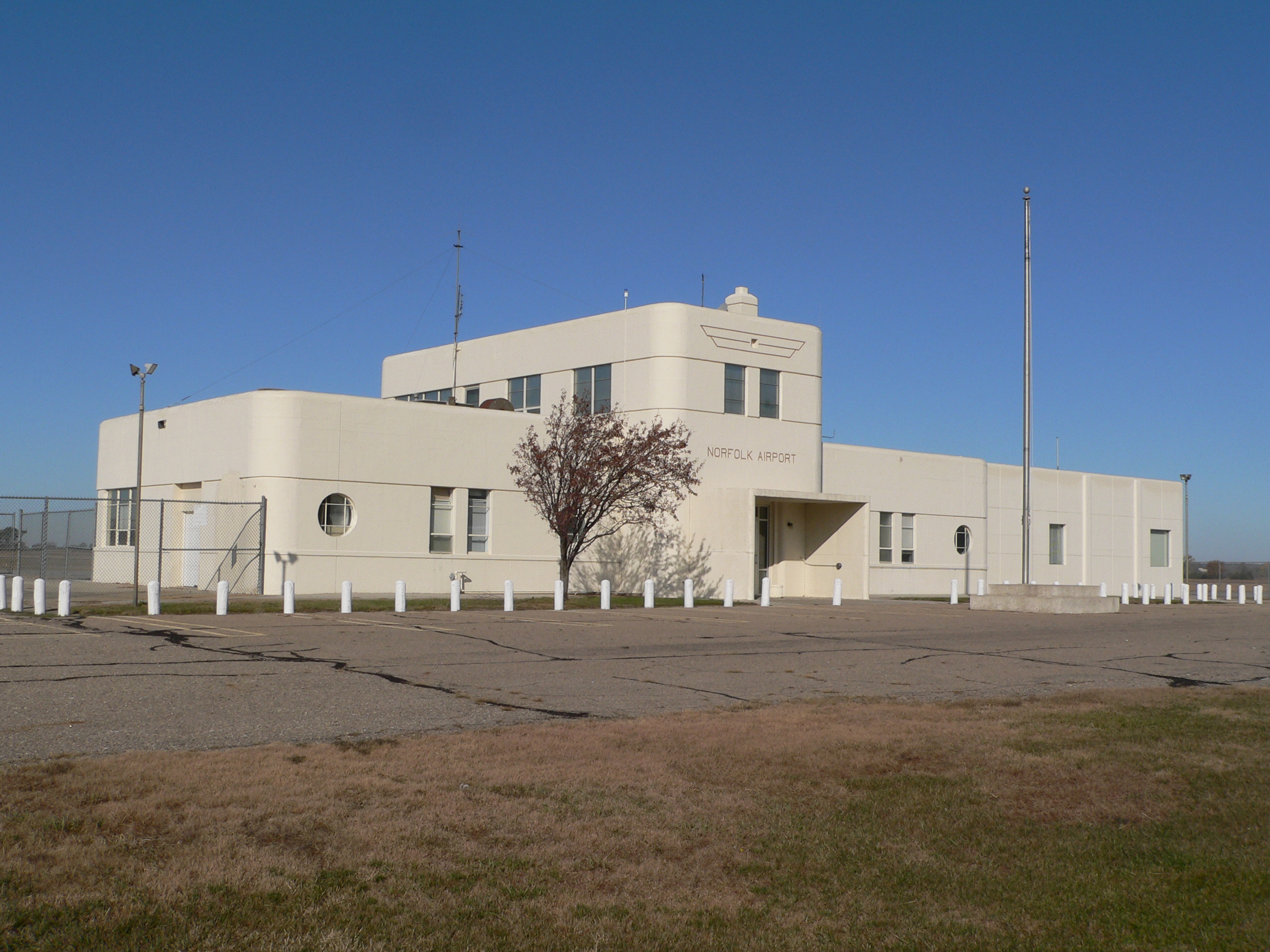
| Former terminal building at Karl Stefan Memorial Airport |
| IATA: OFK – ICAO: KOFK |
| Summary |
| Airport type |
Public |
| Operator |
City of Norfolk |
| Location |
Norfolk, Nebraska |
| Elevation AMSL |
1,573 ft / 479.5 m |
| Coordinates |
41°59′07.67″N 97°26′06.4″W / 41.9854639°N 97.435111°W / 41.9854639; -97.435111Coordinates: 41°59′07.67″N 97°26′06.4″W / 41.9854639°N 97.435111°W / 41.9854639; -97.435111 |
| Runways |
| Direction |
Length |
Surface |
| ft |
m |
| 1/19 |
5,800 |
1,768 |
Asphalt |
| 14/32 |
5,800 |
1,768 |
Asphalt |
Karl Stefan Memorial Airport (IATA: OFK, ICAO: KOFK) is a public airport located three miles (5 km) southwest of the city of Norfolk in Madison County, Nebraska, USA.
The airport is named for Karl Stefan, a local newspaper editor and radio announcer who served several terms in the United States Congress.
The above content comes from Wikipedia and is published under free licenses – click here to read more.
Location & QuickFacts
| FAA Information Effective: | 2008-09-25 |
| Airport Identifier: | OFK |
| Airport Status: | Operational |
| Longitude/Latitude: | 097-26-06.4000W/41-59-07.6700N
-97.435111/41.985464 (Estimated) |
| Elevation: | 1573 ft / 479.45 m (Surveyed) |
| Land: | 926 acres |
| From nearest city: | 3 nautical miles SW of Norfolk, NE |
| Location: | Madison County, NE |
| Magnetic Variation: | 05E (2005) |
Owner & Manager
| Ownership: | Publicly owned |
| Owner: | City Of Norfolk |
| Address: | 127 N. First St
Norfolk, NE 68701-4101 |
| Phone number: | 402-644-8720 |
| Manager: | Mr. Gerald Adams |
| Address: | P.o. Box 1343
Norfolk, NE 68702-1343 |
| Phone number: | 402-371-7210
CELL PHONE 402-841-5130 |
Airport Operations and Facilities
| Airport Use: | Open to public |
| Wind indicator: | Yes |
| Segmented Circle: | Yes |
| Control Tower: | No |
| Lighting Schedule: | DUSK-DAWN
ACTVT HIRL RY 01/19 & MIRL RY 14/32; MALSR RY 01; VASI RYS 01; 19; 14 & PAPI RY 32 & REIL RY 32 - CTAF. |
| Beacon Color: | Clear-Green (lighted land airport) |
| Landing fee charge: | No |
| Sectional chart: | Omaha |
| Region: | ACE - Central |
| Boundary ARTCC: | ZMP - Minneapolis |
| Tie-in FSS: | OLU - Columbus |
| FSS on Airport: | No |
| FSS Toll Free: | 1-800-WX-BRIEF |
| NOTAMs Facility: | OFK (NOTAM-d service avaliable) |
| Federal Agreements: | NGY3 |
Airport Communications
| CTAF: | 122.700 |
| Unicom: | 122.700 |
Airport Services
| Fuel available: | 100LLA |
| Airframe Repair: | MAJOR |
| Power Plant Repair: | MAJOR |
| Bottled Oxygen: | NONE |
| Bulk Oxygen: | NONE |
Runway Information
Runway 01/19
| Dimension: | 5800 x 100 ft / 1767.8 x 30.5 m |
| Surface: | ASPH, Good Condition |
| Surface Treatment: | Porous Friction Course |
| Weight Limit: | Single wheel: 60000 lbs.
Dual wheel: 192000 lbs.
Dual tandem wheel: 360000 lbs. |
| Edge Lights: | High |
| |
Runway 01 |
Runway 19 |
| Longitude: | 097-26-15.0144W | 097-25-49.4972W |
| Latitude: | 41-58-39.3875N | 41-59-33.4260N |
| Elevation: | 1573.00 ft | 1530.00 ft |
| Alignment: | 19 | 127 |
| ILS Type: | ILS
| |
| Traffic Pattern: | Left | Left |
| Markings: | Precision instrument, Good Condition | Non-precision instrument, Good Condition |
| Crossing Height: | 48.00 ft | 41.00 ft |
| VASI: | 4-box on left side | 4-box on left side |
| Visual Glide Angle: | 3.00° | 3.00° |
| Approach lights: | MALSR | |
| Obstruction: | 137 ft tree, 5700.0 ft from runway, 425 ft left of centerline, 40:1 slope to clear | 50 ft tree, 1400.0 ft from runway, 550 ft right of centerline, 24:1 slope to clear |
|
Runway 14/32
| Dimension: | 5800 x 100 ft / 1767.8 x 30.5 m |
| Surface: | ASPH, Good Condition |
| Surface Treatment: | Porous Friction Course |
| Weight Limit: | Single wheel: 75000 lbs.
Dual wheel: 192000 lbs.
Dual tandem wheel: 400000 lbs. |
| Edge Lights: | Medium |
| |
Runway 14 |
Runway 32 |
| Longitude: | 097-26-34.2275W | 097-25-46.8790W |
| Latitude: | 41-59-31.4515N | 41-58-46.3490N |
| Elevation: | 1543.00 ft | 1564.00 ft |
| Alignment: | 127 | 127 |
| Traffic Pattern: | Left | Left |
| Markings: | Non-precision instrument, Good Condition | Non-precision instrument, Good Condition |
| Crossing Height: | 33.00 ft | 32.00 ft |
| Displaced threshold: | 284.00 ft | 357.00 ft |
| VASI: | 4-box on left side | 4-light PAPI on left side |
| Visual Glide Angle: | 3.00° | 3.50° |
| Runway End Identifier: | | Yes |
| Obstruction: | 25 ft rr, 990.0 ft from runway, 375 ft right of centerline, 31:1 slope to clear | 48 ft tree, 1200.0 ft from runway, 400 ft right of centerline, 20:1 slope to clear |
| Decleard distances: | Take off run available 5443.00 ft
Take off distance available 5800.00 ft
Actual stop distance available 5443.00 ft
Landing distance available 5160.00 ft
| Take off run available 5517.00 ft
Take off distance available 5800.00 ft
Actual stop distance available 5517.00 ft
Landing distance available 5160.00 ft
|
|
Radio Navigation Aids
| ID |
Type |
Name |
Ch |
Freq |
Var |
Dist |
| OF | NDB | Carsy | | 510.00 | 08E | 6.2 nm |
| LCG | NDB | Wayne | | 389.00 | 06E | 25.4 nm |
| PLT | NDB | Platte Center | | 407.00 | 08E | 29.5 nm |
| BVN | NDB | Alaby | | 332.00 | 06E | 31.6 nm |
| OFK | VOR/DME | Norfolk | 033X | 109.60 | 08E | 0.1 nm |
| OLU | VOR/DME | Columbus | 055X | 111.80 | 08E | 32.5 nm |
| SCB | VOR/DME | Scribner | 47X | 111.00 | 06E | 42.8 nm |
Remarks
- RY 19 DESIGNATED AS THE CALM WIND RY & ALL RYS HAVE LEFT HAND TRAFFIC ONLY.
- FOR SVC AFT HRS CALL 402-841-5897 OR 402-841-5130.
Images and information placed above are from
http://www.airport-data.com/airport/OFK/
We thank them for the data!
| General Info
|
| Country |
United States
|
| State |
NEBRASKA
|
| FAA ID |
OFK
|
| Latitude |
41-59-07.670N
|
| Longitude |
097-26-06.400W
|
| Elevation |
1573 feet
|
| Near City |
NORFOLK
|
We don't guarantee the information is fresh and accurate. The data may
be wrong or outdated.
For more up-to-date information please refer to other sources.
|
|