 |
|
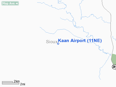
Location & QuickFacts
| FAA Information Effective: | 2008-09-25 |
| Airport Identifier: | 11NE |
| Airport Status: | Operational |
| Longitude/Latitude: | 103-54-58.7770W/42-26-32.8690N
-103.916327/42.442464 (Estimated) |
| Elevation: | 4650 ft / 1417.32 m (Estimated) |
| Land: | 0 acres |
| From nearest city: | 15 nautical miles S of Harrison, NE |
| Location: | Sioux County, NE |
| Magnetic Variation: | 11E (1985) |
Owner & Manager
| Ownership: | Privately owned |
| Owner: | Richard Kaan |
| Address: | 3341 Morrill Road
Harrison, NE 69346 |
| Phone number: | 308-668-2363 |
| Address: |
|
Airport Operations and Facilities
| Airport Use: | Private |
| Wind indicator: | No |
| Segmented Circle: | No |
| Control Tower: | No |
| Landing fee charge: | No |
| Sectional chart: | Cheyenne |
| Region: | ACE - Central |
| Boundary ARTCC: | ZDV - Denver |
| Tie-in FSS: | OLU - Columbus |
| FSS on Airport: | No |
| FSS Toll Free: | 1-800-WX-BRIEF |
Runway Information
Runway 12/30
| Dimension: | 2500 x 100 ft / 762.0 x 30.5 m |
| Surface: | TURF, |
| |
Runway 12 |
Runway 30 |
| Traffic Pattern: | Left | Left |
|
Radio Navigation Aids
| ID |
Type |
Name |
Ch |
Freq |
Var |
Dist |
| TOR | NDB | Torrington | | 293.00 | 11E | 25.0 nm |
| GIG | NDB | Gering | | 341.00 | 11E | 31.7 nm |
| GYZ | NDB | Camp Guernsey | | 280.00 | 11E | 37.5 nm |
| HIN | NDB | Whitney | | 275.00 | 11E | 43.2 nm |
| CDR | VOR/DME | Chadron | 081X | 113.40 | 13E | 27.7 nm |
| BFF | VORTAC | Scottsbluff | 073X | 112.60 | 13E | 38.2 nm |
Remarks
- E111 PRVDD THE APCH TO EACH RWY IS MAINTD FOR A MIN 20:1 GLIDE SLOPE AND THE ARPT TRANSITIONAL SFC BE MAINTD FOR A 7:1 SLOPE.
Images and information placed above are from
http://www.airport-data.com/airport/11NE/
We thank them for the data!
| General Info
|
| Country |
United States
|
| State |
NEBRASKA
|
| FAA ID |
11NE
|
| Latitude |
42-26-32.869N
|
| Longitude |
103-54-58.777W
|
| Elevation |
4650 feet
|
| Near City |
HARRISON
|
We don't guarantee the information is fresh and accurate. The data may
be wrong or outdated.
For more up-to-date information please refer to other sources.
|
|


