 |
|
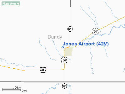
Location & QuickFacts
| FAA Information Effective: | 2008-09-25 |
| Airport Identifier: | 42V |
| Airport Status: | Operational |
| Longitude/Latitude: | 101-32-48.6010W/40-03-28.9800N
-101.546834/40.058050 (Estimated) |
| Elevation: | 3126 ft / 952.80 m (Estimated) |
| Land: | 37 acres |
| From nearest city: | 1 nautical miles NW of Benkelman, NE |
| Location: | Dundy County, NE |
| Magnetic Variation: | 09E (1985) |
Owner & Manager
| Ownership: | Privately owned |
| Owner: | Stan Jones |
| Address: | Box 685
Benkelman, NE 69021 |
| Phone number: | 308-423-2941 |
| Manager: | Stan Jones |
| Address: | Box 685
Benkelman, NE 69021 |
| Phone number: | 308-423-2941 |
Airport Operations and Facilities
| Airport Use: | Open to public |
| Wind indicator: | Yes |
| Segmented Circle: | No |
| Control Tower: | No |
| Landing fee charge: | No |
| Sectional chart: | Cheyenne |
| Region: | ACE - Central |
| Boundary ARTCC: | ZDV - Denver |
| Tie-in FSS: | OLU - Columbus |
| FSS on Airport: | No |
| FSS Toll Free: | 1-800-WX-BRIEF |
| NOTAMs Facility: | OLU (NOTAM-d service avaliable) |
Airport Communications
Airport Services
| Fuel available: | 100LLA
FUEL FOR EMERG USE ONLY. |
| Airframe Repair: | NONE |
| Power Plant Repair: | NONE |
| Bottled Oxygen: | NONE |
| Bulk Oxygen: | NONE |
Runway Information
Runway 15/33
| Dimension: | 3500 x 25 ft / 1066.8 x 7.6 m |
| Surface: | CONC, |
| |
Runway 15 |
Runway 33 |
| Traffic Pattern: | Left | Left |
| Displaced threshold: | 0.00 ft | 1000.00 ft |
| Obstruction: | 17 ft road, 550.0 ft from runway, 32:1 slope to clear | , 50:1 slope to clear
+16 FT ROAD 105 FT FM EOR L/R. |
|
Radio Navigation Aids
| ID |
Type |
Name |
Ch |
Freq |
Var |
Dist |
| MCK | FAN MARKER | Mc Cook | | | 11E | 46.6 nm |
| SYF | NDB | St Francis | | 386.00 | 10E | 22.3 nm |
| ADT | NDB | Atwood | | 365.00 | 09E | 26.6 nm |
| IML | NDB | Imperial | | 283.00 | 09E | 27.5 nm |
| JDM | NDB | Wheatfield | | 408.00 | 08E | 40.2 nm |
| GL | NDB | Shugr | | 414.00 | 09E | 46.0 nm |
| HEQ | NDB | Heginbotham | | 404.00 | 11E | 46.1 nm |
| OIN | NDB | Oberlin | | 341.00 | 09E | 48.5 nm |
| GGF | NDB | Grant | | 359.00 | 09E | 49.6 nm |
| MCK | VOR/DME | Mc Cook | 100X | 115.30 | 08E | 44.6 nm |
| HCT | VORTAC | Hayes Center | 124X | 117.70 | 11E | 37.2 nm |
| GLD | VORTAC | Goodland | 098X | 115.10 | 12E | 40.8 nm |
Remarks
- NEW CROSSWIND RY UNDER CONSTRUCTION WEST OF RY 15/33.
- ESTABLISHED PRIOR TO 1959.
Images and information placed above are from
http://www.airport-data.com/airport/42V/
We thank them for the data!
| General Info
|
| Country |
United States
|
| State |
NEBRASKA
|
| FAA ID |
42V
|
| Latitude |
40-03-28.980N
|
| Longitude |
101-32-48.601W
|
| Elevation |
3126 feet
|
| Near City |
BENKELMAN
|
We don't guarantee the information is fresh and accurate. The data may
be wrong or outdated.
For more up-to-date information please refer to other sources.
|
|


