 |
|
| Jim Kelly Field |
| IATA: LXN – ICAO: KLXN – FAA LID: LXN |
| Summary |
| Airport type |
Public |
| Owner |
Lexington Airport Authority |
| Serves |
Lexington, Nebraska |
| Elevation AMSL |
2,413 ft / 735 m |
| Coordinates |
40°47′26″N 099°46′33″W / 40.79056°N 99.77583°W / 40.79056; -99.77583 |
| Runways |
| Direction |
Length |
Surface |
| ft |
m |
| 14/32 |
5,489 |
1,673 |
Concrete |
| 1/19 |
3,200 |
975 |
Turf |
| Statistics (2007) |
| Aircraft operations |
10,640 |
| Source: Federal Aviation Administration |
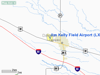
Jim Kelly Field (IATA: LXN, ICAO: KLXN, FAA LID: LXN) is a public use airport located two nautical miles (4 km) northwest of the central business district of Lexington, a city in Dawson County, Nebraska, United States.
Facilities and aircraft
Jim Kelly Field covers an area of 275 acres (111 ha) at an elevation of 2,413 feet (735 m) above mean sea level. It has two runways: 14/32 is 5,489 by 100 feet (1,673 x 30 m) with a concrete surface; 1/19 is 3,200 by 250 feet (975 x 76 m) with a turf surface. For the 12-month period ending August 16, 2007, the airport had 10,640 aircraft operations, an average of 29 per day: 96% general aviation, 4% air taxi and <1% military.
The above content comes from Wikipedia and is published under free licenses – click here to read more.
Location & QuickFacts
| FAA Information Effective: | 2008-09-25 |
| Airport Identifier: | LXN |
| Airport Status: | Operational |
| Longitude/Latitude: | 099-46-33.2910W/40-47-25.5250N
-99.775914/40.790424 (Estimated) |
| Elevation: | 2413 ft / 735.48 m (Surveyed) |
| Land: | 275 acres |
| From nearest city: | 2 nautical miles NW of Lexington, NE |
| Location: | Dawson County, NE |
| Magnetic Variation: | 07E (2005) |
Owner & Manager
| Ownership: | Publicly owned |
| Owner: | Lexington Airport Authority |
| Address: | P.o. Box 972
Lexington, NE 68850-0972 |
| Phone number: | 308-324-5020 |
| Manager: | Nathan Masten |
| Address: | 1501 North Airport Road
Lexington, NE 68850-3471 |
| Phone number: | 308-324-8770 |
Airport Operations and Facilities
| Airport Use: | Open to public |
| Wind indicator: | Yes |
| Segmented Circle: | No |
| Control Tower: | No |
| Lighting Schedule: | DUSK-DAWN
ACTVT MIRL RY 14/32; PAPI RYS 14 & 32 - CTAF. |
| Beacon Color: | Clear-Green (lighted land airport) |
| Landing fee charge: | No |
| Sectional chart: | Omaha |
| Region: | ACE - Central |
| Boundary ARTCC: | ZDV - Denver |
| Tie-in FSS: | OLU - Columbus |
| FSS on Airport: | No |
| FSS Toll Free: | 1-800-WX-BRIEF |
| NOTAMs Facility: | LXN (NOTAM-d service avaliable) |
| Federal Agreements: | NGY |
Airport Communications
| CTAF: | 123.000 |
| Unicom: | 123.000 |
Airport Services
| Fuel available: | 100LLA+ |
| Airframe Repair: | MAJOR |
| Power Plant Repair: | MAJOR |
| Bottled Oxygen: | NONE |
| Bulk Oxygen: | NONE |
Runway Information
Runway 01/19
| Dimension: | 3200 x 250 ft / 975.4 x 76.2 m |
| Surface: | TURF, Fair Condition |
| |
Runway 01 |
Runway 19 |
| Longitude: | 099-46-31.4200W | 099-46-18.4190W |
| Latitude: | 40-47-07.0230N | 40-47-37.0230N |
| Elevation: | 2400.00 ft | 2406.00 ft |
| Alignment: | 18 | 127 |
| Traffic Pattern: | Left | Left |
| Obstruction: | 27 ft rr, 680.0 ft from runway, 25:1 slope to clear | 72 ft trees, 2215.0 ft from runway, 85 ft left of centerline, 30:1 slope to clear |
|
Runway 14/32
| Dimension: | 5489 x 100 ft / 1673.0 x 30.5 m |
| Surface: | CONC, Good Condition |
| Weight Limit: | Single wheel: 30000 lbs. |
| Edge Lights: | Medium |
| |
Runway 14 |
Runway 32 |
| Longitude: | 099-46-59.5830W | 099-46-16.7500W |
| Latitude: | 40-47-49.2530N | 40-47-05.8770N |
| Elevation: | 2412.00 ft | 2403.00 ft |
| Alignment: | 127 | 127 |
| Traffic Pattern: | Left | Left |
| Markings: | Non-precision instrument, Good Condition | Non-precision instrument, Good Condition |
| VASI: | 2-light PAPI on left side | 2-light PAPI on left side |
| Obstruction: | , 50:1 slope to clear | 24 ft rr, 960.0 ft from runway, 31:1 slope to clear |
|
Radio Navigation Aids
| ID |
Type |
Name |
Ch |
Freq |
Var |
Dist |
| RRX | NDB | Darr | | 326.00 | 07E | 4.9 nm |
| DWL | NDB | Willow | | 353.00 | 08E | 14.4 nm |
| HDE | NDB | Holdrege | | 396.00 | 07E | 28.6 nm |
| CSB | NDB | Harry Strunk | | 389.00 | 08E | 34.0 nm |
| BBW | NDB | Broken Bow | | 265.00 | 08E | 39.2 nm |
| OZB | VOR | Cozad | | 109.00 | 09E | 11.4 nm |
| EAR | VOR | Kearney | | 111.20 | 10E | 35.3 nm |
| CUZ | VOR/DME | Custer County | 19X | 108.20 | 08E | 41.9 nm |
| LBF | VORTAC | North Platte | 121X | 117.40 | 11E | 46.8 nm |
Remarks
- RY 01/19 NOT PLOWED WINTER MONTHS.
Images and information placed above are from
http://www.airport-data.com/airport/LXN/
We thank them for the data!
| General Info
|
| Country |
United States
|
| State |
NEBRASKA
|
| FAA ID |
LXN
|
| Latitude |
40-47-27.600N
|
| Longitude |
099-46-38.200W
|
| Elevation |
2413 feet
|
| Near City |
LEXINGTON
|
We don't guarantee the information is fresh and accurate. The data may
be wrong or outdated.
For more up-to-date information please refer to other sources.
|
|


