 |
|
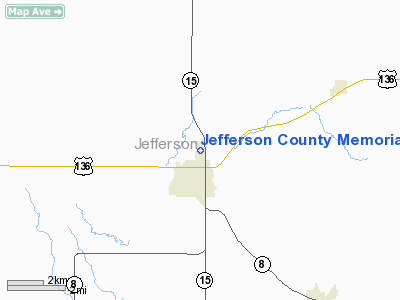
Jefferson County Memorial Hospital Heliport |
Location & QuickFacts
| FAA Information Effective: | 2008-09-25 |
| Airport Identifier: | 17NE |
| Airport Status: | Operational |
| Longitude/Latitude: | 097-10-26.1600W/40-09-17.5800N
-97.173933/40.154883 (Estimated) |
| Elevation: | 1433 ft / 436.78 m (Surveyed) |
| Land: | 0 acres |
| From nearest city: | 1 nautical miles N of Fairbury, NE |
| Location: | Jefferson County, NE |
| Magnetic Variation: | 07E (1985) |
Owner & Manager
| Ownership: | Publicly owned |
| Owner: | Jefferson Community Health Center |
| Address: | 2200 H Street
Fairbury, NE 68352 |
| Phone number: | 402-729-3351 |
| Manager: | Bill Welch |
| Address: | 2200 H Street
Fairbury, NE 68352 |
| Phone number: | 402-729-3351 |
Airport Operations and Facilities
| Airport Use: | Private
MEDICAL. |
| Wind indicator: | Yes |
| Segmented Circle: | No |
| Control Tower: | No |
| Landing fee charge: | No |
| Sectional chart: | Omaha |
| Region: | ACE - Central |
| Boundary ARTCC: | ZMP - Minneapolis |
| Tie-in FSS: | OLU - Columbus |
| FSS on Airport: | No |
| FSS Toll Free: | 1-800-WX-BRIEF |
Runway Information
Helipad H1
| Dimension: | 40 x 40 ft / 12.2 x 12.2 m |
| Surface: | CONC, |
| |
Runway H1 |
Runway |
| Traffic Pattern: | Left | Left |
| Obstruction: | 30 ft bldg, 45.0 ft from runway | |
|
Radio Navigation Aids
| ID |
Type |
Name |
Ch |
Freq |
Var |
Dist |
| FBY | NDB | Fairbury | | 293.00 | 06E | 1.4 nm |
| HJH | NDB | Hebron | | 323.00 | 06E | 19.0 nm |
| HWB | NDB | Shaw | | 263.00 | 06E | 20.2 nm |
| BJU | NDB | Big Blue | | 248.00 | 06E | 20.8 nm |
| DBX | NDB | Morrison | | 212.00 | 06E | 24.4 nm |
| RPB | NDB | Republican | | 414.00 | 07E | 30.3 nm |
| MYZ | NDB | Marysville | | 341.00 | 06E | 30.8 nm |
| FMZ | NDB | Beklof | | 392.00 | 07E | 31.8 nm |
| LN | NDB | Potts | | 385.00 | 06E | 40.3 nm |
| CNK | NDB | Concordia | | 335.00 | 06E | 42.3 nm |
| SWT | NDB | Seward | | 269.00 | 06E | 42.6 nm |
| CYW | NDB | Clay Center | | 362.00 | 07E | 46.5 nm |
| JYR | NDB | York | | 257.00 | 06E | 49.0 nm |
| BIE | VOR | Beatrice | | 110.60 | 07E | 21.2 nm |
| PWE | VORTAC | Pawnee City | 071X | 112.40 | 05E | 44.5 nm |
Remarks
- PRVDD THAT APCH/DEP PATHS TO THE LNDG AREA ARE MAINTAINED FOR A MIN 8:1 GLIDE SLOPE AND THE TRANSITIONAL SURFACE BE MAINTAINED FOR A 2:1 SLOPE.
Images and information placed above are from
http://www.airport-data.com/airport/17NE/
We thank them for the data!
| General Info
|
| Country |
United States
|
| State |
NEBRASKA
|
| FAA ID |
17NE
|
| Latitude |
40-09-26.008N
|
| Longitude |
097-10-35.128W
|
| Elevation |
1460 feet
|
| Near City |
FAIRBURY
|
We don't guarantee the information is fresh and accurate. The data may
be wrong or outdated.
For more up-to-date information please refer to other sources.
|
|


