 |
|
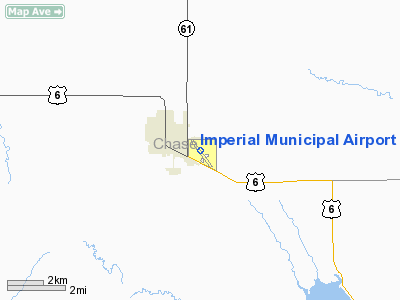
Location & QuickFacts
| FAA Information Effective: | 2008-09-25 |
| Airport Identifier: | IML |
| Airport Status: | Operational |
| Longitude/Latitude: | 101-37-12.5257W/40-30-37.1744N
-101.620146/40.510326 (Estimated) |
| Elevation: | 3275 ft / 998.22 m (Surveyed) |
| Land: | 213 acres |
| From nearest city: | 1 nautical miles SE of Imperial, NE |
| Location: | Chase County, NE |
| Magnetic Variation: | 09E (2000) |
Owner & Manager
| Ownership: | Publicly owned |
| Owner: | Imperial Airport Authority |
| Address: | Box 637, Box 637
Imperial, NE 69033 |
| Phone number: | 308-882-4368 |
| Manager: | Jeff Steggs |
| Address: | Box 1231
Imperial, NE 69033 |
| Phone number: | 308-882-5121 |
Airport Operations and Facilities
| Airport Use: | Open to public |
| Wind indicator: | Yes |
| Segmented Circle: | No |
| Control Tower: | No |
| Lighting Schedule: | DUSK-DAWN
ACTVT MIRL RY 13/31 - CTAF. |
| Beacon Color: | Clear-Green (lighted land airport) |
| Landing fee charge: | No |
| Sectional chart: | Cheyenne |
| Region: | ACE - Central |
| Boundary ARTCC: | ZDV - Denver |
| Tie-in FSS: | OLU - Columbus |
| FSS on Airport: | No |
| FSS Toll Free: | 1-800-WX-BRIEF |
| NOTAMs Facility: | IML (NOTAM-d service avaliable) |
| Federal Agreements: | NGY |
Airport Communications
| CTAF: | 122.800 |
| Unicom: | 122.800 |
Airport Services
| Bottled Oxygen: | NONE |
| Bulk Oxygen: | NONE |
Runway Information
Runway 03/21
| Dimension: | 2756 x 280 ft / 840.0 x 85.3 m |
| Surface: | TURF, Fair Condition |
| |
Runway 03 |
Runway 21 |
| Longitude: | 101-37-22.8600W | 101-36-57.3500W |
| Latitude: | 40-30-34.4300N | 40-30-53.4700N |
| Elevation: | 3267.00 ft | 3274.00 ft |
| Alignment: | 46 | 127 |
| Traffic Pattern: | Left | Left |
| Obstruction: | 4 ft fence, 80.0 ft from runway, 20:1 slope to clear | 18 ft road, 360.0 ft from runway, 20:1 slope to clear |
|
Runway 13/31
| Dimension: | 5022 x 100 ft / 1530.7 x 30.5 m |
| Surface: | CONC, Good Condition |
| Weight Limit: | Single wheel: 21000 lbs. |
| Edge Lights: | Medium |
| |
Runway 13 |
Runway 31 |
| Longitude: | 101-37-33.1222W | 101-36-54.5862W |
| Latitude: | 40-30-53.4362N | 40-30-13.4759N |
| Elevation: | 3273.00 ft | 3265.00 ft |
| Alignment: | 127 | 127 |
| Traffic Pattern: | Left | Left |
| Markings: | Non-precision instrument, Good Condition | Non-precision instrument, Good Condition |
| Crossing Height: | 42.00 ft | 42.00 ft |
| VASI: | 2-light PAPI on left side | 2-light PAPI on left side |
| Visual Glide Angle: | 3.00° | 3.00° |
| Obstruction: | 20 ft road, 750.0 ft from runway, 27:1 slope to clear | 5 ft fence, 345.0 ft from runway, 29:1 slope to clear |
|
Radio Navigation Aids
| ID |
Type |
Name |
Ch |
Freq |
Var |
Dist |
| IML | NDB | Imperial | | 283.00 | 09E | 0.3 nm |
| GGF | NDB | Grant | | 359.00 | 09E | 22.3 nm |
| HEQ | NDB | Heginbotham | | 404.00 | 11E | 30.5 nm |
| SYF | NDB | St Francis | | 386.00 | 10E | 47.6 nm |
| ADT | NDB | Atwood | | 365.00 | 09E | 48.2 nm |
| SAE | VOR/DME | Searle | 39X | 110.20 | 11E | 37.3 nm |
| HCT | VORTAC | Hayes Center | 124X | 117.70 | 11E | 32.0 nm |
Remarks
- BIRDS INVOF ARPT - SEASONAL.
- EXTENSIVE CROP SPRAYING OPNS INVOF ARPT APR THRU AUG.
- RY 03/21 NOT PLOWED WINTER MONTHS.
- EXISTED PRIOR TO 1959.
Images and information placed above are from
http://www.airport-data.com/airport/IML/
We thank them for the data!
| General Info
|
| Country |
United States
|
| State |
NEBRASKA
|
| FAA ID |
IML
|
| Latitude |
40-30-37.488N
|
| Longitude |
101-37-12.338W
|
| Elevation |
3272 feet
|
| Near City |
IMPERIAL
|
We don't guarantee the information is fresh and accurate. The data may
be wrong or outdated.
For more up-to-date information please refer to other sources.
|
|


