 |
|
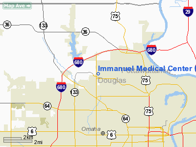
Immanuel Medical Center Heliport |
Location & QuickFacts
| FAA Information Effective: | 2008-09-25 |
| Airport Identifier: | NE71 |
| Airport Status: | Operational |
| Longitude/Latitude: | 096-01-16.0560W/41-19-19.9900N
-96.021127/41.322219 (Estimated) |
| Elevation: | 1246 ft / 379.78 m (Estimated) |
| Land: | 0 acres |
| From nearest city: | 0 nautical miles N of Omaha, NE |
| Location: | Douglas County, NE |
| Magnetic Variation: | 06E (1985) |
Owner & Manager
| Ownership: | Privately owned |
| Owner: | Immanuel Medical Center |
| Address: | 6901 N 72nd St
Omaha, NE 68122 |
| Phone number: | 402-572-2121 |
| Manager: | Charles J. Marr |
| Address: | 6901 N 72nd St
Omaha, NE 68122 |
| Phone number: | 402-572-2121 |
Airport Operations and Facilities
| Airport Use: | Private
MEDICAL. |
| Wind indicator: | No |
| Segmented Circle: | No |
| Control Tower: | No |
| Landing fee charge: | No |
| Sectional chart: | Omaha |
| Region: | ACE - Central |
| Boundary ARTCC: | ZMP - Minneapolis |
| Tie-in FSS: | OLU - Columbus |
| FSS on Airport: | No |
| FSS Toll Free: | 1-800-WX-BRIEF |
Airport Services
| Airframe Repair: | NONE |
| Power Plant Repair: | NONE |
Runway Information
Helipad H1
| Dimension: | 50 x 50 ft / 15.2 x 15.2 m |
| Surface: | CONC, |
| |
Runway H1 |
Runway |
| Traffic Pattern: | Left | Left |
|
Radio Navigation Aids
| ID |
Type |
Name |
Ch |
Freq |
Var |
Dist |
| OM | NDB | Gerfi | | 320.00 | 05E | 4.0 nm |
| MLE | NDB | Millard | | 371.00 | 06E | 8.7 nm |
| PMV | NDB | Plattsmouth | | 329.00 | 06E | 23.3 nm |
| FET | NDB | Fremont | | 311.00 | 06E | 23.7 nm |
| AHQ | NDB | Wahoo | | 400.00 | 07E | 26.5 nm |
| HNR | NDB | Harlan | | 272.00 | 05E | 34.3 nm |
| RDK | NDB | Red Oak | | 230.00 | 04E | 39.3 nm |
| AFK | NDB | Nebraska City | | 347.00 | 05E | 43.7 nm |
| SDA | NDB | Shenandoah | | 411.00 | 05E | 44.2 nm |
| AIO | NDB | Atlantic | | 365.00 | 04E | 44.3 nm |
| LN | NDB | Potts | | 385.00 | 06E | 48.2 nm |
| DNS | NDB | Denison | | 350.00 | 04E | 49.1 nm |
| OFF | TACAN | Offutt | 054X | | 05E | 13.5 nm |
| TQE | VOR | Tekamah | | 108.40 | 07E | 27.2 nm |
| SCB | VOR/DME | Scribner | 47X | 111.00 | 06E | 32.2 nm |
| OVR | VORTAC | Omaha | 110X | 116.30 | 08E | 15.9 nm |
| LNK | VORTAC | Lincoln | 108X | 116.10 | 09E | 40.5 nm |
| OMA | VOT | Omaha | | 109.00 | | 6.3 nm |
Remarks
- INGRESS/EGRESS RTES TO BE WSW & ENE ONLY.
Images and information placed above are from
http://www.airport-data.com/airport/NE71/
We thank them for the data!
| General Info
|
| Country |
United States
|
| State |
NEBRASKA
|
| FAA ID |
NE71
|
| Latitude |
41-19-19.990N
|
| Longitude |
096-01-16.056W
|
| Elevation |
1246 feet
|
| Near City |
OMAHA
|
We don't guarantee the information is fresh and accurate. The data may
be wrong or outdated.
For more up-to-date information please refer to other sources.
|
|


