 |
|
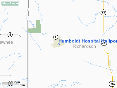
Humboldt Hospital Heliport |
Location & QuickFacts
| FAA Information Effective: | 2008-09-25 |
| Airport Identifier: | NE55 |
| Airport Status: | Operational |
| Longitude/Latitude: | 095-56-31.0000W/40-09-44.0000N
-95.941944/40.162222 (Estimated) |
| Elevation: | 978 ft / 298.09 m (Estimated) |
| Land: | 0 acres |
| From nearest city: | 0 nautical miles NW of Humboldt, NE |
| Location: | Richardson County, NE |
| Magnetic Variation: | 06E (1985) |
Owner & Manager
| Ownership: | Privately owned |
| Owner: | Humboldt Community Hospital |
| Address: | 1128 Grand Ave
Humboldt, NE 68376 |
| Phone number: | 402-862-2231 |
| Manager: | Marlyn Reinitz |
| Address: | 128 Grand Ave
Humboldt, NE 68376 |
| Phone number: | 402-862-2231 |
Airport Operations and Facilities
| Airport Use: | Private
MEDICAL. |
| Wind indicator: | Yes |
| Segmented Circle: | No |
| Control Tower: | No |
| Landing fee charge: | No |
| Sectional chart: | Omaha |
| Region: | ACE - Central |
| Boundary ARTCC: | ZMP - Minneapolis |
| Tie-in FSS: | OLU - Columbus |
| FSS on Airport: | No |
| FSS Toll Free: | 1-800-WX-BRIEF |
Runway Information
Helipad H1
| Dimension: | 40 x 40 ft / 12.2 x 12.2 m |
| Surface: | TURF, |
| |
Runway H1 |
Runway |
| Traffic Pattern: | Left | Left |
|
Radio Navigation Aids
| ID |
Type |
Name |
Ch |
Freq |
Var |
Dist |
| FNB | NDB | Brenner | | 404.00 | 05E | 17.1 nm |
| AYB | NDB | Auburn | | 430.00 | 05E | 17.6 nm |
| AFK | NDB | Nebraska City | | 347.00 | 05E | 26.9 nm |
| MYZ | NDB | Marysville | | 341.00 | 06E | 36.9 nm |
| HWB | NDB | Shaw | | 263.00 | 06E | 37.9 nm |
| BJU | NDB | Big Blue | | 248.00 | 06E | 41.7 nm |
| SDA | NDB | Shenandoah | | 411.00 | 05E | 43.0 nm |
| PMV | NDB | Plattsmouth | | 329.00 | 06E | 47.0 nm |
| EVU | NDB | Emville | | 317.00 | 05E | 48.4 nm |
| BIE | VOR | Beatrice | | 110.60 | 07E | 38.2 nm |
| RBA | VOR/DME | Robinson | 019X | 108.20 | 04E | 30.3 nm |
| PWE | VORTAC | Pawnee City | 071X | 112.40 | 05E | 12.4 nm |
| STJ | VORTAC | St Joseph | 102X | 115.50 | 08E | 48.3 nm |
Remarks
- INBND ACFT CTC HOSPITAL ADMIN OR ASST PRIOR ARRIVAL.
- (1) MAINTAIN CLEAR 8:1 APCH/DEP; (2) MAINTAIN CLEAR 2:1 TRANSITIONAL SURFACE; (3) PROVIDE FIRE EXTINGUISHING EQUIPMENT; (4) MARK; LIGHT OR REMOVE THE OBSTRUCTIONS LISTED IN 95-ACE-199-NRA.
Images and information placed above are from
http://www.airport-data.com/airport/NE55/
We thank them for the data!
| General Info
|
| Country |
United States
|
| State |
NEBRASKA
|
| FAA ID |
NE55
|
| Latitude |
40-09-44.000N
|
| Longitude |
095-56-31.000W
|
| Elevation |
978 feet
|
| Near City |
HUMBOLDT
|
We don't guarantee the information is fresh and accurate. The data may
be wrong or outdated.
For more up-to-date information please refer to other sources.
|
|


