 |
|
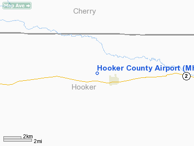
Location & QuickFacts
| FAA Information Effective: | 2008-09-25 |
| Airport Identifier: | MHN |
| Airport Status: | Operational |
| Longitude/Latitude: | 101-04-01.5780W/42-02-59.9900N
-101.067105/42.049997 (Estimated) |
| Elevation: | 3260 ft / 993.65 m (Estimated) |
| Land: | 85 acres |
| From nearest city: | 1 nautical miles W of Mullen, NE |
| Location: | Hooker County, NE |
| Magnetic Variation: | 09E (1985) |
Owner & Manager
| Ownership: | Publicly owned |
| Owner: | Hooker County Airport Authority
ARPT BOARD CHAIRMAN TRACY SPENCER 308-546-2283. |
| Address: | Po Box 184
Mullen, NE 69152 |
| Phone number: | 308-546-2283 |
| Manager: | Tracy Spencer |
| Address: | P.o. Box 184
Mullen, NE 69152 |
| Phone number: | 308-546-2283 |
Airport Operations and Facilities
| Airport Use: | Open to public |
| Wind indicator: | Yes |
| Segmented Circle: | No |
| Control Tower: | No |
| Landing fee charge: | No |
| Sectional chart: | Cheyenne |
| Region: | ACE - Central |
| Boundary ARTCC: | ZDV - Denver |
| Tie-in FSS: | OLU - Columbus |
| FSS on Airport: | No |
| FSS Toll Free: | 1-800-WX-BRIEF |
| NOTAMs Facility: | OLU (NOTAM-d service avaliable) |
Airport Communications
Airport Services
| Airframe Repair: | NONE |
| Power Plant Repair: | NONE |
| Bottled Oxygen: | NONE |
| Bulk Oxygen: | NONE |
Runway Information
Runway 09/27
| Dimension: | 2525 x 25 ft / 769.6 x 7.6 m |
| Surface: | ASPH, Good Condition |
| Weight Limit: | Single wheel: 4000 lbs. |
| |
Runway 09 |
Runway 27 |
| Traffic Pattern: | Left | Left |
| Markings: | Nonstandard, Good Condition
09/27 NSTD MARKINGS; NRS ONLY; DSPLCD THLDS MKD WITH WHITE TIRES. | Nonstandard, Good Condition |
| Displaced threshold: | 100.00 ft | 125.00 ft |
| Obstruction: | 24 ft hill, 200.0 ft from runway, 125 ft left of centerline
APCH SLOPE 12:1 FROM DSPLCD THR.
+5' FENCE, DIST 10', BOTH SIDES OF RY EXTNDD CNTRLN. | 41 ft hill, 650.0 ft from runway, 150 ft right of centerline, 10:1 slope to clear
APCH SLOPE 18:1 FROM DSPLCD THR.
+15' ROAD, DIST 140', BOTH SIDES OF RY EXTNDD CNTRLN. |
|
Radio Navigation Aids
| ID |
Type |
Name |
Ch |
Freq |
Var |
Dist |
| TDD | VOR/DME | Thedford | 023X | 108.60 | 09E | 16.1 nm |
Images and information placed above are from
http://www.airport-data.com/airport/MHN/
We thank them for the data!
| General Info
|
| Country |
United States
|
| State |
NEBRASKA
|
| FAA ID |
MHN
|
| Latitude |
42-02-59.990N
|
| Longitude |
101-04-01.578W
|
| Elevation |
3260 feet
|
| Near City |
MULLEN
|
We don't guarantee the information is fresh and accurate. The data may
be wrong or outdated.
For more up-to-date information please refer to other sources.
|
|


