 |
|
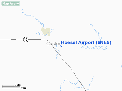
Location & QuickFacts
| FAA Information Effective: | 2008-09-25 |
| Airport Identifier: | 6NE9 |
| Airport Status: | Operational |
| Longitude/Latitude: | 099-53-16.4310W/41-16-05.0230N
-99.887897/41.268062 (Estimated) |
| Elevation: | 2600 ft / 792.48 m (Estimated) |
| Land: | 0 acres |
| From nearest city: | 2 nautical miles SE of Callaway, NE |
| Location: | Custer County, NE |
| Magnetic Variation: | 08E (1985) |
Owner & Manager
| Ownership: | Privately owned |
| Owner: | Albert Hoesel |
| Address: | Rr 1
Callaway, NE 68825 |
| Phone number: | 10SEP90 |
| Manager: | Albert Hoesel |
| Address: | Rr 1
Callaway, NE 68825 |
| Phone number: | 308-836-2978 |
Airport Operations and Facilities
| Airport Use: | Private |
| Wind indicator: | Yes |
| Segmented Circle: | No |
| Control Tower: | No |
| Landing fee charge: | No |
| Sectional chart: | Omaha |
| Region: | ACE - Central |
| Boundary ARTCC: | ZDV - Denver |
| Tie-in FSS: | OLU - Columbus |
| FSS on Airport: | No |
| FSS Toll Free: | 1-800-WX-BRIEF |
Runway Information
Runway 15/33
| Dimension: | 2450 x 50 ft / 746.8 x 15.2 m |
| Surface: | TURF, |
| |
Runway 15 |
Runway 33 |
| Traffic Pattern: | Left | Left |
|
Radio Navigation Aids
| ID |
Type |
Name |
Ch |
Freq |
Var |
Dist |
| BBW | NDB | Broken Bow | | 265.00 | 08E | 15.1 nm |
| DWL | NDB | Willow | | 353.00 | 08E | 25.2 nm |
| RRX | NDB | Darr | | 326.00 | 07E | 25.5 nm |
| BUB | NDB | Burwell | | 377.00 | 07E | 45.2 nm |
| ODX | NDB | Ord | | 356.00 | 07E | 47.4 nm |
| OZB | VOR | Cozad | | 109.00 | 09E | 24.5 nm |
| CUZ | VOR/DME | Custer County | 19X | 108.20 | 08E | 15.8 nm |
| LBF | VORTAC | North Platte | 121X | 117.40 | 11E | 41.1 nm |
Remarks
- INSTALLED PAINTED TIRES AT BOTH ENDS OF RWY.
- PRVDD APCH TO EACH RWY IS MAINTAINED FOR MIN 20:1 GS AND TRANSITIONAL SURFACE MAINTAINED 7:1 SLOPE.
Images and information placed above are from
http://www.airport-data.com/airport/6NE9/
We thank them for the data!
| General Info
|
| Country |
United States
|
| State |
NEBRASKA
|
| FAA ID |
6NE9
|
| Latitude |
41-16-05.023N
|
| Longitude |
099-53-16.431W
|
| Elevation |
2600 feet
|
| Near City |
CALLAWAY
|
We don't guarantee the information is fresh and accurate. The data may
be wrong or outdated.
For more up-to-date information please refer to other sources.
|
|


