 |
|
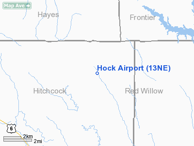
Location & QuickFacts
| FAA Information Effective: | 2008-09-25 |
| Airport Identifier: | 13NE |
| Airport Status: | Operational |
| Longitude/Latitude: | 100-48-31.5620W/40-19-00.0090N
-100.808767/40.316669 (Estimated) |
| Elevation: | 2777 ft / 846.43 m (Surveyed) |
| Land: | 0 acres |
| From nearest city: | 5 nautical miles NE of Culbertson, NE |
| Location: | Hitchcock County, NE |
| Magnetic Variation: | 09E (1985) |
Owner & Manager
| Ownership: | Privately owned |
| Owner: | Rocky M. Hock |
| Address: | 37526 Rd 724
Culbertson, NE 69024-7770 |
| Phone number: | 308-278-2786 |
| Manager: | Rocky M. Hock |
| Address: | 37526 Rd 724
Culbertson, NE 69024-7770 |
| Phone number: | 308-278-2786 |
Airport Operations and Facilities
| Airport Use: | Private |
| Wind indicator: | Yes |
| Segmented Circle: | No |
| Control Tower: | No |
| Landing fee charge: | No |
| Sectional chart: | Omaha |
| Region: | ACE - Central |
| Boundary ARTCC: | ZDV - Denver |
| Tie-in FSS: | OLU - Columbus |
| FSS on Airport: | No |
| FSS Toll Free: | 1-800-WX-BRIEF |
Airport Services
| Airframe Repair: | NONE |
| Power Plant Repair: | NONE |
Runway Information
Runway N/S
| Dimension: | 2600 x 200 ft / 792.5 x 61.0 m |
| Surface: | TURF, |
| |
Runway N |
Runway S |
| Traffic Pattern: | Left | Left |
| Obstruction: | 35 ft pline | |
|
Radio Navigation Aids
| ID |
Type |
Name |
Ch |
Freq |
Var |
Dist |
| MCK | FAN MARKER | Mc Cook | | | 11E | 14.6 nm |
| CSB | NDB | Harry Strunk | | 389.00 | 08E | 29.9 nm |
| ADT | NDB | Atwood | | 365.00 | 09E | 30.7 nm |
| OIN | NDB | Oberlin | | 341.00 | 09E | 31.8 nm |
| IML | NDB | Imperial | | 283.00 | 09E | 39.3 nm |
| DWL | NDB | Willow | | 353.00 | 08E | 47.4 nm |
| JDM | NDB | Wheatfield | | 408.00 | 08E | 49.7 nm |
| OZB | VOR | Cozad | | 109.00 | 09E | 49.6 nm |
| MCK | VOR/DME | Mc Cook | 100X | 115.30 | 08E | 12.0 nm |
| HCT | VORTAC | Hayes Center | 124X | 117.70 | 11E | 9.8 nm |
| LBF | VORTAC | North Platte | 121X | 117.40 | 11E | 44.1 nm |
Remarks
- PRVDD APCH TO EACH RWY IS MAINTD FOR A MIN 20:1 GLIDE SLOPE AND TRANSITIONAL SFC BE MAINTD FOR A 7:1 GLIDE SLOPE.
Images and information placed above are from
http://www.airport-data.com/airport/13NE/
We thank them for the data!
| General Info
|
| Country |
United States
|
| State |
NEBRASKA
|
| FAA ID |
13NE
|
| Latitude |
40-19-00.009N
|
| Longitude |
100-48-31.562W
|
| Elevation |
2777 feet
|
| Near City |
CULBERTSON
|
We don't guarantee the information is fresh and accurate. The data may
be wrong or outdated.
For more up-to-date information please refer to other sources.
|
|


