|
|
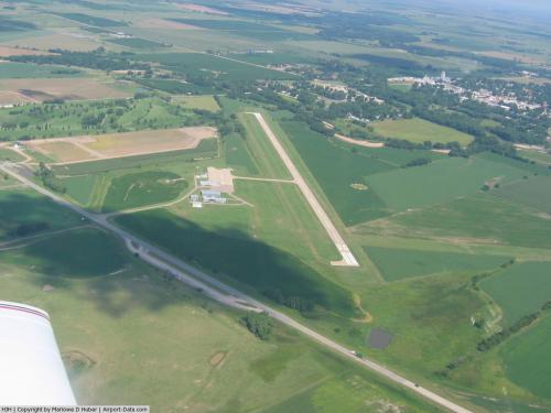 |
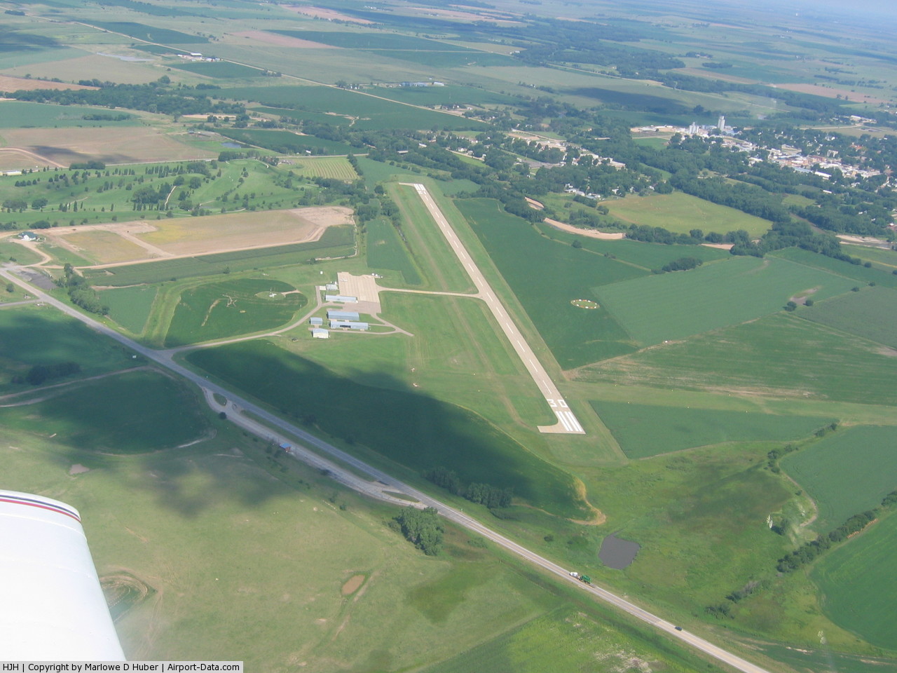
(Click on the photo to enlarge) |
Location & QuickFacts
| FAA Information Effective: | 2008-09-25 |
| Airport Identifier: | HJH |
| Airport Status: | Operational |
| Longitude/Latitude: | 097-35-13.1000W/40-09-08.1000N
-97.586972/40.152250 (Estimated) |
| Elevation: | 1466 ft / 446.84 m (Surveyed) |
| Land: | 217 acres |
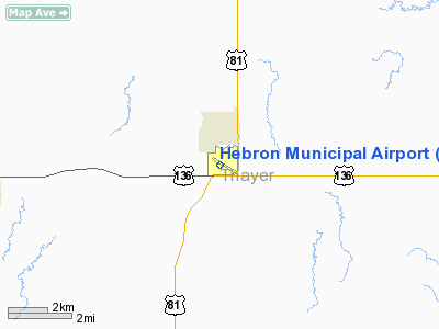
| From nearest city: | 1 nautical miles S of Hebron, NE |
| Location: | Thayer County, NE |
| Magnetic Variation: | 06E (2000) |
Owner & Manager
| Ownership: | Publicly owned |
| Owner: | Hebron Arpt Authority |
| Address: | P.o. Box 256
Hebron, NE 68370-0256 |
| Phone number: | 402-768-7155 |
| Manager: | Duane Vorderstrasse |
| Address: | 446 N 8th St
Hebron, NE 68370-0256 |
| Phone number: | 402-768-7155 |
Airport Operations and Facilities
| Airport Use: | Open to public |
| Wind indicator: | Yes |
| Segmented Circle: | Yes |
| Control Tower: | No |
| Lighting Schedule: | DUSK-DAWN
ACTVT MIRL RY 12/30 - CTAF. |
| Beacon Color: | Clear-Green (lighted land airport) |
| Landing fee charge: | No |
| Sectional chart: | Omaha |
| Region: | ACE - Central |
| Boundary ARTCC: | ZMP - Minneapolis |
| Tie-in FSS: | OLU - Columbus |
| FSS on Airport: | No |
| FSS Toll Free: | 1-800-WX-BRIEF |
| NOTAMs Facility: | HJH (NOTAM-d service avaliable) |
| Federal Agreements: | NGY |
Airport Communications
Airport Services
| Fuel available: | 100LL
FOR FUEL CALL (402) 768-6070. |
| Bottled Oxygen: | NONE |
| Bulk Oxygen: | NONE |
Runway Information
Runway 03/21
| Dimension: | 2532 x 150 ft / 771.8 x 45.7 m |
| Surface: | TURF, Fair Condition |
| |
Runway 03 |
Runway 21 |
| Longitude: | 097-35-02.4390W | 097-34-40.7270W |
| Latitude: | 40-08-56.1620N | 40-09-14.8290N |
| Elevation: | 1468.00 ft | 1452.00 ft |
| Alignment: | 42 | 127 |
| Traffic Pattern: | Left | Left |
| Obstruction: | 29 ft hwy, 700.0 ft from runway, 24:1 slope to clear
OBSTN LCTD ON BOTH SIDES OF RWY CNTRLN EXTDD. | 17 ft hwy, 500.0 ft from runway, 29:1 slope to clear
OBSTN LCTD ON BOTH SIDES OF RWY CNTRLN EXTDD. |
|
Runway 12/30
| Dimension: | 3600 x 60 ft / 1097.3 x 18.3 m |
| Surface: | CONC, Good Condition |
| Weight Limit: | Single wheel: 30000 lbs. |
| Edge Lights: | Medium |
| |
Runway 12 |
Runway 30 |
| Longitude: | 097-35-31.2880W | 097-34-54.9560W |
| Latitude: | 40-09-19.1810N | 40-08-57.0810N |
| Elevation: | 1462.00 ft | 1466.00 ft |
| Alignment: | 127 | 127 |
| Traffic Pattern: | Left | Left |
| Markings: | Non-precision instrument, Good Condition | Non-precision instrument, Good Condition |
| Crossing Height: | 45.00 ft | 45.00 ft |
| VASI: | 2-light PAPI on left side | 2-light PAPI on right side |
| Visual Glide Angle: | 3.00° | 3.00° |
| Obstruction: | 35 ft tree, 900.0 ft from runway, 20:1 slope to clear
OBSTN LCTD 210' RGT OF RWY CNTRLN EXTDD. | 29 ft hwy, 860.0 ft from runway, 22:1 slope to clear
OBSTN LCTD ON BOTH SIDES OF RWY CNTRLN EXTDD. |
|
Radio Navigation Aids
| ID |
Type |
Name |
Ch |
Freq |
Var |
Dist |
| HJH | NDB | Hebron | | 323.00 | 06E | 0.1 nm |
| FBY | NDB | Fairbury | | 293.00 | 06E | 19.4 nm |
| RPB | NDB | Republican | | 414.00 | 07E | 20.6 nm |
| FMZ | NDB | Beklof | | 392.00 | 07E | 26.3 nm |
| DBX | NDB | Morrison | | 212.00 | 06E | 34.4 nm |
| CNK | NDB | Concordia | | 335.00 | 06E | 36.1 nm |
| BJU | NDB | Big Blue | | 248.00 | 06E | 37.7 nm |
| HWB | NDB | Shaw | | 263.00 | 06E | 38.7 nm |
| JYR | NDB | York | | 257.00 | 06E | 44.8 nm |
| MYZ | NDB | Marysville | | 341.00 | 06E | 47.5 nm |
| SWT | NDB | Seward | | 269.00 | 06E | 47.8 nm |
| BIE | VOR | Beatrice | | 110.60 | 07E | 39.2 nm |
| HSI | VOR/DME | Hastings | 025X | 108.80 | 07E | 47.2 nm |
| TKO | VORTAC | Mankato | 035X | 109.80 | 10E | 37.3 nm |
Remarks
- APCHS PROTECTED BY STRUCTURE CONTROL ORDINANCE.
Images and information placed above are from
http://www.airport-data.com/airport/HJH/
We thank them for the data!
| General Info
|
| Country |
United States
|
| State |
NEBRASKA
|
| FAA ID |
HJH
|
| Latitude |
40-09-08.100N
|
| Longitude |
097-35-13.100W
|
| Elevation |
1466 feet
|
| Near City |
HEBRON
|
We don't guarantee the information is fresh and accurate. The data may
be wrong or outdated.
For more up-to-date information please refer to other sources.
|
|