 |
|
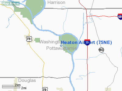
Location & QuickFacts
| FAA Information Effective: | 2008-09-25 |
| Airport Identifier: | 75NE |
| Airport Status: | Operational |
| Longitude/Latitude: | 095-57-24.0440W/41-26-44.9800N
-95.956679/41.445828 (Estimated) |
| Elevation: | 1000 ft / 304.80 m (Estimated) |
| Land: | 0 acres |
| From nearest city: | 4 nautical miles E of Fort Calhoun, NE |
| Location: | Washington County, NE |
| Magnetic Variation: | 06E (1980) |
Owner & Manager
| Ownership: | Privately owned |
| Owner: | Alfred Heaton |
| Address: | Rt 1, Box 155
Fort Calhoun, NE 68023 |
| Phone number: | 402-468-5813 |
| Manager: | Alfred Heaton
OTHER CONTACT KENT HENTON 2705 CO RD. 34 FORT CALHOUN, NE 68023 402-533-4773 |
| Address: | Rt 1, Box 155
Fort Calhoun, NE 68023 |
| Phone number: | 402-468-5813 |
Airport Operations and Facilities
| Airport Use: | Private |
| Wind indicator: | Yes |
| Segmented Circle: | No |
| Control Tower: | No |
| Landing fee charge: | No |
| Sectional chart: | Omaha |
| Region: | ACE - Central |
| Boundary ARTCC: | ZMP - Minneapolis |
| Tie-in FSS: | OLU - Columbus |
| FSS Toll Free: | 1-800-WX-BRIEF |
Runway Information
Runway 17/35
| Dimension: | 2500 x 66 ft / 762.0 x 20.1 m |
| Surface: | TURF, |
| |
Runway 17 |
Runway 35 |
| Traffic Pattern: | Left | Left |
| Obstruction: | 30 ft pline, 100.0 ft from runway | |
|
Radio Navigation Aids
| ID |
Type |
Name |
Ch |
Freq |
Var |
Dist |
| OM | NDB | Gerfi | | 320.00 | 05E | 4.7 nm |
| MLE | NDB | Millard | | 371.00 | 06E | 16.7 nm |
| FET | NDB | Fremont | | 311.00 | 06E | 25.3 nm |
| HNR | NDB | Harlan | | 272.00 | 05E | 28.9 nm |
| PMV | NDB | Plattsmouth | | 329.00 | 06E | 30.2 nm |
| AHQ | NDB | Wahoo | | 400.00 | 07E | 31.5 nm |
| RDK | NDB | Red Oak | | 230.00 | 04E | 41.0 nm |
| AIO | NDB | Atlantic | | 365.00 | 04E | 41.1 nm |
| DNS | NDB | Denison | | 350.00 | 04E | 41.4 nm |
| MEY | NDB | Mapleton | | 335.00 | 05E | 44.8 nm |
| SDA | NDB | Shenandoah | | 411.00 | 05E | 48.6 nm |
| ADU | NDB | Audubon | | 266.00 | 04E | 49.3 nm |
| OFF | TACAN | Offutt | 054X | | 05E | 19.9 nm |
| TQE | VOR | Tekamah | | 108.40 | 07E | 21.3 nm |
| SCB | VOR/DME | Scribner | 47X | 111.00 | 06E | 31.7 nm |
| OVR | VORTAC | Omaha | 110X | 116.30 | 08E | 19.5 nm |
| LNK | VORTAC | Lincoln | 108X | 116.10 | 09E | 47.4 nm |
| OMA | VOT | Omaha | | 109.00 | | 9.6 nm |
Remarks
- PROVIDED APPROACHES ARE MAINTAINED FOR A 20:1 GLIDE SLOPE & TRANSITIONAL SURFACES FOR A 7:1 SLOPE.
Images and information placed above are from
http://www.airport-data.com/airport/75NE/
We thank them for the data!
| General Info
|
| Country |
United States
|
| State |
NEBRASKA
|
| FAA ID |
75NE
|
| Latitude |
41-26-44.980N
|
| Longitude |
095-57-24.044W
|
| Elevation |
1000 feet
|
| Near City |
FORT CALHOUN
|
We don't guarantee the information is fresh and accurate. The data may
be wrong or outdated.
For more up-to-date information please refer to other sources.
|
|


