 |
|
Location & QuickFacts
| FAA Information Effective: | 2008-09-25 |
| Airport Identifier: | NE99 |
| Airport Status: | Operational |
| Longitude/Latitude: | 101-49-05.6440W/41-34-29.9480N
-101.818234/41.574986 (Estimated) |
| Elevation: | 3680 ft / 1121.66 m (Surveyed) |
| Land: | 0 acres |
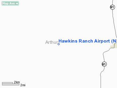
| From nearest city: | 6 nautical miles W of Arthur, NE |
| Location: | Arthur County, NE |
| Magnetic Variation: | 10E (1985) |
Owner & Manager
| Ownership: | Privately owned |
| Owner: | V.s. Hawkins Ranch Co. |
| Address: | Hc 89, Box 7
Arthur, NE 69121 |
| Phone number: | 308-764-2440 |
| Manager: | Margaret Hawkins |
| Address: |
|
Airport Operations and Facilities
| Airport Use: | Private |
| Wind indicator: | No |
| Segmented Circle: | No |
| Control Tower: | No |
| Landing fee charge: | No |
| Sectional chart: | Cheyenne |
| Region: | ACE - Central |
| Boundary ARTCC: | ZDV - Denver |
| Tie-in FSS: | OLU - Columbus |
| FSS on Airport: | No |
| FSS Toll Free: | 1-800-WX-BRIEF |
Airport Services
| Airframe Repair: | NONE |
| Power Plant Repair: | NONE |
Runway Information
Runway N/S
| Dimension: | 2600 x 100 ft / 792.5 x 30.5 m |
| Surface: | TURF, |
| |
Runway N |
Runway S |
| Traffic Pattern: | Left | Left |
|
Radio Navigation Aids
| ID |
Type |
Name |
Ch |
Freq |
Var |
Dist |
| OKS | NDB | Oshkosh | | 233.00 | 09E | 26.2 nm |
| CNP | NDB | Chappell | | 383.00 | 10E | 41.6 nm |
| GGF | NDB | Grant | | 359.00 | 09E | 42.5 nm |
| SAE | VOR/DME | Searle | 39X | 110.20 | 11E | 27.5 nm |
Images and information placed above are from
http://www.airport-data.com/airport/NE99/
We thank them for the data!
| General Info
|
| Country |
United States
|
| State |
NEBRASKA
|
| FAA ID |
NE99
|
| Latitude |
41-34-29.948N
|
| Longitude |
101-49-05.644W
|
| Elevation |
3680 feet
|
| Near City |
ARTHUR
|
We don't guarantee the information is fresh and accurate. The data may
be wrong or outdated.
For more up-to-date information please refer to other sources.
|
|


