 |
|
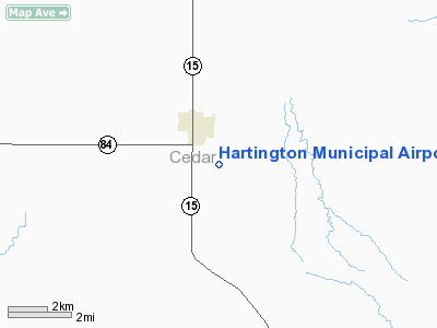
Location & QuickFacts
| FAA Information Effective: | 2008-09-25 |
| Airport Identifier: | 0B4 |
| Airport Status: | Operational |
| Longitude/Latitude: | 097-15-09.5000W/42-36-12.8000N
-97.252639/42.603556 (Estimated) |
| Elevation: | 1387 ft / 422.76 m (Surveyed) |
| Land: | 243 acres |
| From nearest city: | 2 nautical miles SE of Hartington, NE |
| Location: | Cedar County, NE |
| Magnetic Variation: | 06E (2000) |
Owner & Manager
| Ownership: | Publicly owned |
| Owner: | Hartington Airport Authority |
| Address: | 404 W. Main, P.o. Box 188
Hartington, NE 68739 |
| Phone number: | 402-254-3212
CITY HALL PHONE NUMBER; HOURS 0800-1700. |
| Manager: | Tom Becker |
| Address: | 56395 881 Rd
Hartington, NE 68739 |
| Phone number: | 402-254-7317
MOBILE PHONE 402-841-0659 (MANAGER) |
Airport Operations and Facilities
| Airport Use: | Open to public |
| Wind indicator: | Yes |
| Segmented Circle: | No |
| Control Tower: | No |
| Lighting Schedule: | DUSK-DAWN
ACTVT MIRL RY 13/31; PAPI RYS 13 & 31 - CTAF. |
| Beacon Color: | Clear-Green (lighted land airport) |
| Landing fee charge: | No |
| Sectional chart: | Omaha |
| Region: | ACE - Central |
| Boundary ARTCC: | ZMP - Minneapolis |
| Tie-in FSS: | OLU - Columbus |
| FSS on Airport: | No |
| FSS Toll Free: | 1-800-WX-BRIEF |
| NOTAMs Facility: | OLU (NOTAM-d service avaliable) |
| Federal Agreements: | N1 |
Airport Communications
Airport Services
| Fuel available: | 100LL
FOR FUEL CALL (402) 254-6916/3812. |
| Airframe Repair: | MAJOR |
| Power Plant Repair: | MAJOR |
| Bottled Oxygen: | NONE |
| Bulk Oxygen: | NONE |
Runway Information
Runway 03/21
| Dimension: | 2150 x 125 ft / 655.3 x 38.1 m |
| Surface: | TURF, Good Condition |
| |
Runway 03 |
Runway 21 |
| Longitude: | 097-15-50.8000W | 097-15-31.9500W |
| Latitude: | 42-35-59.7100N | 42-36-15.7500N |
| Elevation: | 1387.00 ft | 1374.00 ft |
| Alignment: | 41 | 127 |
| Traffic Pattern: | Left | Left |
| Obstruction: | 32 ft trees, 765.0 ft from runway, 145 ft left of centerline, 23:1 slope to clear | 10 ft road, 215.0 ft from runway, 21:1 slope to clear |
|
Runway 13/31
| Dimension: | 3950 x 60 ft / 1204.0 x 18.3 m |
| Surface: | CONC, Good Condition |
| Edge Lights: | Medium |
| |
Runway 13 |
Runway 31 |
| Longitude: | 097-15-26.0330W | 097-14-52.8850W |
| Latitude: | 42-36-28.0030N | 42-35-57.6330N |
| Elevation: | 1367.00 ft | 1381.00 ft |
| Alignment: | 127 | 127 |
| Traffic Pattern: | Left | Left |
| Markings: | Non-precision instrument, Good Condition | Non-precision instrument, Good Condition |
| Crossing Height: | 40.00 ft | 40.00 ft |
| Displaced threshold: | 0.00 ft | 398.00 ft |
| VASI: | 2-light PAPI on left side | 2-light PAPI on left side |
| Visual Glide Angle: | 3.00° | 4.00° |
| Obstruction: | , 50:1 slope to clear
+5' ROAD, 0' FROM RWY END, 125' LEFT. | 20 ft road, 350.0 ft from runway, 7:1 slope to clear
APCH RATIO 37:1 TO DSPLCD THLD. |
|
Radio Navigation Aids
| ID |
Type |
Name |
Ch |
Freq |
Var |
Dist |
| VMR | NDB | Vermillion | | 375.00 | 06E | 17.0 nm |
| LCG | NDB | Wayne | | 389.00 | 06E | 24.8 nm |
| OI | NDB | Tommi | | 305.00 | 07E | 36.1 nm |
| GAK | NDB | Sioux Gateway | | 233.00 | 06E | 40.2 nm |
| OF | NDB | Carsy | | 510.00 | 08E | 44.2 nm |
| SU | NDB | Salix | | 414.00 | 07E | 45.8 nm |
| YKN | VOR/DME | Yankton | 051X | 111.40 | 07E | 19.8 nm |
| OFK | VOR/DME | Norfolk | 033X | 109.60 | 08E | 37.9 nm |
| SUX | VORTAC | Sioux City | 112X | 116.50 | 09E | 44.0 nm |
Remarks
- RY 03/21 NOT PLOWED WINTER MONTHS.
- EXISTED PRIOR TO 1959.
Images and information placed above are from
http://www.airport-data.com/airport/0B4/
We thank them for the data!
| General Info
|
| Country |
United States
|
| State |
NEBRASKA
|
| FAA ID |
0B4
|
| Latitude |
42-36-12.800N
|
| Longitude |
097-15-09.500W
|
| Elevation |
1387 feet
|
| Near City |
HARTINGTON
|
We don't guarantee the information is fresh and accurate. The data may
be wrong or outdated.
For more up-to-date information please refer to other sources.
|
|


