 |
|
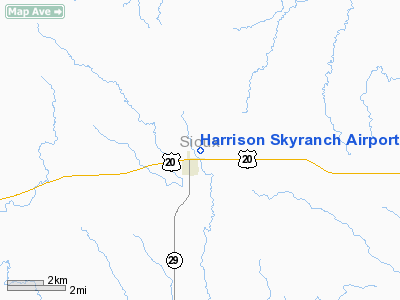
Harrison Skyranch Airport |
Location & QuickFacts
| FAA Information Effective: | 2008-09-25 |
| Airport Identifier: | 9V3 |
| Airport Status: | Closed Indefinitely |
| Longitude/Latitude: | 103-52-31.7600W/42-41-44.8770N
-103.875489/42.695799 (Estimated) |
| Elevation: | 4863 ft / 1482.24 m (Surveyed) |
| Land: | 90 acres |
| From nearest city: | 0 nautical miles NE of Harrison, NE |
| Location: | Sioux County, NE |
| Magnetic Variation: | 11E (1985) |
Owner & Manager
| Ownership: | Publicly owned |
| Owner: | Village Of Harrison
ARPT LEASED TO COUNTY, DEAN LUNDY, CHRMN, CO COMM. |
| Address: | Po Box 5
Harrison, NE 69346 |
| Phone number: | 308-668-2445
OR 308-668-2466/2414. |
| Manager: | Jim Ellicott |
| Address: | Po Box 5
Harrison, NE 69346 |
| Phone number: | 308-668-2445
OR 308-668-2271. |
Airport Operations and Facilities
| Airport Use: | Open to public |
| Wind indicator: | Yes |
| Segmented Circle: | No |
| Control Tower: | No |
| Lighting Schedule: | DUSK-DAWN |
| Beacon Color: | Clear-Green (lighted land airport) |
| Landing fee charge: | No |
| Sectional chart: | Cheyenne |
| Region: | ACE - Central |
| Boundary ARTCC: | ZDV - Denver |
| Tie-in FSS: | OLU - Columbus |
| FSS on Airport: | No |
| FSS Toll Free: | 1-800-WX-BRIEF |
| NOTAMs Facility: | OLU (NOTAM-d service avaliable) |
| Federal Agreements: | 1 |
Airport Communications
Airport Services
| Airframe Repair: | NONE |
| Power Plant Repair: | NONE |
| Bottled Oxygen: | NONE |
| Bulk Oxygen: | NONE |
Runway Information
Runway 12/30
| Dimension: | 2800 x 50 ft / 853.4 x 15.2 m |
| Surface: | TURF, Poor Condition |
| |
Runway 12 |
Runway 30 |
| Traffic Pattern: | Left | Left |
|
Radio Navigation Aids
| ID |
Type |
Name |
Ch |
Freq |
Var |
Dist |
| HIN | NDB | Whitney | | 275.00 | 11E | 35.4 nm |
| TOR | NDB | Torrington | | 293.00 | 11E | 39.8 nm |
| GIG | NDB | Gering | | 341.00 | 11E | 46.0 nm |
| GYZ | NDB | Camp Guernsey | | 280.00 | 11E | 46.2 nm |
| CDR | VOR/DME | Chadron | 081X | 113.40 | 13E | 26.2 nm |
Remarks
- LGTD PLINE POLE 53' AGL 1714' SE AER 30.
- (ARPT STATUS) ARPT CLSD INDEFLY.
- EXISTED PRIOR TO 1959.
Images and information placed above are from
http://www.airport-data.com/airport/9V3/
We thank them for the data!
| General Info
|
| Country |
United States
|
| State |
NEBRASKA
|
| FAA ID |
9V3
|
| Latitude |
42-41-44.877N
|
| Longitude |
103-52-31.760W
|
| Elevation |
4863 feet
|
| Near City |
HARRISON
|
We don't guarantee the information is fresh and accurate. The data may
be wrong or outdated.
For more up-to-date information please refer to other sources.
|
|


